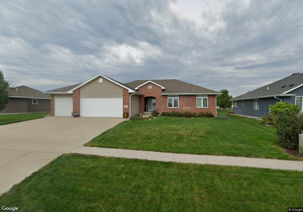
705 Stable Path Sergeant Bluff, IA 51054
Estimated Value: $336,000 - $489,000
5
Beds
4
Baths
3,367
Sq Ft
$127/Sq Ft
Est. Value
About This Home
This home is located at 705 Stable Path, Sergeant Bluff, IA 51054 and is currently estimated at $428,422, approximately $127 per square foot. 705 Stable Path is a home located in Woodbury County with nearby schools including Sergeant Bluff-Luton Primary School, Sergeant Bluff-Luton Elementary School, and Sergeant Bluff-Luton Middle School.
Ownership History
Date
Name
Owned For
Owner Type
Purchase Details
Closed on
Nov 20, 2014
Sold by
Britton Matthew A and Britton Kellie L
Bought by
Estabrook Dustin W and Estabrook Kara L
Current Estimated Value
Purchase Details
Closed on
Mar 11, 2008
Sold by
Settlers Point Llc
Bought by
Britton Matthew A and Britton Kelli L
Create a Home Valuation Report for This Property
The Home Valuation Report is an in-depth analysis detailing your home's value as well as a comparison with similar homes in the area
Home Values in the Area
Average Home Value in this Area
Purchase History
| Date | Buyer | Sale Price | Title Company |
|---|---|---|---|
| Estabrook Dustin W | $295,000 | None Available | |
| Britton Matthew A | $102,900 | -- |
Source: Public Records
Tax History
| Year | Tax Paid | Tax Assessment Tax Assessment Total Assessment is a certain percentage of the fair market value that is determined by local assessors to be the total taxable value of land and additions on the property. | Land | Improvement |
|---|---|---|---|---|
| 2025 | $6,334 | $450,530 | $51,210 | $399,320 |
| 2024 | $61 | $420,870 | $41,550 | $379,320 |
| 2023 | $6,734 | $420,870 | $41,550 | $379,320 |
| 2022 | $6,674 | $392,080 | $41,550 | $350,530 |
| 2021 | $6,674 | $392,080 | $41,550 | $350,530 |
| 2020 | $6,022 | $347,910 | $44,460 | $303,450 |
| 2019 | $5,772 | $347,910 | $44,460 | $303,450 |
| 2018 | $5,630 | $329,010 | $40,010 | $289,000 |
| 2017 | $5,758 | $329,010 | $40,010 | $289,000 |
| 2016 | $5,866 | $310,710 | $0 | $0 |
| 2015 | $4,474 | $290,380 | $37,390 | $252,990 |
| 2014 | $4,221 | $223,960 | $37,390 | $186,570 |
Source: Public Records
Map
Nearby Homes
- 707 Stable Path
- 703 Stable Path
- 704 Coffie Farm Rd
- 709 Stable Path
- 701 Stable Path
- 801 Cottonwood Trail
- 706 Coffie Farm Rd
- 802 Cottonwood Trail
- 802 Cottonwood Landing - Lot 59
- 702 Coffie Farm Rd
- 708 Coffie Farm Rd
- 711 Stable Path
- 803 Cottonwood Trail
- 502 Wild Plum Way
- 708 Stable Path
- 710 Coffie Farm Rd
- 413 Wild Plum Way
- 415 Wild Plum Way
- 504 Wild Plum Way
- 713 Stable Path
Your Personal Tour Guide
Ask me questions while you tour the home.