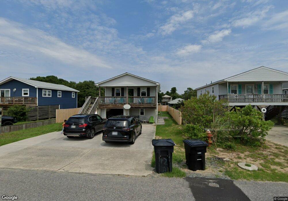
706 W 5th St Unit 29 Kill Devil Hills, NC 27948
Estimated Value: $455,000 - $544,000
3
Beds
3
Baths
1,728
Sq Ft
$289/Sq Ft
Est. Value
About This Home
This home is located at 706 W 5th St Unit 29, Kill Devil Hills, NC 27948 and is currently estimated at $498,811, approximately $288 per square foot. 706 W 5th St Unit 29 is a home located in Dare County with nearby schools including Nags Head Elementary School, First Flight Middle School, and First Flight High School.
Ownership History
Date
Name
Owned For
Owner Type
Purchase Details
Closed on
Feb 1, 2011
Sold by
New Boundaries Llc
Bought by
Harding Dennis D
Current Estimated Value
Purchase Details
Closed on
May 11, 2010
Sold by
Us Bank National Association
Bought by
New Boundaries Llc
Purchase Details
Closed on
Mar 3, 2010
Sold by
Copeland Cameron L and Copeland Summer
Bought by
U S Bank National Association
Purchase Details
Closed on
Jun 14, 2005
Sold by
Morris Cynthia Walke
Bought by
Copeland Cameron L and Copeland Summer
Home Financials for this Owner
Home Financials are based on the most recent Mortgage that was taken out on this home.
Original Mortgage
$187,500
Interest Rate
7.25%
Mortgage Type
Assumption
Create a Home Valuation Report for This Property
The Home Valuation Report is an in-depth analysis detailing your home's value as well as a comparison with similar homes in the area
Home Values in the Area
Average Home Value in this Area
Purchase History
| Date | Buyer | Sale Price | Title Company |
|---|---|---|---|
| Harding Dennis D | -- | None Available | |
| New Boundaries Llc | $21,000 | None Available | |
| U S Bank National Association | $132,477 | None Available | |
| Copeland Cameron L | $180,000 | None Available |
Source: Public Records
Mortgage History
| Date | Status | Borrower | Loan Amount |
|---|---|---|---|
| Previous Owner | Copeland Cameron L | $187,500 |
Source: Public Records
Tax History
| Year | Tax Paid | Tax Assessment Tax Assessment Total Assessment is a certain percentage of the fair market value that is determined by local assessors to be the total taxable value of land and additions on the property. | Land | Improvement |
|---|---|---|---|---|
| 2025 | $2,385 | $439,000 | $196,600 | $242,400 |
| 2024 | $2,051 | $271,500 | $84,500 | $187,000 |
| 2023 | $2,051 | $271,500 | $84,500 | $187,000 |
| 2022 | $1,956 | $271,500 | $84,500 | $187,000 |
| 2021 | $1,956 | $271,500 | $84,500 | $187,000 |
| 2020 | $1,956 | $271,500 | $84,500 | $187,000 |
| 2019 | $1,445 | $166,100 | $65,300 | $100,800 |
| 2018 | $1,413 | $166,100 | $65,300 | $100,800 |
| 2017 | $1,413 | $166,100 | $65,300 | $100,800 |
| 2016 | $1,347 | $166,100 | $65,300 | $100,800 |
| 2014 | $1,268 | $162,400 | $65,300 | $97,100 |
Source: Public Records
Map
Nearby Homes
- 1100 W Durham St Unit lot 697
- 705 W 4th St Unit Lot 23
- 1817 Sioux St Unit Lot 7
- 1208 W 4th St Unit 4
- 1005 W Avalon Dr Unit Lot 272
- 702 W Avalon Dr Unit 206
- 1002 W Avalon Dr Unit Lot 251
- 1208 W 5th St Unit 5
- 1806 Creek St Unit Lot 13
- 1317 Devonshire Rd Unit 36
- 1207 W 4th St Unit Lot 45
- 102 Greensboro St Unit Lot 504
- 0 W Bay Dr Unit Lot3Lot3
- 105 Charlotte St Unit Lot 459
- 613 W Palmetto St Unit Lot 7R
- 106 W Avalon Dr Unit Lot 88
- 527 W Eden St Unit Lot 7-8
- 500 W Eden St
- 510 W Eden St Unit Lot 25 & 26
- 2307 Bay Dr
- 706 W 5th St
- 708 W 5th St
- 704 W 5th St
- 803 W Durham St
- 710 W 5th St
- 702 W 5th St
- 805 W Durham St
- 709 W Durham St
- 801 W Durham St
- 1918 Georgia Ln
- 807 W Durham St Unit 647
- 807 W Durham St
- 800 W 5th St
- 1917 Georgia Ln
- 1919 Georgia Ln
- 707 W Durham St
- 700 W 5th St
- 1916 Georgia Ln
- 809 W Durham St Unit 676
- 809 W Durham St
Your Personal Tour Guide
Ask me questions while you tour the home.