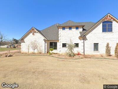
707 E Anderson Ave Apache, OK 73006
Estimated Value: $43,000 - $98,000
2
Beds
1
Bath
896
Sq Ft
$73/Sq Ft
Est. Value
About This Home
This home is located at 707 E Anderson Ave, Apache, OK 73006 and is currently estimated at $65,413, approximately $73 per square foot. 707 E Anderson Ave is a home with nearby schools including Apache Elementary School, Apache Middle School, and Apache High School.
Ownership History
Date
Name
Owned For
Owner Type
Purchase Details
Closed on
Apr 29, 2019
Sold by
Upton Jerry and Upton Gayla
Bought by
Roberts Jerry B and Roberts Teresa A
Current Estimated Value
Purchase Details
Closed on
Apr 28, 2009
Sold by
Clark Dennis A and Clark Annette
Bought by
Upton Jerry
Purchase Details
Closed on
Sep 29, 2008
Purchase Details
Closed on
Dec 6, 1996
Purchase Details
Closed on
Sep 3, 1996
Purchase Details
Closed on
Jul 1, 1993
Purchase Details
Closed on
Aug 1, 1987
Purchase Details
Closed on
Jul 1, 1987
Create a Home Valuation Report for This Property
The Home Valuation Report is an in-depth analysis detailing your home's value as well as a comparison with similar homes in the area
Home Values in the Area
Average Home Value in this Area
Purchase History
| Date | Buyer | Sale Price | Title Company |
|---|---|---|---|
| Roberts Jerry B | -- | None Available | |
| Upton Jerry | $10,000 | -- | |
| -- | -- | -- | |
| -- | $15,000 | -- | |
| -- | $7,000 | -- | |
| -- | $10,000 | -- | |
| -- | $12,500 | -- | |
| -- | $12,500 | -- |
Source: Public Records
Tax History Compared to Growth
Tax History
| Year | Tax Paid | Tax Assessment Tax Assessment Total Assessment is a certain percentage of the fair market value that is determined by local assessors to be the total taxable value of land and additions on the property. | Land | Improvement |
|---|---|---|---|---|
| 2024 | $200 | $2,050 | $335 | $1,715 |
| 2023 | $200 | $1,953 | $330 | $1,623 |
| 2022 | $170 | $1,860 | $330 | $1,530 |
| 2021 | $205 | $1,772 | $330 | $1,442 |
| 2020 | $169 | $1,687 | $330 | $1,357 |
| 2019 | $174 | $1,706 | $330 | $1,376 |
| 2018 | $179 | $1,625 | $330 | $1,295 |
| 2017 | $162 | $1,548 | $330 | $1,218 |
| 2016 | $157 | $1,474 | $330 | $1,144 |
| 2015 | $112 | $1,404 | $330 | $1,074 |
| 2014 | $110 | $1,337 | $330 | $1,007 |
Source: Public Records
Map
Nearby Homes
- 13154 Highway 19
- TBD U S Highway 62
- 223 Oak St
- TBD Edgewater Park Unit L24, B7
- TBD Edgewater Park Unit L12-13, B10
- TBD Edgewater Park Unit L23, B4
- TBD NE King Rd
- TBD Cr 2580
- 1106 E Floyd Ave
- 13190 Oklahoma 19
- 19012 Oklahoma 19
- 5717 NE King Rd
- 320 Lakeview Ave
- 207 N Hillside Rd
- 11945 NE Happy Hollow Rd
- 116 N Lakeside Dr
- TBD Lakeside Dr
- 115 N Brookdale
- 133 S Lakeside Dr
- 5605 NE Snowy Owl Rd
- 707 E Anderson Ave
- 317 N Locust St
- 700 E Lorrist Ave
- 707 E Anderson Ave
- 325 N Locust St
- 716 E Lorrist Ave
- 715 E Anderson St
- 713 E Anderson St
- 618 E Lorrist Ave
- 410 N Locust St
- 303-1/2 E Wallace Ave
- 403 N Locust
- 403 N Locust
- 614 E Lorrist Ave
- 232 Elm St
- 415 N Locust St
- 605 E Anderson St
- 705 E Anderson Ave
- 601 E Anderson St
- 613 Lorrist Ave