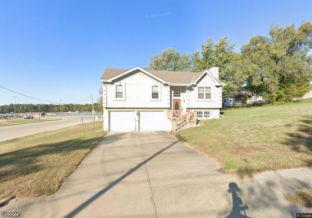
708 12th St Osawatomie, KS 66064
Estimated Value: $219,000 - $243,186
3
Beds
2
Baths
1,177
Sq Ft
$196/Sq Ft
Est. Value
About This Home
This home is located at 708 12th St, Osawatomie, KS 66064 and is currently estimated at $230,297, approximately $195 per square foot. 708 12th St is a home located in Miami County with nearby schools including Swenson Early Childhood Education Center, Trojan Elementary School, and Osawatomie Middle School.
Ownership History
Date
Name
Owned For
Owner Type
Purchase Details
Closed on
Aug 25, 2015
Sold by
Folsom Daniel L and Folsom Anna Marie
Bought by
Folsom Daniel L
Current Estimated Value
Create a Home Valuation Report for This Property
The Home Valuation Report is an in-depth analysis detailing your home's value as well as a comparison with similar homes in the area
Home Values in the Area
Average Home Value in this Area
Purchase History
| Date | Buyer | Sale Price | Title Company |
|---|---|---|---|
| Folsom Daniel L | -- | -- |
Source: Public Records
Tax History Compared to Growth
Tax History
| Year | Tax Paid | Tax Assessment Tax Assessment Total Assessment is a certain percentage of the fair market value that is determined by local assessors to be the total taxable value of land and additions on the property. | Land | Improvement |
|---|---|---|---|---|
| 2025 | $5,291 | $29,567 | $2,719 | $26,848 |
| 2024 | $5,211 | $29,158 | $2,300 | $26,858 |
| 2023 | $5,009 | $27,508 | $2,170 | $25,338 |
| 2022 | $4,373 | $23,046 | $1,963 | $21,083 |
| 2021 | $1,903 | $0 | $0 | $0 |
| 2020 | $3,268 | $0 | $0 | $0 |
| 2019 | $2,777 | $0 | $0 | $0 |
| 2018 | $2,672 | $0 | $0 | $0 |
| 2017 | $2,590 | $0 | $0 | $0 |
| 2016 | -- | $0 | $0 | $0 |
| 2015 | -- | $0 | $0 | $0 |
| 2014 | -- | $0 | $0 | $0 |
| 2013 | -- | $0 | $0 | $0 |
Source: Public Records
Map
Nearby Homes
- 1117 Walnut Ave
- 1103 Chestnut St
- 1324 Pacific Ave
- 1045 Chestnut Ave
- 1109 Main St
- 1017 Pacific Ave
- 716 10th St
- 1015 Main St
- 934 Pacific St
- 302 12th St
- 921 Brown Ave
- 903 Walnut Ave
- 900 Walnut Ave
- 835 Brown Ave
- 1548 Brown Ave
- 1612 Brown Ave
- 721 Pacific Ave
- 901 Chestnut Ave
- 805 Chestnut Ave
- 1512 Charles Ave