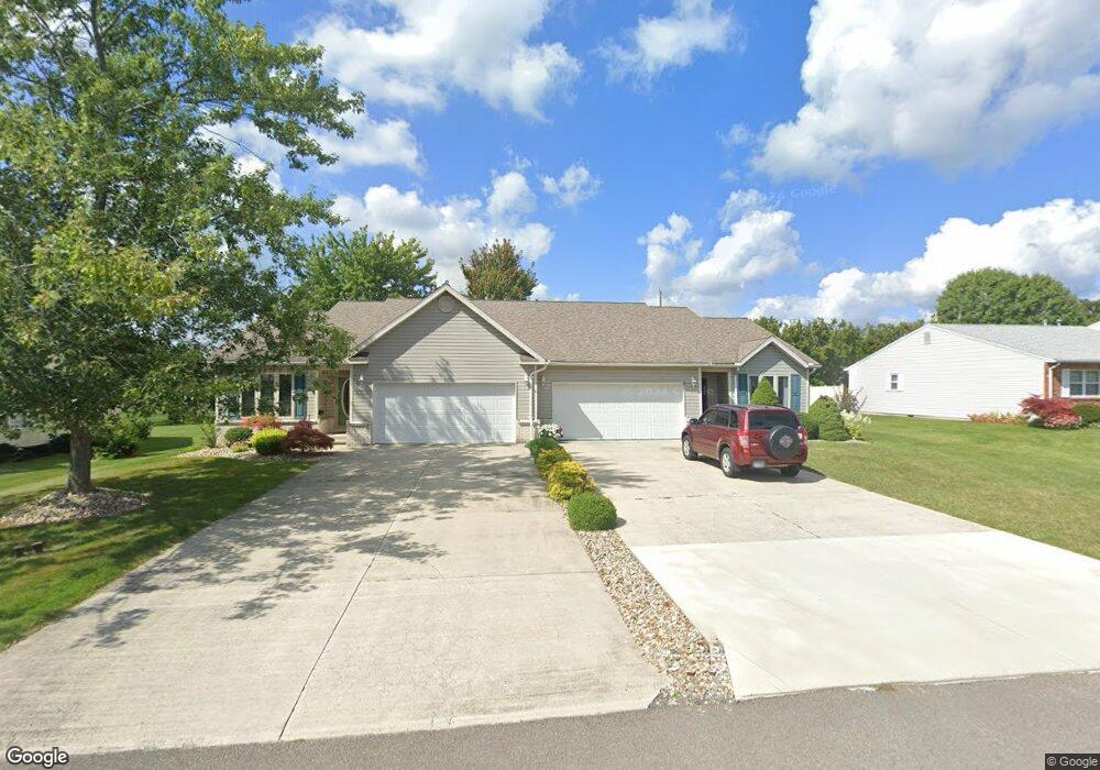
708 Chestnut Dr Upper Sandusky, OH 43351
Estimated Value: $201,488 - $287,000
2
Beds
2
Baths
2,076
Sq Ft
$112/Sq Ft
Est. Value
About This Home
This home is located at 708 Chestnut Dr, Upper Sandusky, OH 43351 and is currently estimated at $233,372, approximately $112 per square foot. 708 Chestnut Dr is a home located in Wyandot County with nearby schools including Upper Sandusky High School and St. Peter Elementary School.
Ownership History
Date
Name
Owned For
Owner Type
Purchase Details
Closed on
Jul 3, 2024
Sold by
Holica Enterprises Llc
Bought by
Church Brenda
Current Estimated Value
Purchase Details
Closed on
May 24, 2024
Sold by
Crow Darlene M
Bought by
Church Brenda
Purchase Details
Closed on
Jun 17, 2013
Sold by
Martin Jane B
Bought by
Church Brenda
Purchase Details
Closed on
Oct 16, 2012
Sold by
Martin Jane B
Bought by
Martin Jane B
Purchase Details
Closed on
Sep 19, 2011
Sold by
Peterson Constance S
Bought by
Martin Jane B
Purchase Details
Closed on
May 23, 2005
Sold by
Kottyan Mary K
Bought by
Mcclain Winona E
Create a Home Valuation Report for This Property
The Home Valuation Report is an in-depth analysis detailing your home's value as well as a comparison with similar homes in the area
Home Values in the Area
Average Home Value in this Area
Purchase History
| Date | Buyer | Sale Price | Title Company |
|---|---|---|---|
| Church Brenda | $250 | None Listed On Document | |
| Church Brenda | $250 | None Listed On Document | |
| Church Brenda | $250 | None Listed On Document | |
| Church Brenda | $250 | None Listed On Document | |
| Church Brenda | $250 | None Listed On Document | |
| Church Brenda | $250 | None Listed On Document | |
| Church Brenda | $105,000 | None Available | |
| Martin Jane B | -- | None Available | |
| Martin Jane B | $99,900 | None Available | |
| Mcclain Winona E | $133,000 | None Available | |
| Kottyan Mary K | -- | None Available |
Source: Public Records
Tax History
| Year | Tax Paid | Tax Assessment Tax Assessment Total Assessment is a certain percentage of the fair market value that is determined by local assessors to be the total taxable value of land and additions on the property. | Land | Improvement |
|---|---|---|---|---|
| 2025 | $1,465 | $58,850 | $3,720 | $55,130 |
| 2024 | $1,299 | $50,630 | $3,080 | $47,550 |
| 2023 | $1,611 | $50,980 | $3,430 | $47,550 |
| 2022 | $1,344 | $44,300 | $3,150 | $41,150 |
| 2021 | $1,184 | $44,300 | $3,150 | $41,150 |
| 2020 | $1,184 | $44,300 | $3,150 | $41,150 |
| 2019 | $1,182 | $44,300 | $3,150 | $41,150 |
| 2018 | $1,120 | $43,070 | $3,150 | $39,920 |
| 2017 | $1,138 | $43,070 | $3,150 | $39,920 |
| 2016 | $1,337 | $43,070 | $3,150 | $39,920 |
| 2015 | -- | $42,290 | $3,150 | $39,140 |
| 2014 | -- | $42,290 | $3,150 | $39,140 |
| 2013 | -- | $42,290 | $3,150 | $39,140 |
Source: Public Records
Map
Nearby Homes
- 605 Polaris Dr
- 512 N 7th St
- 479 N 5th St
- 386 W Finley St
- 333 N 5th St
- 334 N 4th St
- 212 N Hazel St
- 314 N 4th St
- 137 N 8th St
- 116 E Walker St
- 432 E Bigelow St
- 479 Front St
- 0 Ohio 53
- 225 S Hazel St
- 0 State Route 53 & 67 Unit 11165687
- 326 S 8th St
- 1030 Halbedel St
- 9768 County Highway 111
- 955 Greenbrier Rd
- 123 Rivers Edge Ln
- 708 Chestnut Dr Unit B
- 708 Chestnut Dr Unit A
- 708A Chestnut Dr
- 708B Chestnut Dr
- 710 Chestnut Dr
- 712 Chestnut Dr
- 706 Chestnut Dr
- 857 Terrace Dr
- 714 Chestnut Dr
- 859 Terrace Dr
- 855 Terrace Dr
- 723 Chestnut Dr
- 716 Chestnut Dr Unit 8
- 716 Chestnut Dr
- 716 Chestnut Dr Unit 8
- 727 Chestnut Dr
- 725 Chestnut Dr
- 725 Chestnut Dr Unit 725 & 727
- 704 Chestnut Dr
- 721 Chestnut Dr
Your Personal Tour Guide
Ask me questions while you tour the home.