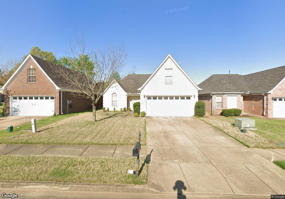
7089 Crape Myrtle Dr Olive Branch, MS 38654
Estimated Value: $244,000 - $282,000
4
Beds
2
Baths
1,631
Sq Ft
$162/Sq Ft
Est. Value
About This Home
This home is located at 7089 Crape Myrtle Dr, Olive Branch, MS 38654 and is currently estimated at $264,372, approximately $162 per square foot. 7089 Crape Myrtle Dr is a home located in DeSoto County with nearby schools including Olive Branch Elementary School, Chickasaw Elementary School, and Olive Branch Middle School.
Ownership History
Date
Name
Owned For
Owner Type
Purchase Details
Closed on
Oct 15, 2021
Sold by
Titus Ladetria K
Bought by
Mcclelland Jerald and Mcclelland David
Current Estimated Value
Purchase Details
Closed on
Apr 18, 2008
Sold by
Coleman Bartley Enterprises Llc
Bought by
Titus Ladetria K
Home Financials for this Owner
Home Financials are based on the most recent Mortgage that was taken out on this home.
Original Mortgage
$154,677
Interest Rate
6.03%
Mortgage Type
FHA
Create a Home Valuation Report for This Property
The Home Valuation Report is an in-depth analysis detailing your home's value as well as a comparison with similar homes in the area
Home Values in the Area
Average Home Value in this Area
Purchase History
| Date | Buyer | Sale Price | Title Company |
|---|---|---|---|
| Mcclelland Jerald | -- | Sure Title | |
| Titus Ladetria K | -- | Realty Title & Escrow |
Source: Public Records
Mortgage History
| Date | Status | Borrower | Loan Amount |
|---|---|---|---|
| Previous Owner | Titus Ladetria K | $154,677 |
Source: Public Records
Tax History
| Year | Tax Paid | Tax Assessment Tax Assessment Total Assessment is a certain percentage of the fair market value that is determined by local assessors to be the total taxable value of land and additions on the property. | Land | Improvement |
|---|---|---|---|---|
| 2025 | $1,585 | $16,281 | $2,500 | $13,781 |
| 2024 | $1,335 | $11,979 | $2,500 | $9,479 |
| 2023 | $1,335 | $11,979 | $0 | $0 |
| 2022 | $1,335 | $11,979 | $2,500 | $9,479 |
| 2021 | $1,335 | $11,979 | $2,500 | $9,479 |
| 2020 | $1,231 | $11,216 | $2,500 | $8,716 |
| 2019 | $1,231 | $11,216 | $2,500 | $8,716 |
| 2017 | $1,213 | $19,552 | $11,026 | $8,526 |
| 2016 | $1,213 | $11,026 | $2,500 | $8,526 |
| 2015 | $1,513 | $19,552 | $11,026 | $8,526 |
| 2014 | $1,250 | $11,296 | $0 | $0 |
| 2013 | $1,205 | $11,296 | $0 | $0 |
Source: Public Records
Map
Nearby Homes
- 6931 Maury Dr
- 6915 Maury Dr
- 7338 Alexander Rd
- 10185 Goodman Rd
- 7182 Archer Ln
- 10238 Cheryl Cove
- 7276 Edgewater Dr
- 6849 Dogwood Manor W
- 9737 Dogwood Ct W
- 9472 Village Pointe
- 10153 Stephenson Ln
- 9861 Alexanders Ridge Dr
- 10141 Fox Chase Dr
- 9678 Stuart Cove
- 9919 Adina Cove
- 7741 Meadow Ridge Ln
- 10395 Catalpa Cove
- 10550 Rose Ln
- 9868 Sequoia Ln
- 6716 Branch Rd S
- 7097 Crape Myrtle Dr
- 7081 Crape Myrtle Dr
- 9892 Southern Oak Way
- 9891 Southern Gum Way
- 7105 Crape Myrtle Dr
- 9884 Southern Oak Way
- 9883 Southern Gum Way
- 7086 Crape Myrtle Dr
- 7094 Crape Myrtle Dr
- 9876 Southern Oak Way
- 7102 Crape Myrtle Dr
- 9875 Southern Gum Way
- 7110 Crape Myrtle Dr
- 7080 Crape Myrtle Dr
- 9903 Southern Oak Way
- 9897 Southern Oak Way
- 7074 Crape Myrtle Dr
- 9868 Southern Oak Way
- 7068 Crape Myrtle Dr
- 9909 Southern Oak Way
Your Personal Tour Guide
Ask me questions while you tour the home.