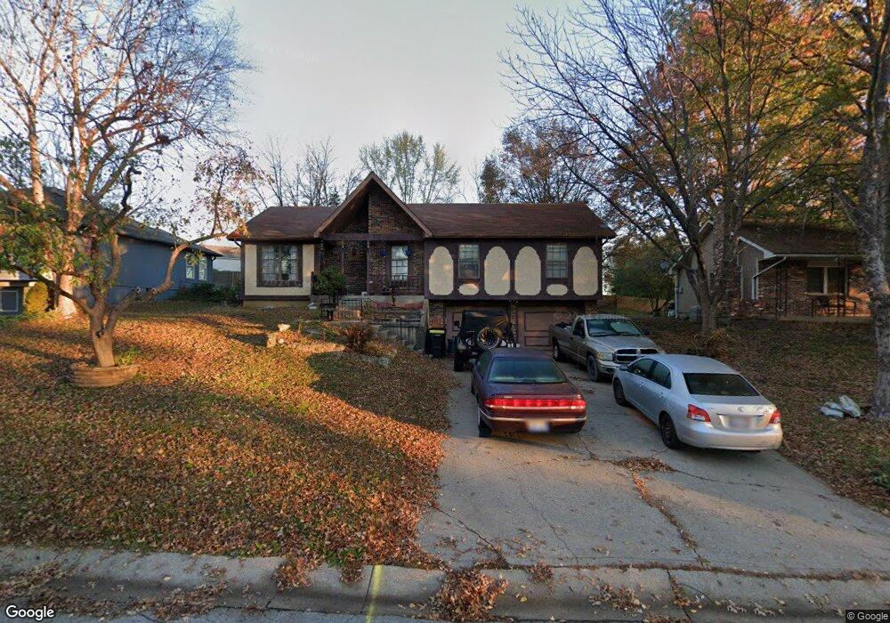
709 Englewood St Lansing, KS 66043
Estimated Value: $259,083 - $289,000
4
Beds
3
Baths
1,360
Sq Ft
$201/Sq Ft
Est. Value
About This Home
This home is located at 709 Englewood St, Lansing, KS 66043 and is currently estimated at $273,271, approximately $200 per square foot. 709 Englewood St is a home located in Leavenworth County with nearby schools including Lansing Elementary School, Lansing Middle 6-8, and Lansing High 9-12.
Ownership History
Date
Name
Owned For
Owner Type
Purchase Details
Closed on
Mar 1, 2000
Bought by
Butts Peter W and Butts Dora A
Current Estimated Value
Home Financials for this Owner
Home Financials are based on the most recent Mortgage that was taken out on this home.
Original Mortgage
$71,800
Outstanding Balance
$56,443
Interest Rate
8.31%
Mortgage Type
New Conventional
Estimated Equity
$216,828
Create a Home Valuation Report for This Property
The Home Valuation Report is an in-depth analysis detailing your home's value as well as a comparison with similar homes in the area
Home Values in the Area
Average Home Value in this Area
Purchase History
| Date | Buyer | Sale Price | Title Company |
|---|---|---|---|
| Butts Peter W | $90,500 | -- |
Source: Public Records
Mortgage History
| Date | Status | Borrower | Loan Amount |
|---|---|---|---|
| Open | Butts Peter W | $71,800 | |
| Closed | Butts Peter W | $34,400 |
Source: Public Records
Tax History Compared to Growth
Tax History
| Year | Tax Paid | Tax Assessment Tax Assessment Total Assessment is a certain percentage of the fair market value that is determined by local assessors to be the total taxable value of land and additions on the property. | Land | Improvement |
|---|---|---|---|---|
| 2025 | $3,434 | $26,954 | $5,173 | $21,781 |
| 2024 | $3,207 | $25,917 | $4,080 | $21,837 |
| 2023 | $3,207 | $24,920 | $4,080 | $20,840 |
| 2022 | $3,084 | $22,655 | $3,102 | $19,553 |
| 2021 | $2,961 | $20,666 | $3,102 | $17,564 |
| 2020 | $2,852 | $19,596 | $3,102 | $16,494 |
| 2019 | $2,671 | $18,348 | $3,102 | $15,246 |
| 2018 | $2,469 | $16,992 | $2,551 | $14,441 |
| 2017 | $2,286 | $15,720 | $2,551 | $13,169 |
| 2016 | $2,264 | $15,564 | $2,551 | $13,013 |
| 2015 | $2,258 | $15,564 | $2,551 | $13,013 |
| 2014 | $2,145 | $15,111 | $2,551 | $12,560 |
Source: Public Records
Map
Nearby Homes
- 415 Fairlane St
- 218 Oak Hill St
- 542 Creekside Ct
- 610 Meadowlark Rd
- 268 Holiday Dr
- 129 Crestview Ct
- 129 Brookwood St
- 124 S Main St
- 202 S Main St
- 1102 N Main St
- 728 Eisenhower Rd
- 4 Eisenhower Rd
- 401 W Olive St
- 527 S Valley Dr
- 1100 N 4th St
- 1102 N 4th St
- 4915 Parkway Dr
- 218 E Kay St
- 603 E Beth St
- 813 Glenview St
- 707 Englewood St
- 410 Maple Ct
- 705 Englewood St
- 713 Englewood St
- 408 Maple Ct
- 706 Englewood St
- 704 Englewood St
- 703 Englewood St
- 708 Englewood St
- 715 Englewood St
- 409 Maple Ct
- 1820 Englewood St
- 403 Brookwood Place
- 402 Brookwood Place
- 406 Maple Ct
- 702 Englewood St
- 701 Englewood St
- 125 Ferncliff St
- 106 Daisy St
- 400 Hillcrest St