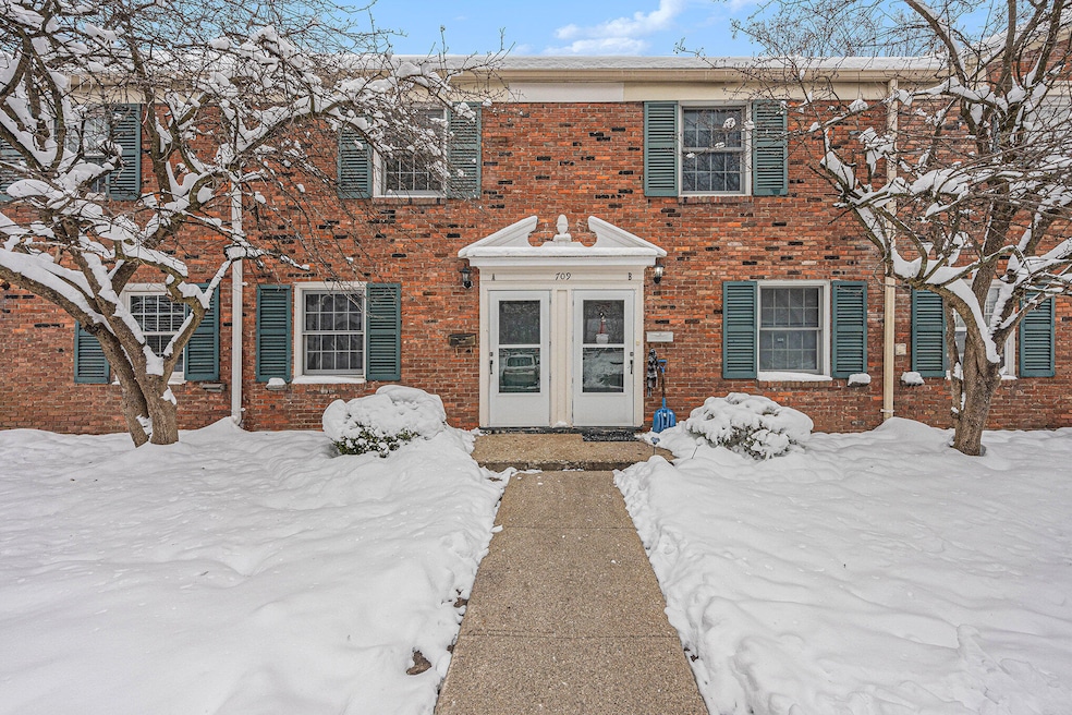
709 Garland Cir Unit A Kalamazoo, MI 49008
Westnedge Hill NeighborhoodHighlights
- 300 Fireplaces
- Forced Air Heating and Cooling System
- Dogs and Cats Allowed
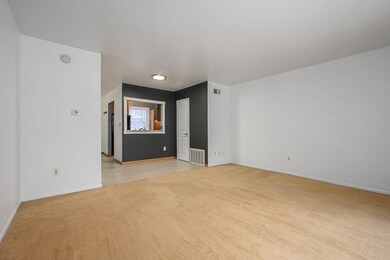
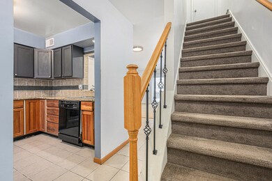
About This Home
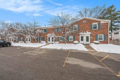
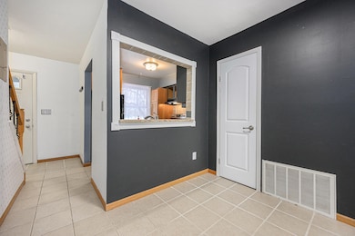
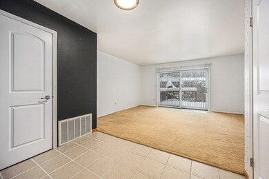
Available Now! Townhouse-style condo at Cherry Knoll. 2 Bedrooms, 1 bath. Dining area & living room with slider to private fenced backyard area. Coin-operated washer/dryer on-site and two designated parking spots. Water, sewer and trash included in rent. Pets welcome under 40lbs.
Listing Agent
Berkshire Hathaway HomeServices MI License #6501366885 Listed on: 12/05/2025

Condo Details
Home Type
- Condominium
Est. Annual Taxes
- $1,720
Year Built
- Built in 1961
Parking
- Off-Street Parking
Interior Spaces
- 960 Sq Ft Home
- 300 Fireplaces
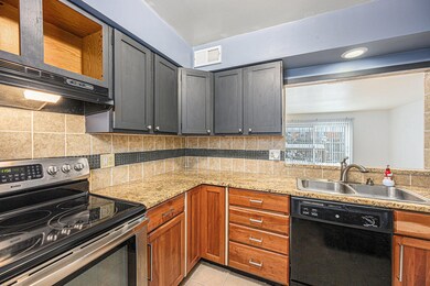
Kitchen
- Electric Range
- Dishwasher
Bedrooms and Bathrooms
- 2 Bedrooms
- 1 Full Bathroom
Utilities
- Forced Air Heating and Cooling System
- Heating System Uses Natural Gas
Listing and Financial Details
- Property Available on 12/5/25
- Tenant pays for cable/satellite, electric, heat, internet access, wifi
- The owner pays for taxes
Community Details
Overview
- Property has a Home Owners Association
- Association fees include lawn/yard care, sewer, snow removal, trash, water
- Cherry Knoll Condos
Pet Policy
- Limit on the number of pets
- Pet Size Limit
- Dogs and Cats Allowed
Map
Source: MichRIC
MLS Number: 25060887
APN: 06-28-487-062
Disclaimer: Certain information contained herein is derived from information provided by parties other than Homes.com. All information provided is deemed reliable, but is not guaranteed to be accurate and should be independently verified.
![]() Information is deemed reliable but not guaranteed.
Information is deemed reliable but not guaranteed.
Copyright 2025 MichRIC, LLC. All rights reserved.
- 714 Garland Cir Unit B
- 2825 Duke St
- 728 Montrose Ave
- 2705 Bronson Blvd
- 2731 Bronson Blvd
- 453 Fairview Ave
- 448 Whitcomb St
- 405 Edgemoor Ave
- 1817 S Westnedge Ave
- 1813 S Westnedge Ave
- 1813, 1817 S Westnedge Ave
- 2338 Glenwood Dr
- 2340 Springhill Dr
- 616 Lynn Ave Unit 23
- 616 Lynn Ave Unit 24
- 616 Lynn Ave Unit 30
- 616 Lynn Ave Unit 31
- 3237 Old Colony Rd
- 1316 S Park St
- 2313 S Westnedge Ave
- 611 Whites Rd
- 544 Denway Cir
- 2007 Stearns Ave Unit 3
- 4037 S Rose St
- 132 Reed Ave Unit 3
- 132 Reed Ave Unit 3
- 132 Reed Ave Unit 3
- 529 McCourtie St Unit 2
- 734 W Kilgore Rd
- 3309 St Joseph St Unit C
- 645 Phillips St
- 100 Candlewyck Dr
- 1125 S Westnedge Ave Unit 2
- 1125 S Westnedge Ave Unit 2
- 1117 S Westnedge Ave
- 413 W Vine St Unit 4
- 742 E Stockbridge Ave Unit 2
- 721 Locust St Unit 5
- 229 W Walnut St Unit 4
- 516 Oak St