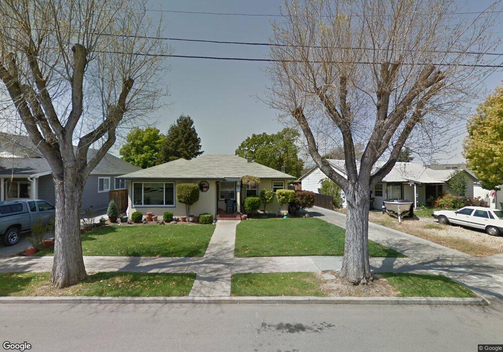
709 S N St Livermore, CA 94550
Downtown Livermore NeighborhoodEstimated Value: $949,548 - $1,173,000
2
Beds
2
Baths
1,634
Sq Ft
$658/Sq Ft
Est. Value
About This Home
This home is located at 709 S N St, Livermore, CA 94550 and is currently estimated at $1,074,387, approximately $657 per square foot. 709 S N St is a home located in Alameda County with nearby schools including Junction Avenue K-8 School, Livermore High School, and St Michael's School.
Ownership History
Date
Name
Owned For
Owner Type
Purchase Details
Closed on
Aug 6, 2012
Sold by
Kato Cheryl A
Bought by
Kato Cheryl A and Kato Living Trust
Current Estimated Value
Purchase Details
Closed on
Nov 19, 2002
Sold by
Kato Cheryl A and The Kato Living Trust
Bought by
Kato Cheryl A
Home Financials for this Owner
Home Financials are based on the most recent Mortgage that was taken out on this home.
Original Mortgage
$115,000
Interest Rate
5.89%
Purchase Details
Closed on
Jan 25, 1996
Sold by
Kato Cheryl A
Bought by
Kato Cheryl A
Create a Home Valuation Report for This Property
The Home Valuation Report is an in-depth analysis detailing your home's value as well as a comparison with similar homes in the area
Home Values in the Area
Average Home Value in this Area
Purchase History
| Date | Buyer | Sale Price | Title Company |
|---|---|---|---|
| Kato Cheryl A | -- | None Available | |
| Kato Cheryl A | -- | Fidelity National Title Co | |
| Kato Cheryl A | -- | -- |
Source: Public Records
Mortgage History
| Date | Status | Borrower | Loan Amount |
|---|---|---|---|
| Closed | Kato Cheryl A | $115,000 |
Source: Public Records
Tax History
| Year | Tax Paid | Tax Assessment Tax Assessment Total Assessment is a certain percentage of the fair market value that is determined by local assessors to be the total taxable value of land and additions on the property. | Land | Improvement |
|---|---|---|---|---|
| 2025 | $4,265 | $280,157 | $156,185 | $123,972 |
| 2024 | $4,265 | $274,664 | $153,123 | $121,541 |
| 2023 | $4,186 | $269,278 | $150,120 | $119,158 |
| 2022 | $4,111 | $263,999 | $147,177 | $116,822 |
| 2021 | $3,274 | $258,823 | $144,292 | $114,531 |
| 2020 | $4,268 | $256,169 | $142,812 | $113,357 |
| 2019 | $4,263 | $251,147 | $140,012 | $111,135 |
| 2018 | $4,142 | $246,224 | $137,268 | $108,956 |
| 2017 | $4,013 | $241,396 | $134,576 | $106,820 |
| 2016 | $3,833 | $236,664 | $131,938 | $104,726 |
| 2015 | $3,607 | $233,109 | $129,956 | $103,153 |
| 2014 | $3,536 | $228,543 | $127,411 | $101,132 |
Source: Public Records
Map
Nearby Homes
- 1766 College Ave
- 2211 College Ave
- 2215 Sherry Ct
- 2235 4th St
- 2342 Palm Ave
- 2463 6th St
- 1087 Murrieta Blvd Unit 243
- 1087 Murrieta Blvd Unit 130
- 1085 Murrieta Blvd Unit 222
- 1085 Murrieta Blvd Unit 318
- 1085 Murrieta Blvd Unit 324
- 170 N N St Unit 102
- 157 Zephyr Place Unit 109
- 1725 Pedrozzi Common
- 1009 Lisbon Ave
- 1144 El Dorado Dr
- 1763 Helsinki Way
- 2155 Chestnut St
- 975 Murrieta Blvd
- 960 Elaine Ave
Your Personal Tour Guide
Ask me questions while you tour the home.