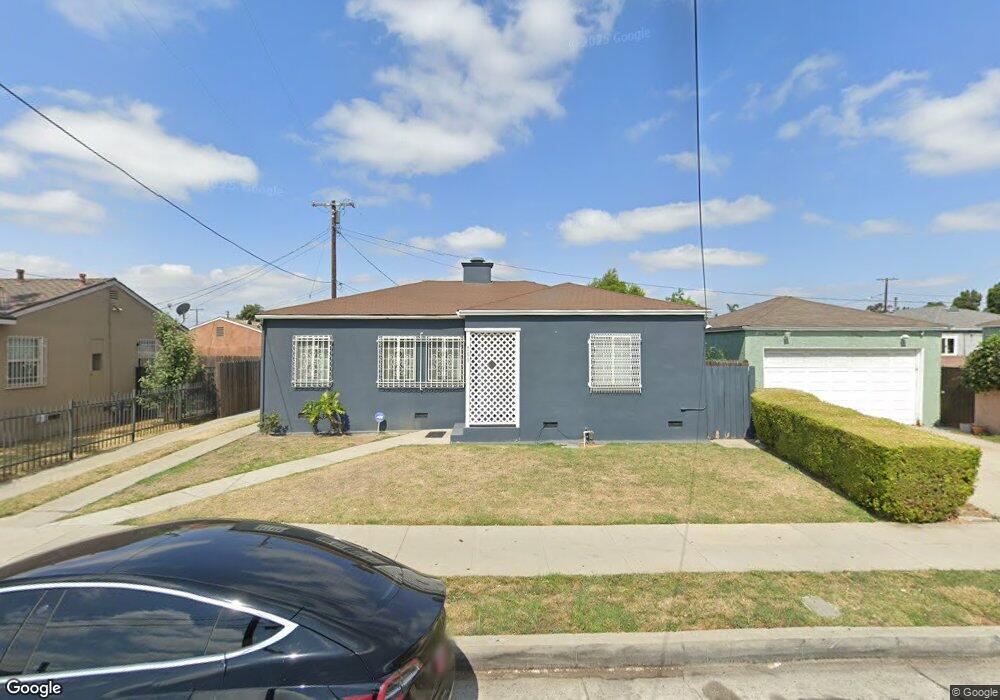
709 S Tamarind Ave Compton, CA 90220
Estimated Value: $556,000 - $620,000
3
Beds
1
Bath
1,200
Sq Ft
$495/Sq Ft
Est. Value
About This Home
This home is located at 709 S Tamarind Ave, Compton, CA 90220 and is currently estimated at $594,155, approximately $495 per square foot. 709 S Tamarind Ave is a home located in Los Angeles County with nearby schools including Dickison Elementary School, Benjamin O. Davis Middle School, and Compton High School.
Ownership History
Date
Name
Owned For
Owner Type
Purchase Details
Closed on
Aug 22, 2005
Sold by
Dobson Ambrose
Bought by
Dobson Alonzo
Current Estimated Value
Home Financials for this Owner
Home Financials are based on the most recent Mortgage that was taken out on this home.
Original Mortgage
$270,000
Interest Rate
6.35%
Mortgage Type
Fannie Mae Freddie Mac
Purchase Details
Closed on
Oct 29, 1997
Sold by
Dobson Ambrose
Bought by
Dobson Ambrose and Dobson Allean
Purchase Details
Closed on
Dec 2, 1996
Sold by
Bowden Jerlean
Bought by
Bowden Jerlean and Dobson Allean
Purchase Details
Closed on
Jul 8, 1994
Sold by
Bowden Jerlean
Bought by
Bowden Jerlean
Home Financials for this Owner
Home Financials are based on the most recent Mortgage that was taken out on this home.
Original Mortgage
$39,000
Interest Rate
8.57%
Create a Home Valuation Report for This Property
The Home Valuation Report is an in-depth analysis detailing your home's value as well as a comparison with similar homes in the area
Home Values in the Area
Average Home Value in this Area
Purchase History
| Date | Buyer | Sale Price | Title Company |
|---|---|---|---|
| Dobson Alonzo | $270,000 | -- | |
| Dobson Ambrose | -- | -- | |
| Bowden Jerlean | -- | -- | |
| Bowden Jerlean | -- | Southern California Title Co |
Source: Public Records
Mortgage History
| Date | Status | Borrower | Loan Amount |
|---|---|---|---|
| Previous Owner | Dobson Alonzo | $270,000 | |
| Previous Owner | Bowden Jerlean | $39,000 |
Source: Public Records
Tax History
| Year | Tax Paid | Tax Assessment Tax Assessment Total Assessment is a certain percentage of the fair market value that is determined by local assessors to be the total taxable value of land and additions on the property. | Land | Improvement |
|---|---|---|---|---|
| 2025 | $5,403 | $203,556 | $97,706 | $105,850 |
| 2024 | $5,403 | $199,566 | $95,791 | $103,775 |
| 2023 | $5,344 | $195,654 | $93,913 | $101,741 |
| 2022 | $4,814 | $191,819 | $92,072 | $99,747 |
| 2021 | $4,840 | $188,059 | $90,267 | $97,792 |
| 2019 | $4,740 | $182,484 | $87,591 | $94,893 |
| 2018 | $4,630 | $178,907 | $85,874 | $93,033 |
| 2017 | $4,541 | $175,400 | $84,191 | $91,209 |
| 2016 | $4,468 | $171,962 | $82,541 | $89,421 |
| 2015 | $2,934 | $169,380 | $81,302 | $88,078 |
| 2014 | $2,883 | $166,063 | $79,710 | $86,353 |
Source: Public Records
Map
Nearby Homes
- 125 E Alondra Blvd
- 114 E Alondra Blvd
- 105 W Cypress St
- 512 S Willowbrook Ave
- 920 S Willowbrook Ave
- 201 Racquet Club Dr
- 229 E Reeve St
- 165 Racquet Club Dr
- 112 E Caldwell St
- 319 W Almond St
- 214 E Johnson St
- 426 W Laurel St
- 501 S Pearl Ave
- 212 S Santa fe Ave
- 427 W Laurel St
- 409 W Almond St
- 200 N Acacia Ave
- 204 N Spring Ave
- 435 W Almond St
- 301 W Magnolia St
- 142 E Cypress St
- 138 E Cypress St
- 134 E Cypress St
- 715 S Tamarind Ave
- 141 E Cocoa St
- 141 E Cocoa St Unit B
- 141 E Cocoa St
- 135 E Cocoa St
- 130 E Cypress St
- 131 E Cocoa St
- 126 E Cypress St
- 127 E Cocoa St Unit A
- 122 E Cypress St
- 623 S Tamarind Ave
- 141 E Cypress St
- 123 E Cocoa St
- 135 E Cypress St
- 118 E Cypress St
- 119 E Cocoa St
- 131 E Cypress St
Your Personal Tour Guide
Ask me questions while you tour the home.