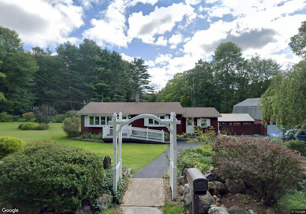
71 Blake Rd Epping, NH 03042
Estimated Value: $354,000 - $566,000
2
Beds
1
Bath
1,032
Sq Ft
$445/Sq Ft
Est. Value
About This Home
This home is located at 71 Blake Rd, Epping, NH 03042 and is currently estimated at $458,914, approximately $444 per square foot. 71 Blake Rd is a home located in Rockingham County with nearby schools including Epping Elementary School, Epping Middle School, and Epping High School.
Create a Home Valuation Report for This Property
The Home Valuation Report is an in-depth analysis detailing your home's value as well as a comparison with similar homes in the area
Home Values in the Area
Average Home Value in this Area
Tax History
| Year | Tax Paid | Tax Assessment Tax Assessment Total Assessment is a certain percentage of the fair market value that is determined by local assessors to be the total taxable value of land and additions on the property. | Land | Improvement |
|---|---|---|---|---|
| 2024 | $6,068 | $240,500 | $121,400 | $119,100 |
| 2023 | $5,628 | $240,500 | $121,400 | $119,100 |
| 2022 | $5,409 | $240,500 | $121,400 | $119,100 |
| 2021 | $5,327 | $237,600 | $121,400 | $116,200 |
| 2020 | $6,167 | $237,600 | $121,400 | $116,200 |
| 2019 | $5,634 | $203,400 | $102,800 | $100,600 |
| 2018 | $5,276 | $203,400 | $102,800 | $100,600 |
| 2017 | $5,697 | $203,400 | $102,800 | $100,600 |
| 2016 | $5,276 | $203,400 | $102,800 | $100,600 |
| 2015 | $5,276 | $203,400 | $102,800 | $100,600 |
| 2014 | $5,001 | $204,800 | $102,800 | $102,000 |
| 2013 | $4,970 | $204,800 | $102,800 | $102,000 |
Source: Public Records
Map
Nearby Homes
- 27 Old State Rd
- 16 Molly Way
- 1 Olde Bridge Ln
- 20 Locksley Ln
- 7 Boulder Ct
- 11 Royal Ln
- 3B Connor Ct Unit 3B
- 55 Sunset Ridge Rd Unit 55A
- 55 Sunset Ridge Rd Unit 55B
- 54 Sunset Ridge Rd Unit 54B
- 3A Connor Ct Unit 3A
- 1A Connor Ct Unit 1A
- 39 Hunter Dr
- 51 Nottingham Rd
- 1B Connor Ct Unit 1B
- 8 Megans Way Unit 95
- lot 103 Megans Way Unit 103
- 65 Sunset Ridge Rd Unit 65A
- 65 Sunset Ridge Rd Unit 65B
- 63 Sunset Ridge Rd Unit 63A
Your Personal Tour Guide
Ask me questions while you tour the home.