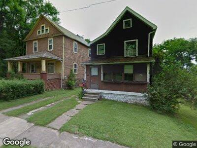
71 Fleming St Youngstown, OH 44510
Brier Hill NeighborhoodEstimated Value: $156,000
3
Beds
1
Bath
1,576
Sq Ft
$99/Sq Ft
Est. Value
About This Home
This home is located at 71 Fleming St, Youngstown, OH 44510 and is currently priced at $156,000, approximately $98 per square foot. 71 Fleming St is a home located in Mahoning County with nearby schools including Harding Elementary School, East High School, and St. Joseph the Provider School.
Ownership History
Date
Name
Owned For
Owner Type
Purchase Details
Closed on
Sep 17, 2019
Bought by
Rescue Mission Of Mahoning
Current Estimated Value
Home Financials for this Owner
Home Financials are based on the most recent Mortgage that was taken out on this home.
Interest Rate
3.56%
Purchase Details
Closed on
Oct 3, 2018
Sold by
Mccullum Levester and Yemma Daniel D
Bought by
Mahoning County Land Reutilization Corpo
Purchase Details
Closed on
Aug 17, 1970
Bought by
Mccullum Levester
Create a Home Valuation Report for This Property
The Home Valuation Report is an in-depth analysis detailing your home's value as well as a comparison with similar homes in the area
Home Values in the Area
Average Home Value in this Area
Purchase History
| Date | Buyer | Sale Price | Title Company |
|---|---|---|---|
| Rescue Mission Of Mahoning | -- | -- | |
| Mahoning County Land Reutilization Corpo | $948 | None Available | |
| Mccullum Levester | -- | -- |
Source: Public Records
Mortgage History
| Date | Status | Borrower | Loan Amount |
|---|---|---|---|
| Closed | Rescue Mission Of Mahoning | -- | |
| Previous Owner | Mahoning County Land Reutilization Corp | $25,000 |
Source: Public Records
Tax History Compared to Growth
Tax History
| Year | Tax Paid | Tax Assessment Tax Assessment Total Assessment is a certain percentage of the fair market value that is determined by local assessors to be the total taxable value of land and additions on the property. | Land | Improvement |
|---|---|---|---|---|
| 2024 | $6 | $120 | $120 | -- |
| 2023 | $6 | $120 | $120 | $0 |
| 2022 | $6 | $100 | $100 | $0 |
| 2021 | $6 | $100 | $100 | $0 |
| 2020 | $6 | $100 | $100 | $0 |
| 2019 | $106 | $100 | $100 | $0 |
| 2018 | $107 | $2,320 | $330 | $1,990 |
| 2017 | $168 | $2,320 | $330 | $1,990 |
| 2016 | $216 | $3,220 | $330 | $2,890 |
| 2015 | $222 | $3,220 | $330 | $2,890 |
| 2014 | $210 | $3,220 | $330 | $2,890 |
| 2013 | $3 | $3,220 | $330 | $2,890 |
Source: Public Records
Map
Nearby Homes
- 146 Jefferson St
- 848 Norwood Ave
- 1360 5th Ave
- 826 Michigan Ave
- 1636 Butler Ave
- 816 Michigan Ave
- 267 N Heights Ave Unit 269
- 1639 Butler Ave
- 506 Bradley Ln
- 1655 5th Ave
- 1611 Wellington Ave
- 239 N Heights Ave
- 1829 Coronado Ave
- 486 Madera Ave
- 36 Whitney Ave N
- 238 Lora Ave
- 487 Carlotta Dr
- 229-231 Lora Ave
- 234 Lora Ave
- 1594 2nd St
- 71 Fleming St
- 63 Fleming St
- 101 Fleming St
- 33 Coral St
- 27 Coral St
- 338 N Worthington St
- 344 N Worthington St
- 102 N Worthington St
- 125 Jefferson St
- 125 Jefferson St
- 117 Jefferson St
- 129 Jefferson St
- 113 Jefferson St Unit 115
- 319 N Worthington St
- 109 Jefferson St
- 107 Jefferson St
- 402 N Worthington St
- 149 Jefferson St
- 337 N Worthington St
- 120 Jefferson St