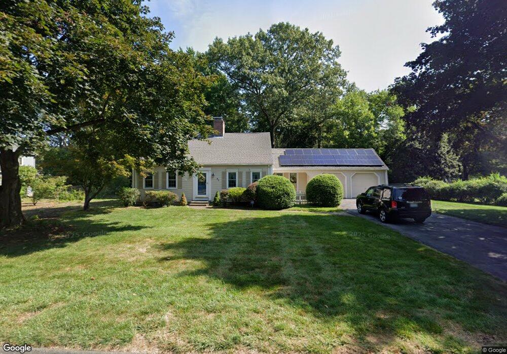
71 Wyndward Rd Longmeadow, MA 01106
Estimated Value: $531,901 - $597,000
4
Beds
2
Baths
2,175
Sq Ft
$254/Sq Ft
Est. Value
About This Home
This home is located at 71 Wyndward Rd, Longmeadow, MA 01106 and is currently estimated at $551,475, approximately $253 per square foot. 71 Wyndward Rd is a home located in Hampden County with nearby schools including Wolf Swamp Road School, Glenbrook Middle School, and Longmeadow High School.
Ownership History
Date
Name
Owned For
Owner Type
Purchase Details
Closed on
Sep 28, 2001
Sold by
Stenstrom David L and Stenstrom Jane M
Bought by
Dunphy Michael J and Dunphy Jane E
Current Estimated Value
Home Financials for this Owner
Home Financials are based on the most recent Mortgage that was taken out on this home.
Original Mortgage
$204,000
Outstanding Balance
$79,970
Interest Rate
6.91%
Mortgage Type
Purchase Money Mortgage
Estimated Equity
$471,505
Create a Home Valuation Report for This Property
The Home Valuation Report is an in-depth analysis detailing your home's value as well as a comparison with similar homes in the area
Home Values in the Area
Average Home Value in this Area
Purchase History
| Date | Buyer | Sale Price | Title Company |
|---|---|---|---|
| Dunphy Michael J | $240,000 | -- |
Source: Public Records
Mortgage History
| Date | Status | Borrower | Loan Amount |
|---|---|---|---|
| Open | Dunphy Michael J | $204,000 |
Source: Public Records
Tax History Compared to Growth
Tax History
| Year | Tax Paid | Tax Assessment Tax Assessment Total Assessment is a certain percentage of the fair market value that is determined by local assessors to be the total taxable value of land and additions on the property. | Land | Improvement |
|---|---|---|---|---|
| 2025 | $10,245 | $485,100 | $165,000 | $320,100 |
| 2024 | $10,032 | $485,100 | $165,000 | $320,100 |
| 2023 | $9,475 | $413,400 | $142,100 | $271,300 |
| 2022 | $9,035 | $366,700 | $142,100 | $224,600 |
| 2021 | $8,614 | $348,200 | $135,300 | $212,900 |
| 2020 | $8,021 | $331,300 | $127,800 | $203,500 |
| 2019 | $7,528 | $312,500 | $127,800 | $184,700 |
| 2018 | $7,485 | $307,500 | $158,000 | $149,500 |
| 2017 | $7,251 | $307,500 | $158,000 | $149,500 |
| 2016 | $6,832 | $280,800 | $150,900 | $129,900 |
| 2015 | $6,592 | $279,100 | $149,200 | $129,900 |
Source: Public Records
Map
Nearby Homes
- 757 Shaker Rd
- 95 Tedford Dr
- 151 Wolf Swamp Rd
- 49 Wimbleton Dr
- 25 Whitmun Rd
- 85 Inverness Ln
- 12 Concord Terrace
- 408 Maple Rd
- 120 Inverness Ln
- 35 Roosevelt Blvd
- 217 Inverness Ln
- 32 Magnolia Dr
- 5 Ferncroft St
- 3 E Forrest Dr
- 2 Nevins Ave
- 41 Liberty Ln
- 43 Liberty Ln
- 39 Liberty Ln
- 60 Roosevelt Blvd
- 50 Liberty Ln