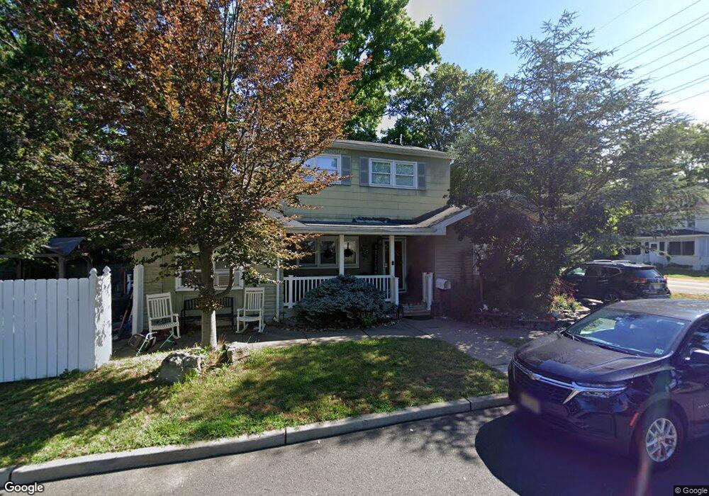
710 Branch St Union Beach, NJ 07735
Estimated Value: $520,000 - $576,000
4
Beds
2
Baths
2,190
Sq Ft
$255/Sq Ft
Est. Value
About This Home
This home is located at 710 Branch St, Union Beach, NJ 07735 and is currently estimated at $557,857, approximately $254 per square foot. 710 Branch St is a home located in Monmouth County with nearby schools including Memorial School, Icob Academy, and St. Joseph Elementary School.
Ownership History
Date
Name
Owned For
Owner Type
Purchase Details
Closed on
Jul 22, 2020
Sold by
Loporto Mary Ann and Loporto Frank A
Bought by
Loporto Paul and Loporto Dawn
Current Estimated Value
Home Financials for this Owner
Home Financials are based on the most recent Mortgage that was taken out on this home.
Original Mortgage
$271,131
Interest Rate
2.8%
Mortgage Type
FHA
Purchase Details
Closed on
Dec 17, 1984
Bought by
Lo Porto Frank A and Mary Ann
Create a Home Valuation Report for This Property
The Home Valuation Report is an in-depth analysis detailing your home's value as well as a comparison with similar homes in the area
Home Values in the Area
Average Home Value in this Area
Purchase History
| Date | Buyer | Sale Price | Title Company |
|---|---|---|---|
| Loporto Paul | $300,000 | Amrock | |
| Loporto Paul | $300,000 | None Listed On Document | |
| Lo Porto Frank A | $72,900 | -- |
Source: Public Records
Mortgage History
| Date | Status | Borrower | Loan Amount |
|---|---|---|---|
| Previous Owner | Loporto Paul | $271,131 |
Source: Public Records
Tax History Compared to Growth
Tax History
| Year | Tax Paid | Tax Assessment Tax Assessment Total Assessment is a certain percentage of the fair market value that is determined by local assessors to be the total taxable value of land and additions on the property. | Land | Improvement |
|---|---|---|---|---|
| 2025 | $8,784 | $465,100 | $206,300 | $258,800 |
| 2024 | $9,078 | $426,000 | $179,800 | $246,200 |
| 2023 | $9,078 | $424,200 | $156,400 | $267,800 |
| 2022 | $8,126 | $368,200 | $125,000 | $243,200 |
| 2021 | $8,126 | $331,000 | $113,700 | $217,300 |
| 2020 | $7,898 | $313,900 | $110,700 | $203,200 |
| 2019 | $7,719 | $299,300 | $105,500 | $193,800 |
| 2018 | $7,381 | $275,100 | $87,200 | $187,900 |
| 2017 | $7,114 | $254,900 | $87,200 | $167,700 |
| 2016 | $7,020 | $251,700 | $87,200 | $164,500 |
| 2015 | $6,932 | $253,100 | $96,000 | $157,100 |
| 2014 | $7,597 | $228,700 | $84,200 | $144,500 |
Source: Public Records
Map
Nearby Homes
- 1701 Florence Ave
- 702 Branch St
- 1700 Florence Ave
- 703 Branch St
- 1713 Florence Ave
- 705 Branch St
- 707 Branch St
- 1708 Florence Ave
- 1710 Florence Ave
- 211 Bank St
- 1706 Florence Ave
- 1717 Florence Ave
- 1712 Florence Ave
- 218 Branch St
- 1702 Florence Ave
- 217 Bank St
- 402 Harrison Ave
- 1716 Florence Ave Unit 661
- 18 Johnson Ave
- 404 Harrison Ave