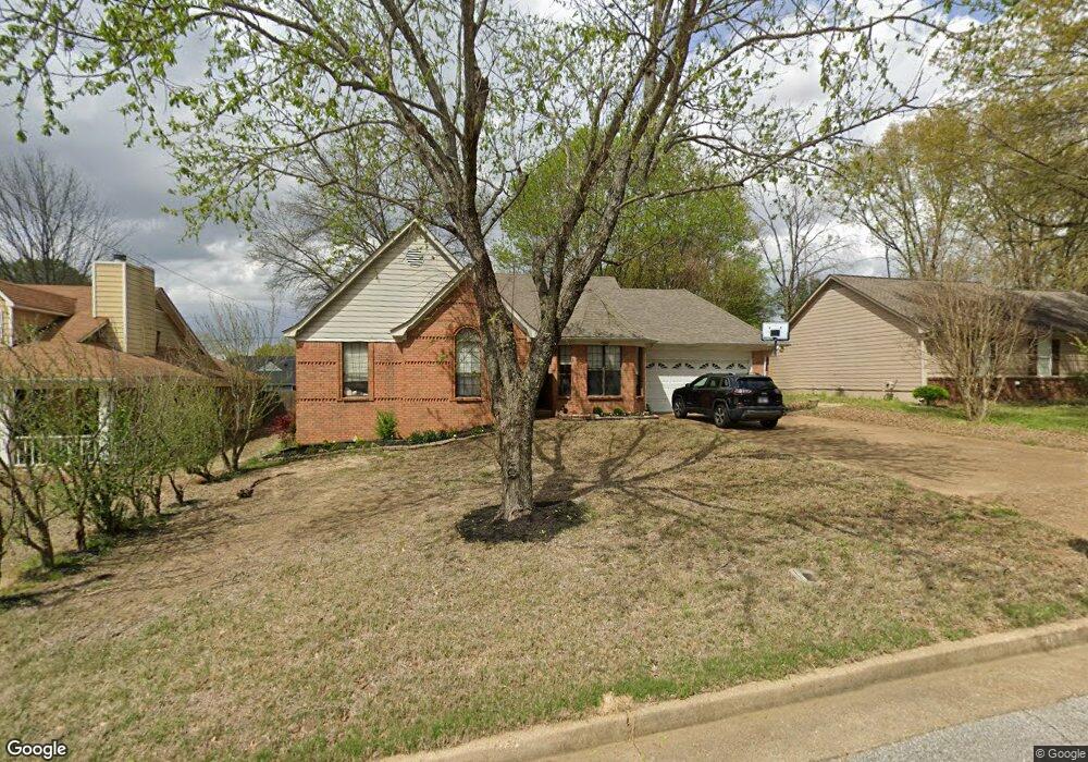
7102 Maplewood Rd Olive Branch, MS 38654
Estimated Value: $232,000 - $247,000
3
Beds
2
Baths
1,400
Sq Ft
$169/Sq Ft
Est. Value
About This Home
This home is located at 7102 Maplewood Rd, Olive Branch, MS 38654 and is currently estimated at $236,634, approximately $169 per square foot. 7102 Maplewood Rd is a home located in DeSoto County with nearby schools including Pleasant Hill Elementary School, DeSoto Central Middle School, and DeSoto Central High School.
Ownership History
Date
Name
Owned For
Owner Type
Purchase Details
Closed on
Aug 15, 2008
Sold by
Mcpherson Martha G
Bought by
Butler Jerry E
Current Estimated Value
Home Financials for this Owner
Home Financials are based on the most recent Mortgage that was taken out on this home.
Original Mortgage
$134,000
Outstanding Balance
$86,794
Interest Rate
6.32%
Mortgage Type
VA
Estimated Equity
$149,840
Create a Home Valuation Report for This Property
The Home Valuation Report is an in-depth analysis detailing your home's value as well as a comparison with similar homes in the area
Home Values in the Area
Average Home Value in this Area
Purchase History
| Date | Buyer | Sale Price | Title Company |
|---|---|---|---|
| Butler Jerry E | -- | Title & Closing Services |
Source: Public Records
Mortgage History
| Date | Status | Borrower | Loan Amount |
|---|---|---|---|
| Open | Butler Jerry E | $134,000 |
Source: Public Records
Tax History
| Year | Tax Paid | Tax Assessment Tax Assessment Total Assessment is a certain percentage of the fair market value that is determined by local assessors to be the total taxable value of land and additions on the property. | Land | Improvement |
|---|---|---|---|---|
| 2025 | $274 | $9,865 | $2,500 | $7,365 |
| 2024 | $323 | $9,865 | $2,500 | $7,365 |
| 2023 | $323 | $9,865 | $0 | $0 |
| 2022 | $323 | $9,865 | $2,500 | $7,365 |
| 2021 | $323 | $9,865 | $2,500 | $7,365 |
| 2020 | $323 | $9,865 | $2,500 | $7,365 |
| 2019 | $323 | $9,865 | $2,500 | $7,365 |
| 2017 | $296 | $16,818 | $9,659 | $7,159 |
| 2016 | $296 | $9,659 | $2,500 | $7,159 |
| 2015 | $1,325 | $16,818 | $9,659 | $7,159 |
| 2014 | $296 | $9,659 | $0 | $0 |
| 2013 | $288 | $9,659 | $0 | $0 |
Source: Public Records
Map
Nearby Homes
- 7103 Larkfield Rd
- 7248 Kingcrest Rd
- 10190 May Flowers St
- 4777 Bolivar Trail N
- 10319 March Meadows Way
- 784 Arrow Cove
- 6934 Sunrise Loop W
- 6920 Saint Micheals
- 6703 Jessie Hoyt Dr
- 0 S Hamilton Cir
- 6923 Silver Cloud Cove
- 6635 Renee Dr
- 7128 Apache Dr
- 6559 Shenandoah Ln
- 7501 Iron Loop
- 6363 Cheyenne Dr
- 7402 Grandiflora Dr
- 7300 W Shahkoka Dr
- 6502 Timber Oaks Dr
- 6384 Acree Woods Dr
- 7118 Maplewood Rd
- 7076 Maplewood Rd
- 7132 Maplewood Rd
- 7117 Larkfield Rd
- 7091 Larkfield Rd
- 7113 Maplewood Rd
- 7095 Maplewood Rd
- 7043 Maplewood Rd
- 7079 Larkfield Rd
- 7131 Larkfield Rd
- 7127 Maplewood Rd
- 7079 Maplewood Rd
- 7146 Maplewood Rd
- 7139 Maplewood Rd
- 7051 Maplewood Rd
- 7145 Larkfield Rd
- 7061 Larkfield Rd
- 7118 Larkfield Rd
- 7162 Maplewood Rd
Your Personal Tour Guide
Ask me questions while you tour the home.