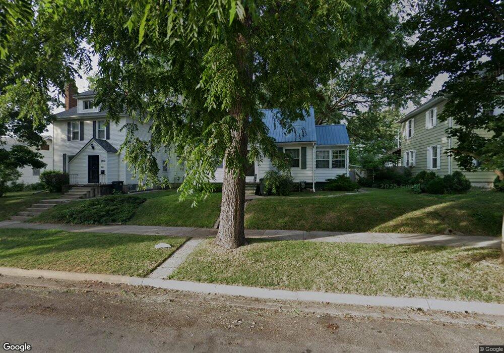
711 Johnson St Waterloo, IA 50702
Neighbors Helping Neighbors NeighborhoodEstimated Value: $81,989 - $101,000
2
Beds
1
Bath
950
Sq Ft
$97/Sq Ft
Est. Value
About This Home
This home is located at 711 Johnson St, Waterloo, IA 50702 and is currently estimated at $91,747, approximately $96 per square foot. 711 Johnson St is a home located in Black Hawk County with nearby schools including Lowell Elementary School, Bunger Middle School, and West High School.
Ownership History
Date
Name
Owned For
Owner Type
Purchase Details
Closed on
Nov 14, 2006
Sold by
Torlak Fahrudin and Torlak Nezira
Bought by
Marquez Laura and Marquez Leonardo
Current Estimated Value
Home Financials for this Owner
Home Financials are based on the most recent Mortgage that was taken out on this home.
Original Mortgage
$76,500
Outstanding Balance
$45,396
Interest Rate
6.36%
Mortgage Type
New Conventional
Estimated Equity
$46,351
Create a Home Valuation Report for This Property
The Home Valuation Report is an in-depth analysis detailing your home's value as well as a comparison with similar homes in the area
Home Values in the Area
Average Home Value in this Area
Purchase History
| Date | Buyer | Sale Price | Title Company |
|---|---|---|---|
| Marquez Laura | $76,500 | None Available |
Source: Public Records
Mortgage History
| Date | Status | Borrower | Loan Amount |
|---|---|---|---|
| Open | Marquez Laura | $76,500 |
Source: Public Records
Tax History
| Year | Tax Paid | Tax Assessment Tax Assessment Total Assessment is a certain percentage of the fair market value that is determined by local assessors to be the total taxable value of land and additions on the property. | Land | Improvement |
|---|---|---|---|---|
| 2025 | $1,774 | $83,480 | $11,250 | $72,230 |
| 2024 | $1,774 | $81,750 | $11,250 | $70,500 |
| 2023 | $1,294 | $81,750 | $11,250 | $70,500 |
| 2022 | $1,260 | $58,950 | $11,250 | $47,700 |
| 2021 | $1,386 | $58,950 | $11,250 | $47,700 |
| 2020 | $1,364 | $56,850 | $11,250 | $45,600 |
| 2019 | $103 | $56,850 | $11,250 | $45,600 |
| 2018 | $1,371 | $56,850 | $11,250 | $45,600 |
| 2017 | $1,409 | $56,850 | $11,250 | $45,600 |
| 2016 | $1,290 | $56,850 | $11,250 | $45,600 |
| 2015 | $1,290 | $56,850 | $11,250 | $45,600 |
| 2014 | $1,234 | $53,340 | $11,250 | $42,090 |
Source: Public Records
Map
Nearby Homes
- 611 Johnson St
- 1125 Bertch Ave
- 1207 Bertch Ave
- 1134 Bertch Ave
- 1229 W 7th St
- 1017 Forest Ave
- 1115 Hawthorne Ave
- 236 Linwood Ave
- 826 Williston Ave
- 929 Randolph St
- 701 W 7th St
- 820 Bertch Ave
- 1013 W 6th St
- 1012 W 6th St
- 1129 South St
- 915 W 5th St
- 519 W 9th St
- 739 W 11th St
- 1101 Glenny Ave
- 812 Hawthorne Ave
- 717 Johnson St
- 707 Johnson St
- 723 Johnson St
- 703 Johnson St
- 727 Johnson St
- 1112 Leavitt St
- 1102 Leavitt St
- 1116 Leavitt St
- 1122 Leavitt St
- 733 Johnson St
- 1126 Leavitt St
- 1100 Leavitt St
- 1106 W 9th St
- 737 Johnson St
- 619 Johnson St Unit 11
- 619 Johnson St Unit 8
- 619 Johnson St Unit 7
- 619 Johnson St Unit 5
- 1132 Leavitt St
- 1136 Leavitt St
Your Personal Tour Guide
Ask me questions while you tour the home.