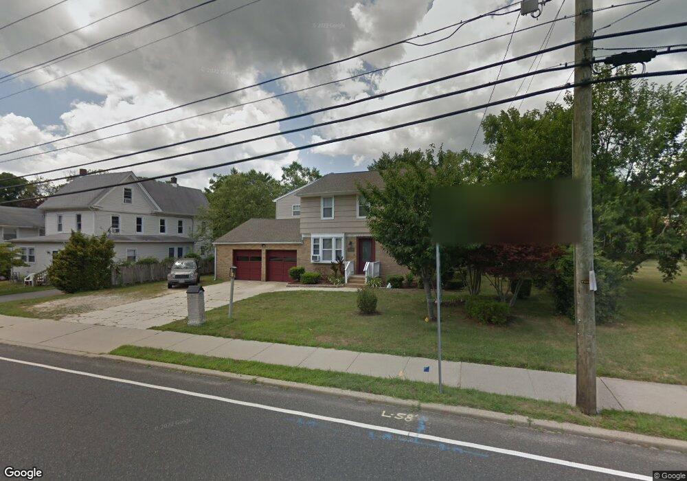
711 N Shore Rd Absecon, NJ 08201
Estimated Value: $400,206 - $496,000
--
Bed
--
Bath
2,982
Sq Ft
$148/Sq Ft
Est. Value
About This Home
This home is located at 711 N Shore Rd, Absecon, NJ 08201 and is currently estimated at $440,052, approximately $147 per square foot. 711 N Shore Rd is a home located in Atlantic County with nearby schools including Emma C. Attales Middle School, Champion Baptist Academy, and Assumption Regional Catholic School.
Ownership History
Date
Name
Owned For
Owner Type
Purchase Details
Closed on
Jun 30, 2006
Sold by
Rusciano Andrew
Bought by
Collins Joanne and Collins Patricia
Current Estimated Value
Home Financials for this Owner
Home Financials are based on the most recent Mortgage that was taken out on this home.
Original Mortgage
$232,000
Outstanding Balance
$137,352
Interest Rate
6.6%
Mortgage Type
Purchase Money Mortgage
Estimated Equity
$302,700
Purchase Details
Closed on
Aug 12, 2000
Sold by
Surita Andrew
Bought by
Rusciano Andrew
Create a Home Valuation Report for This Property
The Home Valuation Report is an in-depth analysis detailing your home's value as well as a comparison with similar homes in the area
Home Values in the Area
Average Home Value in this Area
Purchase History
| Date | Buyer | Sale Price | Title Company |
|---|---|---|---|
| Collins Joanne | $290,000 | -- | |
| Rusciano Andrew | -- | -- |
Source: Public Records
Mortgage History
| Date | Status | Borrower | Loan Amount |
|---|---|---|---|
| Open | Collins Joanne | $232,000 |
Source: Public Records
Tax History Compared to Growth
Tax History
| Year | Tax Paid | Tax Assessment Tax Assessment Total Assessment is a certain percentage of the fair market value that is determined by local assessors to be the total taxable value of land and additions on the property. | Land | Improvement |
|---|---|---|---|---|
| 2025 | $8,409 | $251,300 | $102,200 | $149,100 |
| 2024 | $8,409 | $251,300 | $102,200 | $149,100 |
| 2023 | $8,308 | $251,300 | $102,200 | $149,100 |
| 2022 | $8,308 | $251,300 | $102,200 | $149,100 |
| 2021 | $8,283 | $251,300 | $102,200 | $149,100 |
| 2020 | $8,298 | $251,300 | $102,200 | $149,100 |
| 2019 | $8,238 | $251,300 | $102,200 | $149,100 |
| 2018 | $8,273 | $251,300 | $102,200 | $149,100 |
| 2017 | $8,212 | $251,300 | $102,200 | $149,100 |
| 2016 | $7,981 | $251,300 | $102,200 | $149,100 |
| 2015 | $7,878 | $251,300 | $102,200 | $149,100 |
| 2014 | $7,770 | $251,300 | $102,200 | $149,100 |
Source: Public Records
Map
Nearby Homes
- 743 N Shore Rd
- 625 N Shore Rd
- 4 E Curran Dr
- 505 Sooy Ln
- 621 S New York Rd
- 117 E Wyoming Ave
- 613 S New York Rd
- 506 Lazy Ln
- 210 Coolidge Ave
- 243 Pennsylvania Ave
- 00 California Ave
- 244 E Wyoming Ave
- 506 E Forestbrook Dr
- 0 E Dickinson Ave
- 90 E Woodland Ave Unit E90
- 539 E Pennsylvania Ave
- 47 E Woodland Ave Unit C47
- 130 Crestview Ave
- 399 Pitney Rd
- 194 N Shore Rd