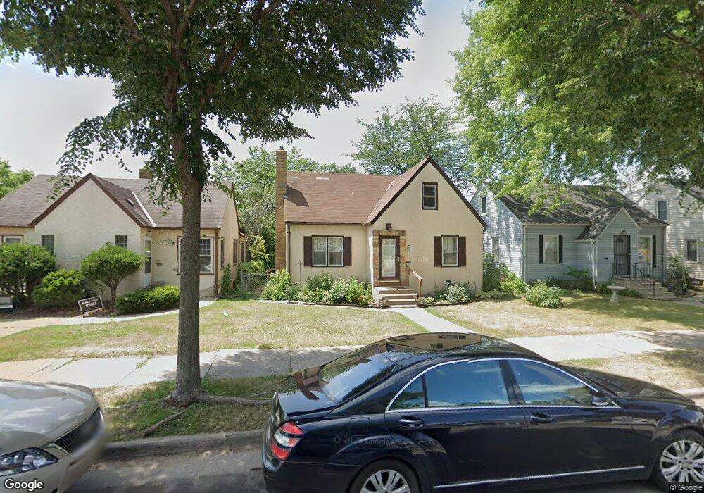
711 Sheridan Ave N Minneapolis, MN 55411
Willard-Hay NeighborhoodEstimated Value: $228,000 - $269,000
3
Beds
2
Baths
1,444
Sq Ft
$174/Sq Ft
Est. Value
About This Home
This home is located at 711 Sheridan Ave N, Minneapolis, MN 55411 and is currently estimated at $251,545, approximately $174 per square foot. 711 Sheridan Ave N is a home located in Hennepin County with nearby schools including Bryn Mawr Elementary School, Anwatin Middle School, and North Community High School.
Ownership History
Date
Name
Owned For
Owner Type
Purchase Details
Closed on
Oct 31, 2017
Sold by
Harbour Portfolio Vl Lp
Bought by
Orange Capital Funding Llc
Current Estimated Value
Purchase Details
Closed on
Jan 26, 2012
Sold by
Harbour Portfolio Vi Lp
Bought by
Bruce Edwina K
Purchase Details
Closed on
Sep 13, 2007
Sold by
Hsbc Bank Usa Na
Bought by
Raitz Troy
Purchase Details
Closed on
Dec 10, 2004
Sold by
Washington Clifford L and Washington Marilyn M
Bought by
Lano Tamsen
Create a Home Valuation Report for This Property
The Home Valuation Report is an in-depth analysis detailing your home's value as well as a comparison with similar homes in the area
Home Values in the Area
Average Home Value in this Area
Purchase History
| Date | Buyer | Sale Price | Title Company |
|---|---|---|---|
| Orange Capital Funding Llc | $36,543 | None Available | |
| Bruce Edwina K | $63,000 | None Available | |
| Raitz Troy | $85,000 | -- | |
| Lano Tamsen | $190,000 | -- |
Source: Public Records
Mortgage History
| Date | Status | Borrower | Loan Amount |
|---|---|---|---|
| Closed | Bruce Edwina K | $0 |
Source: Public Records
Tax History Compared to Growth
Tax History
| Year | Tax Paid | Tax Assessment Tax Assessment Total Assessment is a certain percentage of the fair market value that is determined by local assessors to be the total taxable value of land and additions on the property. | Land | Improvement |
|---|---|---|---|---|
| 2024 | $6,138 | $234,000 | $23,000 | $211,000 |
| 2023 | $4,533 | $233,000 | $23,000 | $210,000 |
| 2022 | $2,595 | $233,000 | $16,000 | $217,000 |
| 2021 | $4,209 | $189,000 | $16,000 | $173,000 |
| 2020 | $6,449 | $166,500 | $13,800 | $152,700 |
| 2019 | $5,346 | $151,500 | $9,200 | $142,300 |
| 2018 | $2,245 | $137,500 | $9,200 | $128,300 |
| 2017 | $1,897 | $124,000 | $8,400 | $115,600 |
| 2016 | $2,053 | $121,000 | $8,400 | $112,600 |
| 2015 | $1,737 | $105,000 | $8,400 | $96,600 |
| 2014 | -- | $94,500 | $8,400 | $86,100 |
Source: Public Records
Map
Nearby Homes
- 723 Sheridan Ave N
- 819 Sheridan Ave N
- 701 Vincent Ave N
- 905 Queen Ave N
- 918 Queen Ave N
- 2224 4th Ave N
- 2713 Glenwood Ave
- 722 Newton Ave N
- 2108 Glenwood Ave
- 1214 Penn Ave N
- 426 Logan Ave N
- 1332 Upton Ave N
- 1336 Russell Ave N
- 8 Queen Ave S
- 1028 Knox Ave N
- 1030 Knox Ave N
- 20 Vincent Ave S
- 1400 Queen Ave N
- 226 Gramercy Ave
- 40 Penn Ave S
- 705 Sheridan Ave N
- 715 Sheridan Ave N
- 719 Sheridan Ave N
- 701 Sheridan Ave N
- 710 Thomas Ave N
- 706 Thomas Ave N
- 714 Thomas Ave N
- 710 Sheridan Ave N
- 700 Thomas Ave N
- 700 Sheridan Ave N
- 720 Thomas Ave N
- 626 Thomas Ave N
- 720 Sheridan Ave N
- 729 Sheridan Ave N
- 621 Sheridan Ave N
- 724 Thomas Ave N
- 622 Sheridan Ave N
- 622 Thomas Ave N
- 615 Sheridan Ave N
- 730 Sheridan Ave N