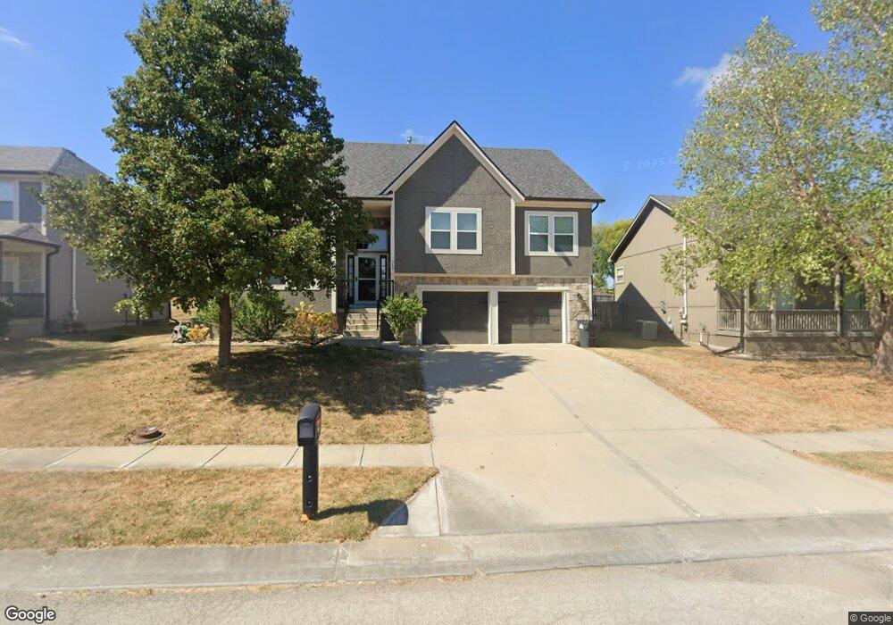
712 SW Joseph Cir Grain Valley, MO 64029
Estimated Value: $328,953 - $472,000
4
Beds
3
Baths
1,840
Sq Ft
$212/Sq Ft
Est. Value
About This Home
This home is located at 712 SW Joseph Cir, Grain Valley, MO 64029 and is currently estimated at $389,488, approximately $211 per square foot. 712 SW Joseph Cir is a home located in Jackson County with nearby schools including Grain Valley High School.
Ownership History
Date
Name
Owned For
Owner Type
Purchase Details
Closed on
May 26, 2020
Sold by
Norman James and Norman Taylor
Bought by
Norman James and Norman Tyler
Current Estimated Value
Home Financials for this Owner
Home Financials are based on the most recent Mortgage that was taken out on this home.
Original Mortgage
$173,550
Outstanding Balance
$153,789
Interest Rate
3.3%
Mortgage Type
New Conventional
Estimated Equity
$235,699
Purchase Details
Closed on
Mar 13, 2017
Sold by
Ejc Rentals Llc
Bought by
Norman James and Burkett Taylor
Create a Home Valuation Report for This Property
The Home Valuation Report is an in-depth analysis detailing your home's value as well as a comparison with similar homes in the area
Home Values in the Area
Average Home Value in this Area
Purchase History
| Date | Buyer | Sale Price | Title Company |
|---|---|---|---|
| Norman James | -- | Assured Quality Title Co | |
| Norman James | $195,000 | First American Title Ins Co |
Source: Public Records
Mortgage History
| Date | Status | Borrower | Loan Amount |
|---|---|---|---|
| Open | Norman James | $173,550 |
Source: Public Records
Tax History Compared to Growth
Tax History
| Year | Tax Paid | Tax Assessment Tax Assessment Total Assessment is a certain percentage of the fair market value that is determined by local assessors to be the total taxable value of land and additions on the property. | Land | Improvement |
|---|---|---|---|---|
| 2025 | $3,791 | $52,928 | $7,919 | $45,009 |
| 2024 | $3,649 | $46,026 | $4,060 | $41,966 |
| 2023 | $3,649 | $46,026 | $4,923 | $41,103 |
| 2022 | $4,013 | $44,270 | $5,425 | $38,845 |
| 2021 | $3,919 | $44,270 | $5,425 | $38,845 |
| 2020 | $3,970 | $44,238 | $5,425 | $38,813 |
| 2019 | $3,890 | $44,238 | $5,425 | $38,813 |
| 2018 | $3,886 | $41,297 | $5,059 | $36,238 |
| 2017 | $3,660 | $41,297 | $5,059 | $36,238 |
| 2016 | $3,660 | $38,915 | $6,376 | $32,539 |
| 2014 | $3,616 | $38,152 | $6,251 | $31,901 |
Source: Public Records
Map
Nearby Homes
- 1309 SW Graystone Cir
- 1215 SW Lone Star Ct
- 1214 SW Windcrest Ct
- 1219 SW Windcrest Ct
- 719 S Minter Rd
- 509 SW Joseph Ct
- 1203 SW Lakeview Dr
- 1200 SW Foxtail Dr
- 636 SW Lakeview Dr
- 401 S Minter Rd
- 714 SW Brome Dr
- 913 SW Abar Dr
- 1024 Christie Ln
- 29800 E 65th St
- 1418 SW Blue Branch Dr
- 6205 Chiles Rd
- 1010 SW Cross Creek Dr
- 725 SW Tisha Ln
- 640 SW Crestview Dr
- 1402 NW Broadway Throughway
- 710 SW Joseph Cir
- 714 SW Joseph Cir
- 1302 SW Addie Ln
- 708 SW Joseph Cir
- 713 SW Joseph Cir
- 1306 SW Addie Ln
- 707 SW Joseph Cir
- 715 SW Joseph Cir
- 706 SW Joseph Cir
- 711 SW Joseph Cir
- 709 SW Joseph Cir
- 719 SW Joseph Cir
- 1303 SW Addie Ln
- 1308 SW Addie Ln
- 704 SW Joseph Cir
- 1307 SW Addie Ln
- 1310 SW Addie Ln
- 702 SW Joseph Cir
- 721 SW Joseph Cir
- 703 SW Joseph Cir