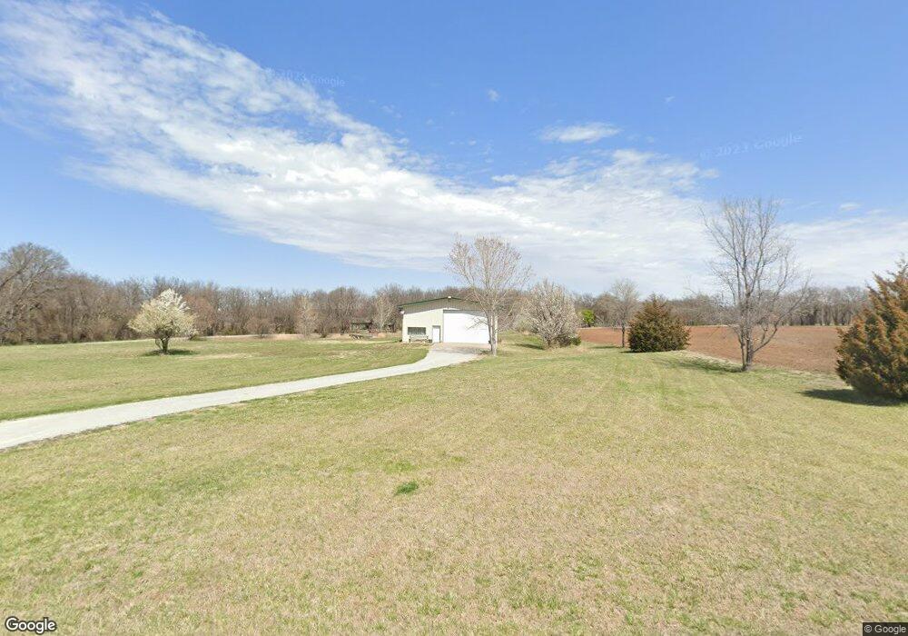
7120 E 111th St S Mulvane, KS 67110
Estimated Value: $309,000 - $410,842
4
Beds
2
Baths
2,516
Sq Ft
$143/Sq Ft
Est. Value
About This Home
This home is located at 7120 E 111th St S, Mulvane, KS 67110 and is currently estimated at $359,921, approximately $143 per square foot. 7120 E 111th St S is a home located in Sedgwick County with nearby schools including Munson Primary School, Mulvane Grade School, and Mulvane Middle School.
Ownership History
Date
Name
Owned For
Owner Type
Purchase Details
Closed on
Oct 13, 2017
Sold by
Hlad James L
Bought by
Cusick Joseph B and Cusick Sonja M
Current Estimated Value
Home Financials for this Owner
Home Financials are based on the most recent Mortgage that was taken out on this home.
Original Mortgage
$223,250
Outstanding Balance
$186,477
Interest Rate
3.82%
Mortgage Type
New Conventional
Estimated Equity
$173,444
Purchase Details
Closed on
Jan 8, 2002
Sold by
Bloomgren Rosemarie K and Bloomgren Donald H
Bought by
Hlad Marilyn J
Home Financials for this Owner
Home Financials are based on the most recent Mortgage that was taken out on this home.
Original Mortgage
$155,200
Interest Rate
7.03%
Create a Home Valuation Report for This Property
The Home Valuation Report is an in-depth analysis detailing your home's value as well as a comparison with similar homes in the area
Home Values in the Area
Average Home Value in this Area
Purchase History
| Date | Buyer | Sale Price | Title Company |
|---|---|---|---|
| Cusick Joseph B | -- | None Available | |
| Hlad Marilyn J | -- | Columbian Natl Title Ins Co |
Source: Public Records
Mortgage History
| Date | Status | Borrower | Loan Amount |
|---|---|---|---|
| Open | Cusick Joseph B | $223,250 | |
| Closed | Hlad Marilyn J | $155,200 |
Source: Public Records
Tax History
| Year | Tax Paid | Tax Assessment Tax Assessment Total Assessment is a certain percentage of the fair market value that is determined by local assessors to be the total taxable value of land and additions on the property. | Land | Improvement |
|---|---|---|---|---|
| 2025 | $4,480 | $37,035 | $5,405 | $31,630 |
| 2023 | $4,480 | $32,339 | $5,141 | $27,198 |
| 2022 | $3,565 | $29,061 | $4,830 | $24,231 |
| 2021 | $3,562 | $28,590 | $3,163 | $25,427 |
| 2020 | $3,146 | $25,291 | $3,163 | $22,128 |
| 2019 | $3,109 | $24,019 | $3,197 | $20,822 |
| 2018 | $2,948 | $23,370 | $3,243 | $20,127 |
| 2017 | $2,782 | $0 | $0 | $0 |
| 2016 | $2,600 | $0 | $0 | $0 |
| 2015 | $2,597 | $0 | $0 | $0 |
| 2014 | $2,467 | $0 | $0 | $0 |
Source: Public Records
Map
Nearby Homes
- 4 Louis Dr
- 10100 S Rock Rd
- 1619 N Rock Rd
- 105 E Burlington Dr
- 1850 N Rock Rd
- 1729 N Timbercreek Dr
- 170 Chestnut Dr
- 122 E Eagle Watch St
- 219 Pioneer Place
- 217 E Filmore
- 225 Filmore St
- 1657 N Prairie Run Cir
- 503 Charles Ave
- 515 Franklin Ave
- 1602 N Topaz Ln
- 742 Sullivan Dr
- 1651 N Diamond Cir
- 1647 N Diamond Cir
- 1615 N Diamond Cir
- 1612 N Diamond Cir
- 77.5 Acres Unit See Legal
- 219 E Northern Ct
- 227 E Northern Ct
- 220 E Northern Ct
- 223 E Northern Ct
- 1501 N Rockwood Blvd
- 1502 N Rockwood Blvd
- 37 Circle Dr
- 1434 Louis Dr
- 14 Circle Dr
- 13 Louis Dr
- 1503 N Rockwood Blvd
- 1432 Louis Dr
- 1504 N Rockwood Blvd
- 1430 Louis Dr
- 1505 N Rockwood Blvd
- 1428 Louis Dr
- 36 Circle Dr
- 12 Louis Dr
- 12 Louis Dr
Your Personal Tour Guide
Ask me questions while you tour the home.