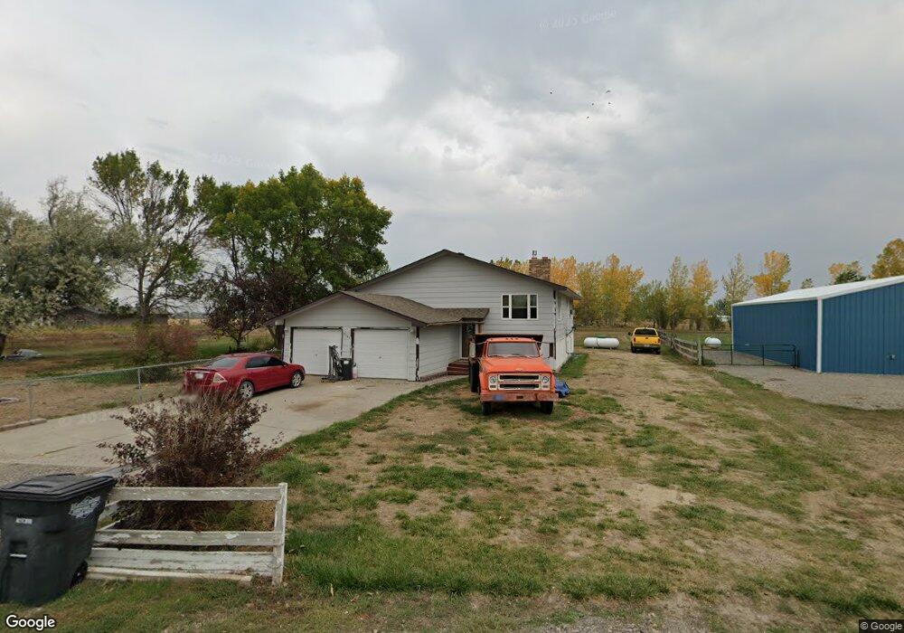
7131 Bronco Rd Shepherd, MT 59079
Estimated Value: $393,000 - $458,000
4
Beds
2
Baths
3,156
Sq Ft
$135/Sq Ft
Est. Value
About This Home
This home is located at 7131 Bronco Rd, Shepherd, MT 59079 and is currently estimated at $427,361, approximately $135 per square foot. 7131 Bronco Rd is a home located in Yellowstone County with nearby schools including Shepherd Elementary School, Shepherd Middle School, and Shepherd High School.
Ownership History
Date
Name
Owned For
Owner Type
Purchase Details
Closed on
Oct 4, 2024
Sold by
Cumber Gavin A
Bought by
Steiner Leo G and Steiner Rachel M
Current Estimated Value
Home Financials for this Owner
Home Financials are based on the most recent Mortgage that was taken out on this home.
Original Mortgage
$312,000
Outstanding Balance
$308,788
Interest Rate
6.46%
Mortgage Type
New Conventional
Estimated Equity
$118,573
Purchase Details
Closed on
May 15, 2019
Sold by
George Marlene R
Bought by
Cumber Gavin A
Home Financials for this Owner
Home Financials are based on the most recent Mortgage that was taken out on this home.
Original Mortgage
$217,171
Interest Rate
4.1%
Mortgage Type
New Conventional
Create a Home Valuation Report for This Property
The Home Valuation Report is an in-depth analysis detailing your home's value as well as a comparison with similar homes in the area
Purchase History
| Date | Buyer | Sale Price | Title Company |
|---|---|---|---|
| Steiner Leo G | -- | First Montana Title | |
| Cumber Gavin A | -- | -- |
Source: Public Records
Mortgage History
| Date | Status | Borrower | Loan Amount |
|---|---|---|---|
| Open | Steiner Leo G | $312,000 | |
| Previous Owner | Cumber Gavin A | $217,171 |
Source: Public Records
Tax History
| Year | Tax Paid | Tax Assessment Tax Assessment Total Assessment is a certain percentage of the fair market value that is determined by local assessors to be the total taxable value of land and additions on the property. | Land | Improvement |
|---|---|---|---|---|
| 2025 | $3,158 | $404,200 | $64,613 | $339,587 |
| 2024 | $3,158 | $365,900 | $52,776 | $313,124 |
| 2023 | $3,213 | $365,900 | $52,776 | $313,124 |
| 2022 | $2,514 | $267,300 | $0 | $0 |
| 2021 | $2,635 | $267,300 | $0 | $0 |
| 2020 | $2,509 | $245,600 | $0 | $0 |
| 2019 | $1,903 | $223,200 | $0 | $0 |
| 2018 | $2,033 | $225,200 | $0 | $0 |
| 2017 | $1,995 | $225,200 | $0 | $0 |
| 2016 | $1,909 | $224,800 | $0 | $0 |
| 2015 | $1,899 | $224,800 | $0 | $0 |
| 2014 | $1,555 | $98,315 | $0 | $0 |
Source: Public Records
Map
Nearby Homes
- 5430 Cerkoney Ln
- 0 Shepherd Road Lot Shepherd Rd
- 0 SHepherd Road lot Shepherd Rd
- 8020 Wade St
- 5652 Bengston Rd
- 7306 Kendra Lynn Dr
- 3863 Glenn Edward Rd
- 6447 US Highway 312
- L5B4 Trumbo Cir
- 3835 Nellie Christine Dr
- L4B4 Trumbo Cir
- L3B4 Trumbo Cir
- L2B4 True Grit St
- L1B4 True Grit St
- L12B3 Molly Dr
- L11B3 High Noon Dr
- L13B2 High Noon Dr
- L13B3 Molly Dr
- L16B3 True Grit St
- L15B3 True Grit St
- 7117 Bronco Rd
- 0 Bronco Rd
- 5358 Yeoman Rd
- 7130 Bronco Rd
- 5316 Yeoman Rd
- 7110 Bronco Rd
- 5408 Yeoman Rd
- 7103 Bronco Rd
- 7042 Bronco Rd
- 7033 Bronco Rd
- 7119 Mustang Rd
- 5420 Cerkoney Ln
- 5406 Cerkoney Ln
- 5242 Yeoman Rd
- 7026 Bronco Rd
- 7105 Mustang Rd
- 7043 Mustang Rd
- 7132 Mustang Rd
- 5303 Percheron Rd
- 7108 Mustang Rd
Your Personal Tour Guide
Ask me questions while you tour the home.