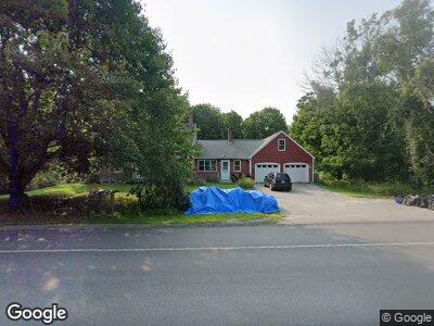
714 Brunswick Rd Richmond, ME 04357
Richmond NeighborhoodEstimated Value: $427,000 - $526,000
3
Beds
4
Baths
1,962
Sq Ft
$242/Sq Ft
Est. Value
About This Home
This home is located at 714 Brunswick Rd, Richmond, ME 04357 and is currently estimated at $474,928, approximately $242 per square foot. 714 Brunswick Rd is a home located in Sagadahoc County with nearby schools including Marcia Buker School, Dresden Elementary School, and Hall-Dale Elementary School.
Ownership History
Date
Name
Owned For
Owner Type
Purchase Details
Closed on
Nov 2, 2007
Sold by
Lincoln Vera D
Bought by
Meagher Joseph G
Current Estimated Value
Home Financials for this Owner
Home Financials are based on the most recent Mortgage that was taken out on this home.
Original Mortgage
$290,000
Outstanding Balance
$182,416
Interest Rate
5.5%
Mortgage Type
Purchase Money Mortgage
Estimated Equity
$399,220
Create a Home Valuation Report for This Property
The Home Valuation Report is an in-depth analysis detailing your home's value as well as a comparison with similar homes in the area
Home Values in the Area
Average Home Value in this Area
Purchase History
| Date | Buyer | Sale Price | Title Company |
|---|---|---|---|
| Meagher Joseph G | -- | -- |
Source: Public Records
Mortgage History
| Date | Status | Borrower | Loan Amount |
|---|---|---|---|
| Open | Meagher Joseph G | $290,000 |
Source: Public Records
Tax History Compared to Growth
Tax History
| Year | Tax Paid | Tax Assessment Tax Assessment Total Assessment is a certain percentage of the fair market value that is determined by local assessors to be the total taxable value of land and additions on the property. | Land | Improvement |
|---|---|---|---|---|
| 2024 | $7,415 | $314,200 | $190,600 | $123,600 |
| 2023 | $6,755 | $314,200 | $190,600 | $123,600 |
| 2022 | $6,143 | $314,200 | $190,600 | $123,600 |
| 2021 | $6,596 | $337,400 | $213,800 | $123,600 |
| 2020 | $6,596 | $337,400 | $213,800 | $123,600 |
| 2019 | $6,596 | $337,400 | $213,800 | $123,600 |
| 2018 | $6,596 | $337,400 | $213,800 | $123,600 |
| 2017 | $6,596 | $337,400 | $213,800 | $123,600 |
| 2016 | $6,461 | $337,400 | $213,800 | $123,600 |
| 2015 | $6,309 | $337,400 | $213,800 | $123,600 |
| 2014 | $6,512 | $337,400 | $213,800 | $123,600 |
| 2013 | $6,107 | $337,400 | $213,800 | $123,600 |
Source: Public Records
Map
Nearby Homes
- 0 Pleasant Ridge Ln
- 495 Brunswick Rd
- 30 Pamrok Ln
- 33 Lawson Ridge Ln
- 11 Balsam Ln
- TBD Woodland Dr
- 18 Garland Lane Extension
- Lot TBA Pond Rd
- 88 Woodland Dr
- 1178 Brunswick Ave
- Lot 18 Innovation Way
- 64 Beechnut Ridge Ln
- 15 Barnett Way
- 515 Main St
- 543 Dead River Rd
- 17 Brookwood Ln
- 737 Marston Rd
- 16 Libby Hill Rd
- 67 Brandons Ln
- Lot 2 Cobbo Ln
- 714 Brunswick Rd
- 10 Thorofare Rd
- 697 Brunswick Rd
- 00 Route 201
- Lot 1 Route 201
- Lot 3 Route 201
- 2550 Rt 201
- 2490 Rt 201 Pleasant Pond
- 0 Lot 2 Thorofare Rd Unit 1472111
- 0 Lot 1 Thorofare Rd Unit 1472110
- 10 Stillwater Ln
- 7 Thorofare Rd
- TBD Brunswick Rd Unit Lot 57B
- TBD Brunswick Rd Unit Lot 57A
- TBD Brunswick Rd Unit Lot 57
- TBD Brunswick Rd Unit Lot 57.04
- TBD Brunswick Rd Unit Lot 57.02
- TBD Brunswick Rd
- 100 Mitchell Rd
- 100 Mitchell Rd