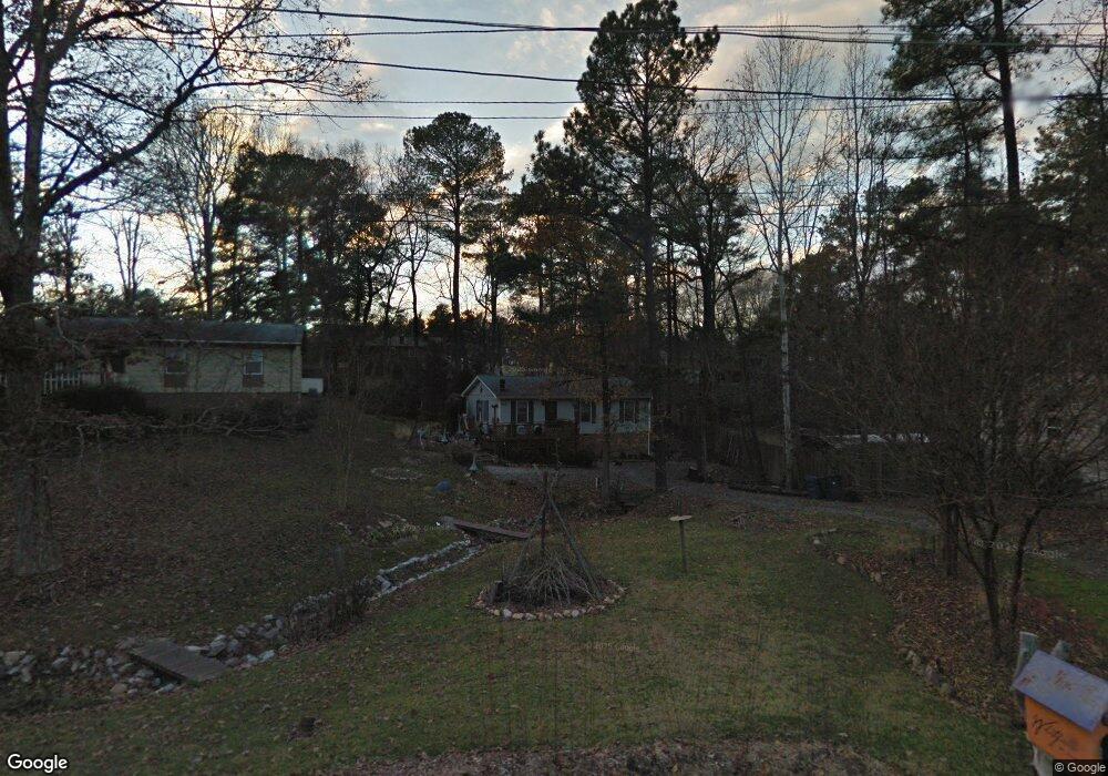
714 Locust Dr Durham, NC 27703
Eastern Durham NeighborhoodEstimated Value: $244,086 - $268,000
3
Beds
2
Baths
1,100
Sq Ft
$236/Sq Ft
Est. Value
About This Home
This home is located at 714 Locust Dr, Durham, NC 27703 and is currently estimated at $259,272, approximately $235 per square foot. 714 Locust Dr is a home located in Durham County with nearby schools including Bethesda Elementary School, John W Neal Middle School, and Southern School of Energy & Sustainability.
Ownership History
Date
Name
Owned For
Owner Type
Purchase Details
Closed on
Mar 29, 1999
Sold by
Ross Kevin J and Ross Barham Ross
Bought by
Whitfield Nita Jane
Current Estimated Value
Home Financials for this Owner
Home Financials are based on the most recent Mortgage that was taken out on this home.
Original Mortgage
$86,861
Outstanding Balance
$21,447
Interest Rate
6.74%
Mortgage Type
FHA
Estimated Equity
$237,825
Create a Home Valuation Report for This Property
The Home Valuation Report is an in-depth analysis detailing your home's value as well as a comparison with similar homes in the area
Home Values in the Area
Average Home Value in this Area
Purchase History
| Date | Buyer | Sale Price | Title Company |
|---|---|---|---|
| Whitfield Nita Jane | $89,000 | -- |
Source: Public Records
Mortgage History
| Date | Status | Borrower | Loan Amount |
|---|---|---|---|
| Open | Whitfield Nita Jane | $86,861 |
Source: Public Records
Tax History Compared to Growth
Tax History
| Year | Tax Paid | Tax Assessment Tax Assessment Total Assessment is a certain percentage of the fair market value that is determined by local assessors to be the total taxable value of land and additions on the property. | Land | Improvement |
|---|---|---|---|---|
| 2025 | $2,299 | $231,910 | $97,500 | $134,410 |
| 2024 | $1,705 | $122,197 | $25,940 | $96,257 |
| 2023 | $1,601 | $122,197 | $25,940 | $96,257 |
| 2022 | $1,564 | $122,197 | $25,940 | $96,257 |
| 2021 | $1,557 | $122,197 | $25,940 | $96,257 |
| 2020 | $1,520 | $122,197 | $25,940 | $96,257 |
| 2019 | $1,520 | $122,197 | $25,940 | $96,257 |
| 2018 | $1,260 | $92,900 | $19,425 | $73,475 |
| 2017 | $1,251 | $92,900 | $19,425 | $73,475 |
| 2016 | $1,209 | $92,900 | $19,425 | $73,475 |
| 2015 | $1,365 | $98,612 | $20,713 | $77,899 |
| 2014 | $1,365 | $98,612 | $20,713 | $77,899 |
Source: Public Records
Map
Nearby Homes
- 806 Lindley Dr
- 428 Walton St
- 509 Walton St
- 3004 Forrestal Dr
- 135 Cushman St
- 3211 Ivey Wood Ln
- 118 Lynn Rd
- 1218 Kendall Dr
- 1316 Kendall Dr
- 3563 Carr Rd
- 413 S Adams St
- 650 Ganyard Farm Way Unit 6
- 3004 Cathy Dr
- 519 Pleasant Dr
- 207 S Adams St
- 136 E End Ave
- 140 E End Ave
- 15 Red Sunset Ln
- 3217 Rowena Ave
- 3230 Rowena Ave Unit B
- 718 Locust Dr
- 710 Locust Dr
- 706 Locust Dr
- 719 Lindley Dr
- 3103 Nantuckett Ave
- 723 Lindley Dr
- 707 Lindley Dr
- 705 Lindley Dr
- 3101 Nantucket Ave
- 3101 Nantuckett Ave
- 3107 Nantuckett Ave
- 709 Locust Dr
- 700 Locust Dr
- 715 Locust Dr
- 3109 Nantuckett Ave
- 3109 Nantucket Ave
- 703 Lindley Dr
- 707 Locust Dr
- 3115 Nantuckett Ave
- 3102 Nantucket Ave