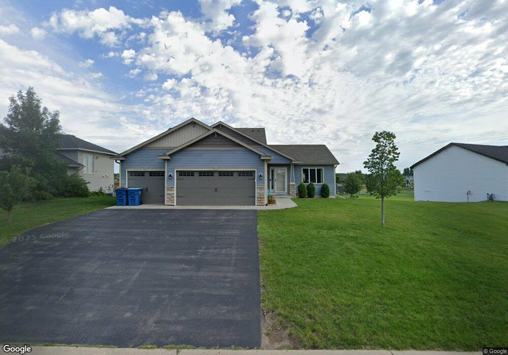
715 10th St Clearwater, MN 55320
Estimated Value: $349,000 - $366,000
4
Beds
3
Baths
2,422
Sq Ft
$148/Sq Ft
Est. Value
About This Home
This home is located at 715 10th St, Clearwater, MN 55320 and is currently estimated at $358,328, approximately $147 per square foot. 715 10th St is a home located in Wright County with nearby schools including Clearview Elementary School and South Junior High School.
Ownership History
Date
Name
Owned For
Owner Type
Purchase Details
Closed on
May 20, 2022
Sold by
Ford Trevor and Ford Shelby
Bought by
Atkinson Cameron and Atkinson Becca
Current Estimated Value
Home Financials for this Owner
Home Financials are based on the most recent Mortgage that was taken out on this home.
Original Mortgage
$334,650
Outstanding Balance
$316,350
Interest Rate
4.72%
Mortgage Type
New Conventional
Estimated Equity
$41,978
Purchase Details
Closed on
Nov 8, 2018
Sold by
Progressive Builders Inc
Bought by
Ford Trevor and Ford Shelby
Home Financials for this Owner
Home Financials are based on the most recent Mortgage that was taken out on this home.
Original Mortgage
$208,165
Interest Rate
4.7%
Mortgage Type
New Conventional
Create a Home Valuation Report for This Property
The Home Valuation Report is an in-depth analysis detailing your home's value as well as a comparison with similar homes in the area
Purchase History
| Date | Buyer | Sale Price | Title Company |
|---|---|---|---|
| Atkinson Cameron | $345,000 | -- | |
| Ford Trevor | $244,900 | Liberty Title Inc | |
| Progresslve Builders Inc | $24,900 | Liberty Title Inc |
Source: Public Records
Mortgage History
| Date | Status | Borrower | Loan Amount |
|---|---|---|---|
| Open | Atkinson Cameron | $334,650 | |
| Previous Owner | Ford Trevor | $208,165 |
Source: Public Records
Tax History
| Year | Tax Paid | Tax Assessment Tax Assessment Total Assessment is a certain percentage of the fair market value that is determined by local assessors to be the total taxable value of land and additions on the property. | Land | Improvement |
|---|---|---|---|---|
| 2025 | $4,052 | $352,900 | $61,000 | $291,900 |
| 2024 | $3,930 | $348,900 | $66,000 | $282,900 |
| 2023 | $3,644 | $346,600 | $66,000 | $280,600 |
| 2022 | $3,572 | $286,300 | $43,000 | $243,300 |
| 2021 | $3,492 | $255,300 | $31,000 | $224,300 |
| 2020 | $3,154 | $250,600 | $31,000 | $219,600 |
| 2019 | $172 | $221,600 | $0 | $0 |
| 2018 | $304 | $18,000 | $0 | $0 |
| 2017 | $310 | $16,000 | $0 | $0 |
| 2016 | $300 | $0 | $0 | $0 |
| 2015 | $304 | $0 | $0 | $0 |
| 2014 | -- | $0 | $0 | $0 |
Source: Public Records
Map
Nearby Homes
- 650 Juliet Ave
- 625 Juliet Ave
- XXX Huber Ave NW
- 17121 Huber Ave NW
- XX Xx Hwy 24
- 183 Cardinal Ln
- 165 Cardinal Ln
- 131 Goldfinch Ln
- 108 Goldfinch Ln
- 97 Goldfinch Ln
- 520 County Road 75 NW
- 440 Lime St
- 4XX Prairie St
- 1XX Maple St
- 530 County Road 75
- 7XX County Road 143
- 5365 92nd St SE
- 19148 Eaglewood Rd
- xxx 148th St NW
- 1714 216th St E
- 717 10th St
- 0 Unassigned Unit 3608139
- 0 Unassigned Unit 3608139
- xx Grunwald Ave NW
- XX5 10th St
- XX04 10th St
- 710 10th St
- 8XX Mitchell Ave NE
- 720 10th St
- XX8 Mitchell Ave
- 1010 Mitchell Ave
- 695 10th St
- 805 10th St
- 1020 Mitchell Ave
- 800 10th St
- 815 10th St
- 1025 Mitchell Ave
- 810 10th St
- 1033 Mitchell Ave
- 1030 Mitchell Ave
Your Personal Tour Guide
Ask me questions while you tour the home.