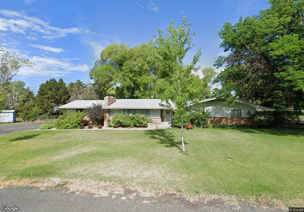
715 Daniel Dr Grand Junction, CO 81506
North Grand Junction NeighborhoodEstimated Value: $444,000 - $498,000
3
Beds
2
Baths
1,765
Sq Ft
$265/Sq Ft
Est. Value
About This Home
This home is located at 715 Daniel Dr, Grand Junction, CO 81506 and is currently estimated at $467,007, approximately $264 per square foot. 715 Daniel Dr is a home located in Mesa County with nearby schools including Tope Elementary School, West Middle School, and Grand Junction High School.
Ownership History
Date
Name
Owned For
Owner Type
Purchase Details
Closed on
May 1, 2015
Sold by
Hale Beverly A
Bought by
Beverly A Hale Trust
Current Estimated Value
Purchase Details
Closed on
Sep 17, 2014
Sold by
Beverly A Hale Trust
Bought by
Murphy Mark D and Murphy Dyan
Purchase Details
Closed on
Jul 16, 2009
Sold by
Margaret Mandeville Trust
Bought by
Hale George R and Hale Beverly A
Purchase Details
Closed on
Dec 27, 2002
Sold by
Mandeville Margaret L
Bought by
Margaret Mandeville Trust
Create a Home Valuation Report for This Property
The Home Valuation Report is an in-depth analysis detailing your home's value as well as a comparison with similar homes in the area
Home Values in the Area
Average Home Value in this Area
Purchase History
| Date | Buyer | Sale Price | Title Company |
|---|---|---|---|
| Beverly A Hale Trust | -- | None Available | |
| Murphy Mark D | -- | None Available | |
| Beverly A Hale Trust | -- | None Available | |
| Hale George R | $243,300 | Land Title Guarantee Company | |
| Margaret Mandeville Trust | -- | -- |
Source: Public Records
Tax History
| Year | Tax Paid | Tax Assessment Tax Assessment Total Assessment is a certain percentage of the fair market value that is determined by local assessors to be the total taxable value of land and additions on the property. | Land | Improvement |
|---|---|---|---|---|
| 2024 | $1,569 | $22,740 | $7,500 | $15,240 |
| 2023 | $1,569 | $22,740 | $7,500 | $15,240 |
| 2022 | $1,344 | $19,170 | $6,950 | $12,220 |
| 2021 | $1,351 | $19,720 | $7,150 | $12,570 |
| 2020 | $1,261 | $18,860 | $6,440 | $12,420 |
| 2019 | $1,192 | $18,860 | $6,440 | $12,420 |
| 2018 | $1,180 | $17,010 | $5,760 | $11,250 |
| 2017 | $1,178 | $17,010 | $5,760 | $11,250 |
| 2016 | $1,033 | $16,770 | $5,730 | $11,040 |
Source: Public Records
Map
Nearby Homes
- 722 Pacific Dr
- 719 Centauri Dr
- TBD Cascade Dr
- 2700 G Rd Unit 12C
- 2700 G Rd Unit 5C
- 2700 G Rd Unit 12F
- 2700 G Rd Unit 7-B
- 692 Tilman Dr
- 694 Sperber Ln
- 4340 N Club Ct Unit D
- 697 Sperber Ln
- 2714 Centercliff Dr
- 2671 G 1 2 Rd
- 683 Tilman Dr
- 690 Edgecliff Ct
- 682 Tilman Dr
- 702 Golfmore Dr Unit A
- 702 Golfmore Dr Unit F
- 745 Golfmore Dr
- 680 Tilman Dr
- 0 Daniel Dr
- 719 Daniel Dr
- 710 Daniel Dr
- 711 Daniel Dr
- 716 Daniel Dr
- 716 Victor Dr
- 2681 Carol Place
- 2680 Kimberly Dr
- 2684 Carol Place
- 718 Daniel Dr
- 2686 Carol Place
- 2679 Kimberly Dr
- 2680 Carol Place
- 2690 Kimberly Dr
- 2685 Kimberly Dr
- 715 Victor Dr
- 721 Victor Dr
- 710 Victor Dr
- 0 Victor Dr
- 721 Pacific Dr
Your Personal Tour Guide
Ask me questions while you tour the home.