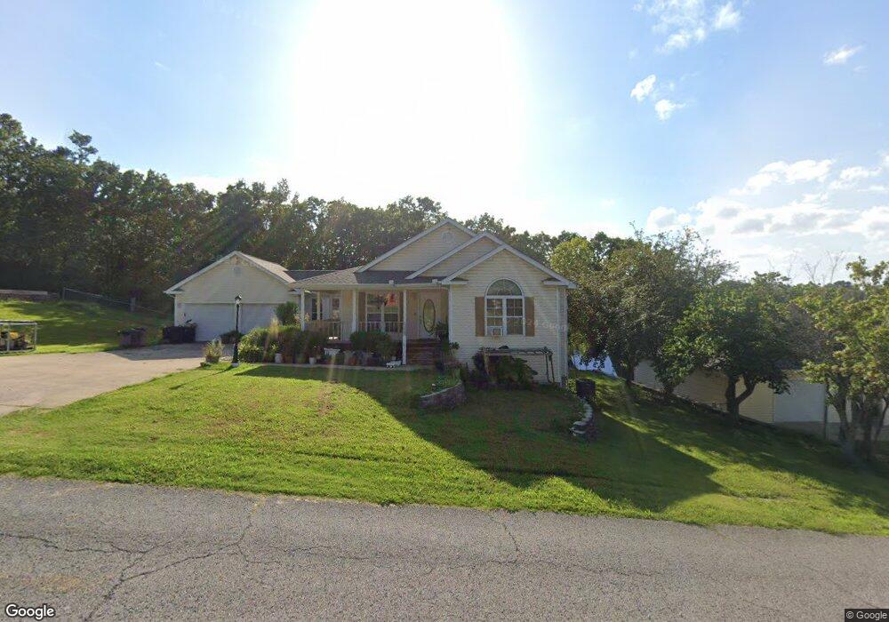
715 E Pamela Dr West Plains, MO 65775
Estimated Value: $276,121 - $408,000
--
Bed
--
Bath
1,651
Sq Ft
$204/Sq Ft
Est. Value
About This Home
This home is located at 715 E Pamela Dr, West Plains, MO 65775 and is currently estimated at $337,530, approximately $204 per square foot. 715 E Pamela Dr is a home with nearby schools including Faith Assembly Christian School.
Ownership History
Date
Name
Owned For
Owner Type
Purchase Details
Closed on
Jun 7, 2006
Sold by
Reed Elizabeth L
Bought by
Pham Michael and Candelario Veronica
Current Estimated Value
Home Financials for this Owner
Home Financials are based on the most recent Mortgage that was taken out on this home.
Original Mortgage
$94,000
Outstanding Balance
$6,200
Interest Rate
6.63%
Mortgage Type
New Conventional
Estimated Equity
$331,330
Purchase Details
Closed on
Nov 2, 2005
Sold by
Lieberman John and Lieberman Daphane
Bought by
Pham Michael X and Candelario Veronica
Create a Home Valuation Report for This Property
The Home Valuation Report is an in-depth analysis detailing your home's value as well as a comparison with similar homes in the area
Home Values in the Area
Average Home Value in this Area
Purchase History
| Date | Buyer | Sale Price | Title Company |
|---|---|---|---|
| Pham Michael | -- | None Available | |
| Pham Michael X | -- | None Available |
Source: Public Records
Mortgage History
| Date | Status | Borrower | Loan Amount |
|---|---|---|---|
| Open | Pham Michael | $94,000 |
Source: Public Records
Tax History Compared to Growth
Tax History
| Year | Tax Paid | Tax Assessment Tax Assessment Total Assessment is a certain percentage of the fair market value that is determined by local assessors to be the total taxable value of land and additions on the property. | Land | Improvement |
|---|---|---|---|---|
| 2025 | $1,690 | $41,230 | $5,320 | $35,910 |
| 2024 | $1,673 | $36,810 | -- | -- |
| 2023 | $1,673 | $36,810 | $0 | $0 |
| 2022 | $1,585 | $34,880 | $0 | $0 |
| 2021 | $1,423 | $34,880 | $0 | $0 |
| 2020 | $1,423 | $31,290 | $0 | $0 |
| 2019 | $1,482 | $31,290 | $0 | $0 |
| 2018 | $1,483 | $31,290 | $0 | $0 |
| 2017 | $1,479 | $31,290 | $0 | $0 |
| 2015 | -- | $30,340 | $0 | $0 |
| 2014 | -- | $30,340 | $0 | $0 |
| 2013 | -- | $30,340 | $0 | $0 |
Source: Public Records
Map
Nearby Homes
- 2032 Wild Turkey Trail
- 2006 Big Deer
- 2008 Wild Turkey Trail
- 000 Wild Turkey Trail Unit Block 1 Lot 13
- 000 Wild Turkey Trail Unit Block 1 Lot 10
- 000 Wild Turkey Trail Unit Block 1 Lot 2
- 000 Wild Turkey Trail Unit Block 1 Lot 1
- 000 Wild Turkey Trail Unit Block 1 Lot 18
- 000 Wild Turkey Trail Unit Block 1 Lot 6
- 000 Wild Turkey Trail Unit Block 1 Lot 5
- 000 Wild Turkey Trail Unit Block 1 Lot 4
- 000 Wild Turkey Trail Unit Block 1 Lot 3
- 000 Wild Turkey Trail Unit Block 1 Lot 17
- 000 Wild Turkey Trail Unit Block 1 Lot 9
- Lot 9 Wild Turkey Trail
- Tbd
- Tbd Big Deer Run (Lot 20)
- 1911 Gobbler Ct
- 1907 Gobbler Ct
- Tbd Dogwood Cir
- 713 E Pamela Dr
- 717 E Pamela Dr
- 714 E Pamela Dr
- 712 E Pamela Dr
- 716 E Pamela Dr
- 710 E Pamela Dr
- 709 E 709 Pamela
- 718 E Pamela Dr
- 709 E Pamela Dr
- tbd E Pamela Dr
- 0 E Pamela Dr
- 2021 Wild Turkey Trail
- 2027 Wild Turkey Trail
- 708 E Pamela Dr
- 2007 Big Deer Run
- 720 E Pamela Dr
- 707 E Pamela Dr
- 2009 Big Deer Run
- 0 Hickory Lake Dr
- 2029 Wild Turkey Trail