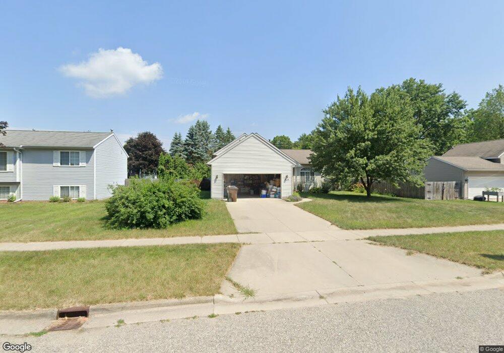
715 Hunt St Lowell, MI 49331
Estimated Value: $322,000 - $369,000
3
Beds
2
Baths
1,404
Sq Ft
$243/Sq Ft
Est. Value
About This Home
This home is located at 715 Hunt St, Lowell, MI 49331 and is currently estimated at $341,481, approximately $243 per square foot. 715 Hunt St is a home located in Kent County with nearby schools including Bushnell Elementary School, Cherry Creek Elementary School, and Lowell Middle School.
Ownership History
Date
Name
Owned For
Owner Type
Purchase Details
Closed on
May 15, 2023
Sold by
Robertson Derek T
Bought by
Robertson Derek T and Robertson Melinda
Current Estimated Value
Purchase Details
Closed on
Aug 27, 2003
Sold by
Verbrugge Christopher and Verbrugge Roxie
Bought by
Robertson Derek T
Home Financials for this Owner
Home Financials are based on the most recent Mortgage that was taken out on this home.
Original Mortgage
$79,500
Interest Rate
6.44%
Mortgage Type
Purchase Money Mortgage
Purchase Details
Closed on
Feb 18, 2000
Bought by
Robertson Verbrugge and Robertson Derek T
Purchase Details
Closed on
Jul 21, 1999
Bought by
Holwerda Bldrs and Robertson Derek T
Create a Home Valuation Report for This Property
The Home Valuation Report is an in-depth analysis detailing your home's value as well as a comparison with similar homes in the area
Home Values in the Area
Average Home Value in this Area
Purchase History
| Date | Buyer | Sale Price | Title Company |
|---|---|---|---|
| Robertson Derek T | -- | None Listed On Document | |
| Robertson Derek T | $159,000 | Metropolitan Title Co | |
| Robertson Verbrugge | $137,700 | -- | |
| Holwerda Bldrs | $15,000 | -- |
Source: Public Records
Mortgage History
| Date | Status | Borrower | Loan Amount |
|---|---|---|---|
| Previous Owner | Robertson Derek T | $79,500 |
Source: Public Records
Tax History Compared to Growth
Tax History
| Year | Tax Paid | Tax Assessment Tax Assessment Total Assessment is a certain percentage of the fair market value that is determined by local assessors to be the total taxable value of land and additions on the property. | Land | Improvement |
|---|---|---|---|---|
| 2025 | $2,973 | $159,500 | $0 | $0 |
| 2024 | $2,973 | $136,900 | $0 | $0 |
| 2023 | $3,361 | $126,100 | $0 | $0 |
| 2022 | $3,224 | $113,400 | $0 | $0 |
| 2021 | $3,134 | $102,100 | $0 | $0 |
| 2020 | $2,597 | $94,100 | $0 | $0 |
| 2019 | $3,050 | $91,900 | $0 | $0 |
| 2018 | $2,985 | $85,500 | $0 | $0 |
| 2017 | $2,910 | $78,800 | $0 | $0 |
| 2016 | $2,829 | $75,100 | $0 | $0 |
| 2015 | -- | $75,100 | $0 | $0 |
| 2013 | -- | $61,700 | $0 | $0 |
Source: Public Records
Map
Nearby Homes
- 610 Birchwood Ct SE
- 510 N Hudson St SE
- 725 N Lafayette St SE
- 521 Spring St
- 913 N Monroe St
- 926 N Washington St
- 220 King St Unit 10
- 220 King St Unit 6
- 1550 Carol Lynne Dr
- 1060 N Washington St
- 1080 N Washington St SE
- Cedarwood Plan at Flat River Estates
- Sycamore Plan at Flat River Estates
- Elmwood Plan at Flat River Estates
- Chestnut Plan at Flat River Estates
- Redwood Plan at Flat River Estates
- Whitby Plan at Flat River Estates
- Bay Harbor Plan at Flat River Estates
- Pentwater Plan at Flat River Estates
- Maplewood Plan at Flat River Estates