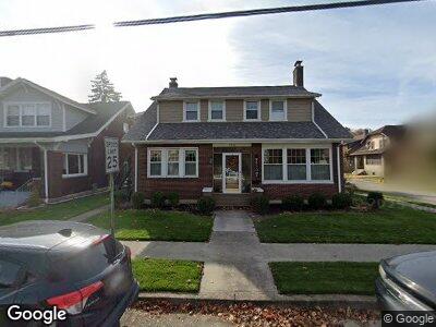
715 N Mckean St Kittanning, PA 16201
Estimated Value: $151,000 - $251,000
3
Beds
3
Baths
2,950
Sq Ft
$65/Sq Ft
Est. Value
About This Home
This home is located at 715 N Mckean St, Kittanning, PA 16201 and is currently estimated at $192,043, approximately $65 per square foot. 715 N Mckean St is a home located in Armstrong County with nearby schools including West Hills Intermediate School, West Hills Primary School, and Grace Christian School.
Ownership History
Date
Name
Owned For
Owner Type
Purchase Details
Closed on
Jun 30, 2005
Sold by
Miller Andrew and Edwards Alyssa M
Bought by
Frerotte Luann
Current Estimated Value
Home Financials for this Owner
Home Financials are based on the most recent Mortgage that was taken out on this home.
Original Mortgage
$108,000
Interest Rate
5.71%
Mortgage Type
New Conventional
Purchase Details
Closed on
Mar 30, 1998
Bought by
Cornell, Linda Trustee
Create a Home Valuation Report for This Property
The Home Valuation Report is an in-depth analysis detailing your home's value as well as a comparison with similar homes in the area
Home Values in the Area
Average Home Value in this Area
Purchase History
| Date | Buyer | Sale Price | Title Company |
|---|---|---|---|
| Frerotte Luann | $127,000 | None Available | |
| Cornell, Linda Trustee | -- | -- |
Source: Public Records
Mortgage History
| Date | Status | Borrower | Loan Amount |
|---|---|---|---|
| Open | Frerotte Luann | $81,000 | |
| Closed | Frerotte Luann | $108,000 |
Source: Public Records
Tax History Compared to Growth
Tax History
| Year | Tax Paid | Tax Assessment Tax Assessment Total Assessment is a certain percentage of the fair market value that is determined by local assessors to be the total taxable value of land and additions on the property. | Land | Improvement |
|---|---|---|---|---|
| 2025 | $4,526 | $40,980 | $22,260 | $18,720 |
| 2024 | $4,321 | $40,980 | $22,260 | $18,720 |
| 2023 | $3,353 | $40,980 | $22,260 | $18,720 |
| 2022 | $3,353 | $40,980 | $22,260 | $18,720 |
| 2021 | $3,353 | $40,980 | $22,260 | $18,720 |
| 2020 | $3,353 | $40,980 | $22,260 | $18,720 |
| 2019 | $3,353 | $40,980 | $22,260 | $18,720 |
| 2018 | $3,350 | $31,800 | $5,060 | $26,740 |
| 2017 | $3,331 | $40,980 | $22,260 | $18,720 |
| 2016 | $3,331 | $40,980 | $22,260 | $18,720 |
| 2015 | $2,662 | $40,980 | $22,260 | $18,720 |
| 2014 | $2,662 | $40,980 | $22,260 | $18,720 |
Source: Public Records
Map
Nearby Homes
- 305 Chestnut St
- 122 Rebecca St
- 509 N Jefferson St
- 507 Woodward Ave
- 543 Highland Ave
- 941 Johnston Ave
- 418 Pine Hill Rd
- 250 N Water St
- 121 Oak Ave
- 1173 Orr Ave
- 461 Butler Rd
- 111 E Brady Rd
- 106 Sunset Dr
- 536 1/2 Butler Rd
- 232 Clearfield Pike
- 119 6th St
- 1520 Orr Ave
- 404 Arthur St
- 202 Locust Ln
- 265 Wible Rd
- 715 N Mckean St
- 711 N Mckean St
- 709 N Mckean St
- 707 N McKean St Half Duplex
- 112 Hazel St
- 123 Hazel St
- 125 Hazel St
- 121 Hazel St
- 110 Hazel St
- 127 Hazel St
- 119 Hazel St
- 237 Chestnut St
- 245 Chestnut St
- 235 Chestnut St
- 108 Hazel St
- 233 Chestnut St
- 712 N Mckean St
- 231 Chestnut St
- 105 Hazel St Unit 107
- 229 Chestnut St