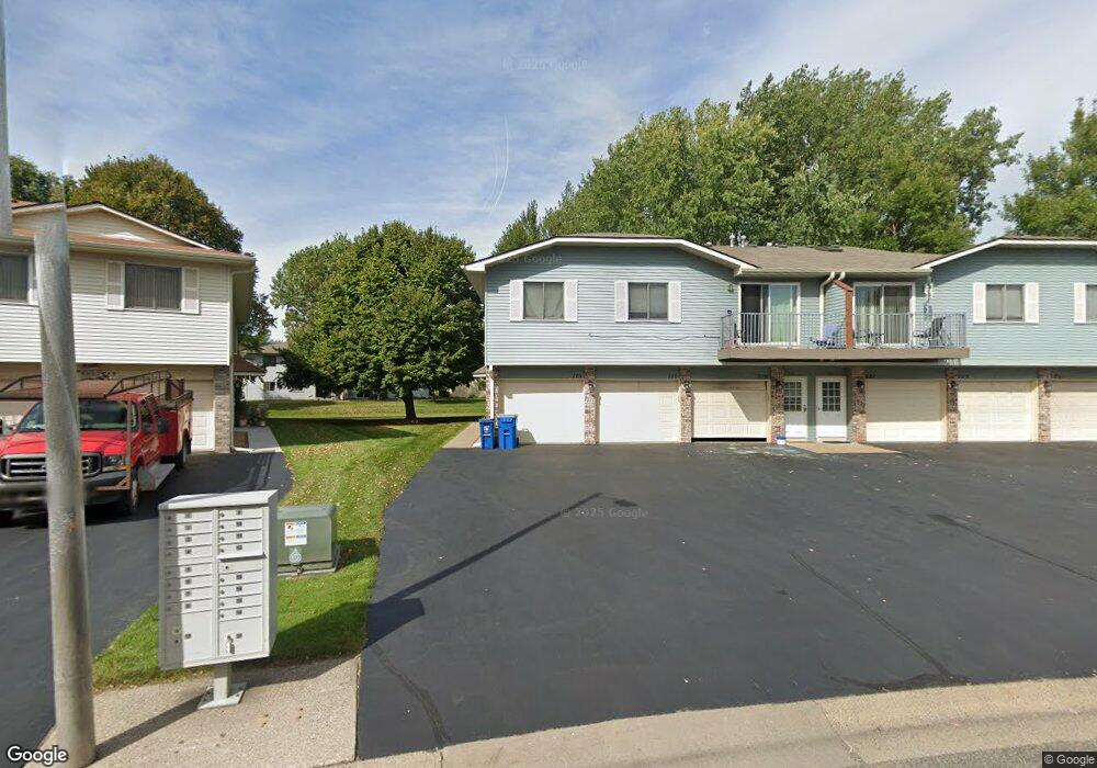
715 Parkside Dr Unit 715F Saint Paul, MN 55127
Estimated Value: $195,000 - $212,000
2
Beds
1
Bath
1,015
Sq Ft
$197/Sq Ft
Est. Value
About This Home
This home is located at 715 Parkside Dr Unit 715F, Saint Paul, MN 55127 and is currently estimated at $199,945, approximately $196 per square foot. 715 Parkside Dr Unit 715F is a home located in Ramsey County with nearby schools including Vadnais Heights Elementary School, Sunrise Park Middle School, and AFSA High School.
Ownership History
Date
Name
Owned For
Owner Type
Purchase Details
Closed on
Nov 14, 2014
Sold by
Burth Brian Joseph
Bought by
Peterson Travis J
Current Estimated Value
Home Financials for this Owner
Home Financials are based on the most recent Mortgage that was taken out on this home.
Original Mortgage
$87,300
Outstanding Balance
$66,652
Interest Rate
3.91%
Mortgage Type
Stand Alone First
Estimated Equity
$133,293
Purchase Details
Closed on
Dec 20, 2012
Sold by
Secretary Of Housing & Urban Development
Bought by
Burth Brian Joseph
Home Financials for this Owner
Home Financials are based on the most recent Mortgage that was taken out on this home.
Original Mortgage
$54,003
Interest Rate
3.25%
Mortgage Type
FHA
Purchase Details
Closed on
Oct 30, 2001
Sold by
Bickford Todd A
Bought by
Boehland Melvin G and Boehland Patricia S
Purchase Details
Closed on
Jun 26, 1998
Sold by
Twedt Geri Lynn
Bought by
Bickford Todd H
Create a Home Valuation Report for This Property
The Home Valuation Report is an in-depth analysis detailing your home's value as well as a comparison with similar homes in the area
Home Values in the Area
Average Home Value in this Area
Purchase History
| Date | Buyer | Sale Price | Title Company |
|---|---|---|---|
| Peterson Travis J | $92,727 | Title Recording Services Inc | |
| Burth Brian Joseph | -- | None Available | |
| Boehland Melvin G | $117,000 | -- | |
| Bickford Todd H | $72,500 | -- |
Source: Public Records
Mortgage History
| Date | Status | Borrower | Loan Amount |
|---|---|---|---|
| Open | Peterson Travis J | $87,300 | |
| Previous Owner | Burth Brian Joseph | $54,003 |
Source: Public Records
Tax History Compared to Growth
Tax History
| Year | Tax Paid | Tax Assessment Tax Assessment Total Assessment is a certain percentage of the fair market value that is determined by local assessors to be the total taxable value of land and additions on the property. | Land | Improvement |
|---|---|---|---|---|
| 2025 | $2,056 | $193,700 | $1,000 | $192,700 |
| 2023 | $2,056 | $174,000 | $1,000 | $173,000 |
| 2022 | $1,702 | $155,900 | $1,000 | $154,900 |
| 2021 | $1,546 | $143,200 | $1,000 | $142,200 |
| 2020 | $1,538 | $136,100 | $1,000 | $135,100 |
| 2019 | $1,268 | $127,400 | $1,000 | $126,400 |
| 2018 | $1,202 | $115,400 | $1,000 | $114,400 |
| 2017 | $950 | $111,700 | $1,000 | $110,700 |
| 2016 | $928 | $0 | $0 | $0 |
| 2015 | $820 | $87,900 | $13,200 | $74,700 |
| 2014 | $798 | $0 | $0 | $0 |
Source: Public Records
Map
Nearby Homes
- 697 Parkside Dr Unit 697H
- 3300 Greenbrier St Unit 3300C
- 3329 Greenbrier St
- 696 Monn Ave
- 731 Berwood Ave
- 832 Woodgate Dr Unit 107
- 3230 Edgerton St
- 3120 Greenbrier St
- 963 E Berwood Ave
- 3003 Greenbrier St
- 3028 Edgerton St
- 3000 Ontario Rd
- 3015 Basswood St
- Revere Plan at Pioneer Commons - Colonial Manor Collection
- Franklin Plan at Pioneer Commons - Colonial Manor Collection
- Raleigh Plan at Pioneer Commons - Liberty Collection
- St.Clair Plan at Pioneer Commons - Liberty Collection
- 3092 Vanderbie St
- 3309 Nathaniel Ct
- 441 Mario Dr
- 703 Parkside Dr Unit 703F
- 717 Parkside Dr Unit 717G
- 725 Parkside Dr Unit 725F
- 707 Parkside Dr Unit 707H
- 719 Parkside Dr Unit 719H
- 723 Parkside Dr Unit 723G
- 705 Parkside Dr Unit 705G
- 713 Parkside Dr Unit 713F
- 721 Parkside Dr Unit 721H
- 711 Parkside Dr Unit 711G
- 709 Parkside Dr Unit 709H
- 715 715 Parkside-Drive-
- 715 715 Parkside Dr
- 717 717 Parkside Dr
- 721 721 Parkside-Drive-
- 721 721 Parkside Dr
- 711 711 Parkside-Drive-
- 725 725 Parkside-Drive-
- 707 707 Parkside Dr
- 703 703 Parkside-Drive-