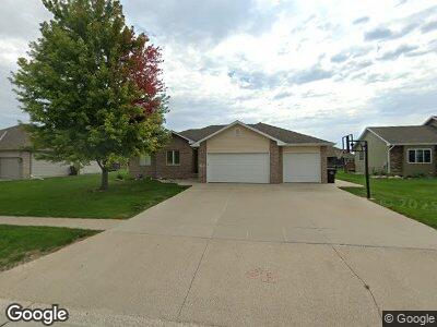
716 Coffie Farm Rd Sergeant Bluff, IA 51054
Estimated Value: $371,579 - $435,000
4
Beds
3
Baths
2,684
Sq Ft
$147/Sq Ft
Est. Value
About This Home
This home is located at 716 Coffie Farm Rd, Sergeant Bluff, IA 51054 and is currently estimated at $395,645, approximately $147 per square foot. 716 Coffie Farm Rd is a home located in Woodbury County with nearby schools including Sergeant Bluff-Luton Primary School, Sergeant Bluff-Luton Elementary School, and Sergeant Bluff-Luton Middle School.
Ownership History
Date
Name
Owned For
Owner Type
Purchase Details
Closed on
Jul 30, 2019
Sold by
Fnma
Bought by
Tejral Larry E and Paxton-Tejral Debbie A
Current Estimated Value
Purchase Details
Closed on
Aug 21, 2009
Sold by
Cougill Mary E
Bought by
Tejral Larry E and Paxtontejral Debbie A
Home Financials for this Owner
Home Financials are based on the most recent Mortgage that was taken out on this home.
Original Mortgage
$187,600
Interest Rate
5.29%
Mortgage Type
New Conventional
Purchase Details
Closed on
Mar 4, 2005
Sold by
Lenz Construction L L C
Bought by
Cougill Daniel R and Cougill Mary E
Home Financials for this Owner
Home Financials are based on the most recent Mortgage that was taken out on this home.
Original Mortgage
$159,220
Interest Rate
5.67%
Mortgage Type
New Conventional
Create a Home Valuation Report for This Property
The Home Valuation Report is an in-depth analysis detailing your home's value as well as a comparison with similar homes in the area
Home Values in the Area
Average Home Value in this Area
Purchase History
| Date | Buyer | Sale Price | Title Company |
|---|---|---|---|
| Tejral Larry E | -- | -- | |
| Tejral Larry E | $234,500 | -- | |
| Cougill Daniel R | $168,000 | None Available |
Source: Public Records
Mortgage History
| Date | Status | Borrower | Loan Amount |
|---|---|---|---|
| Open | Tejral Larry E | $259,462 | |
| Previous Owner | Tejral Larry E | $187,600 | |
| Previous Owner | Cougill Mary E | $182,500 | |
| Previous Owner | Cougill Mary E | $20,264 | |
| Previous Owner | Cougill Daniel R | $159,220 |
Source: Public Records
Tax History Compared to Growth
Tax History
| Year | Tax Paid | Tax Assessment Tax Assessment Total Assessment is a certain percentage of the fair market value that is determined by local assessors to be the total taxable value of land and additions on the property. | Land | Improvement |
|---|---|---|---|---|
| 2024 | $4,596 | $317,720 | $40,560 | $277,160 |
| 2023 | $5,324 | $317,720 | $40,560 | $277,160 |
| 2022 | $5,278 | $303,000 | $40,560 | $262,440 |
| 2021 | $5,278 | $303,000 | $40,560 | $262,440 |
| 2020 | $4,876 | $274,540 | $43,400 | $231,140 |
| 2019 | $4,592 | $274,540 | $43,400 | $231,140 |
| 2018 | $4,480 | $263,530 | $43,400 | $220,130 |
| 2017 | $4,480 | $263,530 | $43,400 | $220,130 |
| 2016 | $4,950 | $263,530 | $0 | $0 |
| 2015 | $4,509 | $246,290 | $40,560 | $205,730 |
| 2014 | $4,254 | $225,710 | $40,560 | $185,150 |
Source: Public Records
Map
Nearby Homes
- 716 Coffie Farm Rd
- 714 Coffie Farm Rd
- 718 Coffie Farm Rd
- 717 Stable Path
- 712 Coffie Farm Rd
- 720 Coffie Farm Rd
- 719 Stable Path
- 404 Homestead Ln
- 715 Stable Path
- 715 Stable Path
- 713 Stable Path
- 710 Coffie Farm Rd
- 719 Coffie Farm Rd
- 721 Stable Path
- 722 Coffie Farm Rd
- 402 Homestead Ln
- 721 Coffie Farm Rd
- 711 Stable Path
- 405 Homestead Ln
- 723 Stable Path