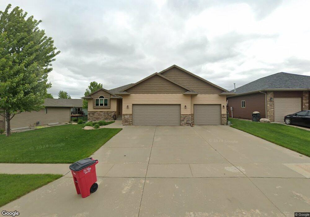
716 S Little Brook Ln Sioux Falls, SD 57106
Northwest Sioux Falls NeighborhoodEstimated Value: $404,758 - $589,000
3
Beds
3
Baths
1,308
Sq Ft
$351/Sq Ft
Est. Value
About This Home
This home is located at 716 S Little Brook Ln, Sioux Falls, SD 57106 and is currently estimated at $459,190, approximately $351 per square foot. 716 S Little Brook Ln is a home with nearby schools including Discovery Elementary School, Memorial Middle School, and Jefferson High School - 67.
Ownership History
Date
Name
Owned For
Owner Type
Purchase Details
Closed on
Feb 16, 2012
Sold by
Paul Fck Homes Inc
Bought by
Jensen Brian J and Jensen Lori S
Current Estimated Value
Home Financials for this Owner
Home Financials are based on the most recent Mortgage that was taken out on this home.
Original Mortgage
$229,261
Outstanding Balance
$156,009
Interest Rate
3.75%
Mortgage Type
FHA
Estimated Equity
$303,181
Purchase Details
Closed on
Nov 30, 2011
Sold by
Wfc Llc
Bought by
Paul Fick Homes Inc
Create a Home Valuation Report for This Property
The Home Valuation Report is an in-depth analysis detailing your home's value as well as a comparison with similar homes in the area
Home Values in the Area
Average Home Value in this Area
Purchase History
| Date | Buyer | Sale Price | Title Company |
|---|---|---|---|
| Jensen Brian J | $237,577 | -- | |
| Paul Fick Homes Inc | -- | -- |
Source: Public Records
Mortgage History
| Date | Status | Borrower | Loan Amount |
|---|---|---|---|
| Open | Jensen Brian J | $229,261 |
Source: Public Records
Tax History Compared to Growth
Tax History
| Year | Tax Paid | Tax Assessment Tax Assessment Total Assessment is a certain percentage of the fair market value that is determined by local assessors to be the total taxable value of land and additions on the property. | Land | Improvement |
|---|---|---|---|---|
| 2024 | $4,607 | $339,600 | $43,700 | $295,900 |
| 2023 | $4,898 | $348,600 | $39,400 | $309,200 |
| 2022 | $4,527 | $303,300 | $39,400 | $263,900 |
| 2021 | $4,879 | $306,300 | $0 | $0 |
| 2020 | $4,879 | $315,300 | $0 | $0 |
| 2019 | $4,436 | $280,897 | $0 | $0 |
| 2018 | $4,257 | $274,934 | $0 | $0 |
| 2017 | $4,072 | $270,959 | $42,373 | $228,586 |
| 2016 | $4,072 | $259,032 | $42,373 | $216,659 |
| 2015 | $4,045 | $247,333 | $40,530 | $206,803 |
| 2014 | $3,876 | $239,302 | $40,530 | $198,772 |
Source: Public Records
Map
Nearby Homes
- 7805 W Noah Cir
- 7524 W Boysenberry St
- 7809 W Stoney Creek St
- 1101 S Discovery Ave
- 7517 W 15th St
- 7512 W Stoney Creek St
- 1301 Hyannis Port Ln
- 1209 S Discovery Ave
- 1200 S Monticello Ave
- 604 S Mary Gene Ave
- 519 S Horizon Cir
- 1315 S President Ct
- 501 S Mary Gene Ave
- 1501 S Wheatland Ave
- 8709 W Rathburn St
- 521 S Big Stone Ave
- 7721 W Raegan St
- 8101 W 24th St
- 8105 W 24th St
- 8605 W Bryggen Ct
- 720 S Little Brook Ln
- 708 S Little Brook Ln
- 709 S Discovery Ave
- 705 S Discovery Ave
- 715 S Discovery Ave
- 800 S Little Brook Ln
- 800 S Little Brook Ln Ln
- 719 S Little Brook Ln
- 700 S Little Brook Ln
- 719 S Discovery Ave
- 715 S Little Brook Ln
- 723 S Little Brook Ln
- 709 S Little Brook Ln
- 709 S Little Brook Ln Ln
- 806 S Little Brook Ln
- 801 S Little Brook Ln
- 801 S Discovery Ave
- 7613 W Boysenberry St
- 705 S Little Brook Ln
- 7616 W Boysenberry St