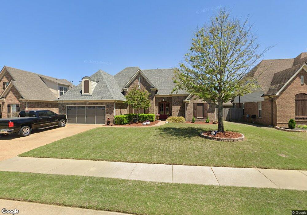
7166 Carriebrook Dr Olive Branch, MS 38654
Center Hill NeighborhoodEstimated Value: $332,000 - $383,000
4
Beds
--
Bath
2,913
Sq Ft
$122/Sq Ft
Est. Value
About This Home
This home is located at 7166 Carriebrook Dr, Olive Branch, MS 38654 and is currently estimated at $356,813, approximately $122 per square foot. 7166 Carriebrook Dr is a home with nearby schools including Overpark Elementary School, Center Hill High School, and Desoto Christian Academy.
Ownership History
Date
Name
Owned For
Owner Type
Purchase Details
Closed on
Apr 29, 2011
Sold by
Westin Homes Llc
Bought by
Arnold Anna M and Arnold Robert L
Current Estimated Value
Home Financials for this Owner
Home Financials are based on the most recent Mortgage that was taken out on this home.
Original Mortgage
$267,383
Outstanding Balance
$184,616
Interest Rate
4.74%
Mortgage Type
VA
Estimated Equity
$172,197
Create a Home Valuation Report for This Property
The Home Valuation Report is an in-depth analysis detailing your home's value as well as a comparison with similar homes in the area
Home Values in the Area
Average Home Value in this Area
Purchase History
| Date | Buyer | Sale Price | Title Company |
|---|---|---|---|
| Arnold Anna M | -- | None Available |
Source: Public Records
Mortgage History
| Date | Status | Borrower | Loan Amount |
|---|---|---|---|
| Open | Arnold Anna M | $267,383 |
Source: Public Records
Tax History Compared to Growth
Tax History
| Year | Tax Paid | Tax Assessment Tax Assessment Total Assessment is a certain percentage of the fair market value that is determined by local assessors to be the total taxable value of land and additions on the property. | Land | Improvement |
|---|---|---|---|---|
| 2024 | $1,516 | $18,610 | $3,500 | $15,110 |
| 2023 | $1,516 | $18,610 | $0 | $0 |
| 2022 | $1,516 | $18,610 | $3,500 | $15,110 |
| 2021 | $1,516 | $18,610 | $3,500 | $15,110 |
| 2020 | $1,111 | $18,610 | $3,500 | $15,110 |
| 2019 | $1,111 | $18,610 | $3,500 | $15,110 |
| 2017 | $1,093 | $33,206 | $18,353 | $14,853 |
| 2016 | $1,093 | $18,353 | $3,500 | $14,853 |
| 2015 | $1,848 | $33,206 | $18,353 | $14,853 |
| 2014 | $1,128 | $18,705 | $0 | $0 |
| 2013 | $529 | $18,705 | $0 | $0 |
Source: Public Records
Map
Nearby Homes
- 13185 Cades Ln
- 7338 Hunters Horn Dr
- 7375 Fox Creek Dr
- 7350 Hunters Horn Dr
- 7397 Hunters Horn Dr
- 6719 Red Hawk Cove
- 13881 Goodman Rd
- 13043 Oxbourne N
- 7251 Eastern Dr
- 13850 Wesley Banks Blvd
- 7247 Eastern Rd
- 6610 John Hamilton Way E
- 13825 Molly Madeline Ln
- 13965 Blvd
- 6535 Beckett Ln
- 13981 Wesley Banks Blvd
- 6520 Beckett Ln
- 13827 Jack Thomas Blvd
- 6540 John Hamilton Way E
- 6478 Beckett Ln
- 7182 Carriebrook Dr
- 7154 Carriebrook Dr
- 7161 Windswept Ln
- 7179 Windswept Ln
- 7149 Windswept Ln
- 7140 Carriebrook Dr
- 7140 Carriebrook Dr Unit 69
- 7200 Carriebrook Dr
- 7167 Carriebrook Dr
- 7131 Windswept Ln
- 7183 Carriebrook Dr
- 7157 Carriebrook Dr
- 7197 Windswept Ln
- 7126 Carriebrook Dr Unit 68
- 7126 Carriebrook Dr
- 7141 Carriebrook Dr
- 7199 Carriebrook Dr
- 7119 Windswept Ln
- 7180 Windswept Ln
- 7162 Windswept Ln