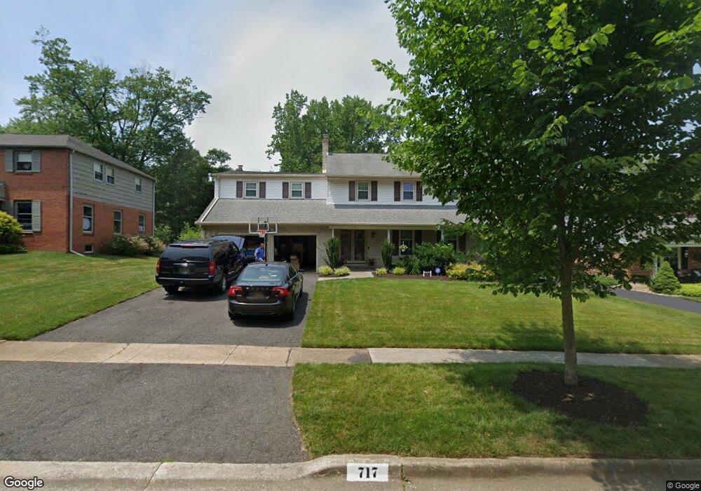
717 Bristol Rd Wilmington, DE 19803
Fairfax NeighborhoodEstimated Value: $698,000 - $739,000
5
Beds
3
Baths
2,853
Sq Ft
$249/Sq Ft
Est. Value
About This Home
This home is located at 717 Bristol Rd, Wilmington, DE 19803 and is currently estimated at $711,000, approximately $249 per square foot. 717 Bristol Rd is a home located in New Castle County with nearby schools including Lombardy Elementary School, Springer Middle School, and Brandywine High School.
Ownership History
Date
Name
Owned For
Owner Type
Purchase Details
Closed on
Apr 20, 2009
Sold by
Friedberg Michael A and Friedberg Janet K
Bought by
Bonner David R and Bonner Wendy W
Current Estimated Value
Home Financials for this Owner
Home Financials are based on the most recent Mortgage that was taken out on this home.
Original Mortgage
$275,000
Outstanding Balance
$173,751
Interest Rate
4.93%
Mortgage Type
Purchase Money Mortgage
Estimated Equity
$537,249
Create a Home Valuation Report for This Property
The Home Valuation Report is an in-depth analysis detailing your home's value as well as a comparison with similar homes in the area
Home Values in the Area
Average Home Value in this Area
Purchase History
| Date | Buyer | Sale Price | Title Company |
|---|---|---|---|
| Bonner David R | $455,000 | None Available |
Source: Public Records
Mortgage History
| Date | Status | Borrower | Loan Amount |
|---|---|---|---|
| Open | Bonner David R | $275,000 |
Source: Public Records
Tax History Compared to Growth
Tax History
| Year | Tax Paid | Tax Assessment Tax Assessment Total Assessment is a certain percentage of the fair market value that is determined by local assessors to be the total taxable value of land and additions on the property. | Land | Improvement |
|---|---|---|---|---|
| 2024 | $4,921 | $129,300 | $19,200 | $110,100 |
| 2023 | $4,497 | $129,300 | $19,200 | $110,100 |
| 2022 | $4,574 | $129,300 | $19,200 | $110,100 |
| 2021 | $4,574 | $129,300 | $19,200 | $110,100 |
| 2020 | $4,575 | $129,300 | $19,200 | $110,100 |
| 2019 | $5,121 | $129,300 | $19,200 | $110,100 |
| 2018 | $4,372 | $129,300 | $19,200 | $110,100 |
| 2017 | $4,304 | $129,300 | $19,200 | $110,100 |
| 2016 | $4,301 | $129,300 | $19,200 | $110,100 |
| 2015 | $3,957 | $129,300 | $19,200 | $110,100 |
| 2014 | $3,955 | $129,300 | $19,200 | $110,100 |
Source: Public Records
Map
Nearby Homes
- 709 Foulkstone Rd
- 0 Concord Mall Unit DENC2076028
- 104 Cleveland Ave
- 9 Bethel St
- 307 Princess Ave
- 1105 Invermere Rd
- 1111 Invermere Rd
- 1106 Invermere Way
- 1108 Invermere Rd
- 1115 Invermere Rd
- 1363 Coulee Way
- 542 Kerfoot Farm Rd
- 307 Half Acre Dr
- 216 Duncan Ave
- 107 Alders Dr
- 2702 Charlotte Ave
- 2403 Bryn Mawr Ave
- 2402 Wellesley Ave
- 414 Lee Terrace
- 233 Prospect Dr