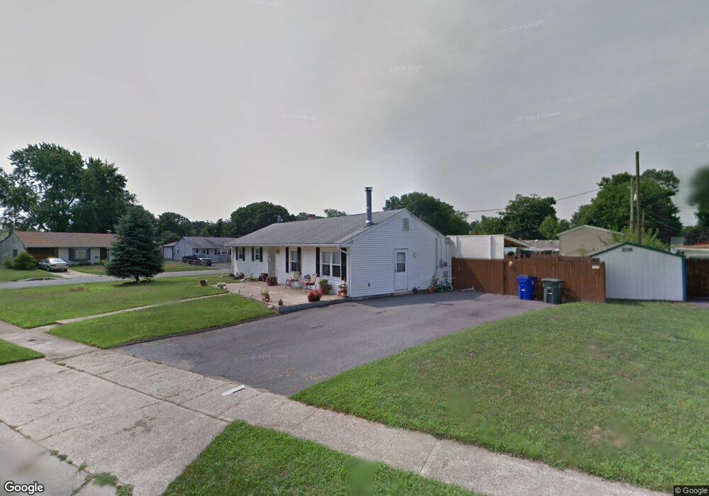
717 Donald Dr Newark, DE 19713
Estimated Value: $285,000 - $316,502
3
Beds
1
Bath
1,200
Sq Ft
$247/Sq Ft
Est. Value
About This Home
This home is located at 717 Donald Dr, Newark, DE 19713 and is currently estimated at $295,876, approximately $246 per square foot. 717 Donald Dr is a home located in New Castle County with nearby schools including Robert S. Gallaher Elementary School, Christiana High School, and Shue-Medill Middle School.
Ownership History
Date
Name
Owned For
Owner Type
Purchase Details
Closed on
Apr 17, 2008
Sold by
Federal National Mortgage Association
Bought by
Zamudio Ivan Dejesus and Zamudio Maria G
Current Estimated Value
Home Financials for this Owner
Home Financials are based on the most recent Mortgage that was taken out on this home.
Original Mortgage
$173,627
Outstanding Balance
$109,813
Interest Rate
5.94%
Mortgage Type
FHA
Estimated Equity
$186,063
Purchase Details
Closed on
Oct 15, 2007
Sold by
Adams Michael Q and Mortgage Electronic Registrati
Bought by
Federal National Mortgage Association
Purchase Details
Closed on
Apr 30, 2004
Sold by
Hill Kevin D and Hill Laura L
Bought by
Adams Michael Q
Home Financials for this Owner
Home Financials are based on the most recent Mortgage that was taken out on this home.
Original Mortgage
$145,000
Interest Rate
5.36%
Mortgage Type
Purchase Money Mortgage
Create a Home Valuation Report for This Property
The Home Valuation Report is an in-depth analysis detailing your home's value as well as a comparison with similar homes in the area
Home Values in the Area
Average Home Value in this Area
Purchase History
| Date | Buyer | Sale Price | Title Company |
|---|---|---|---|
| Zamudio Ivan Dejesus | $175,000 | None Available | |
| Federal National Mortgage Association | $180,000 | None Available | |
| Adams Michael Q | $145,000 | -- |
Source: Public Records
Mortgage History
| Date | Status | Borrower | Loan Amount |
|---|---|---|---|
| Open | Zamudio Ivan Dejesus | $173,627 | |
| Previous Owner | Adams Michael Q | $145,000 |
Source: Public Records
Tax History Compared to Growth
Tax History
| Year | Tax Paid | Tax Assessment Tax Assessment Total Assessment is a certain percentage of the fair market value that is determined by local assessors to be the total taxable value of land and additions on the property. | Land | Improvement |
|---|---|---|---|---|
| 2024 | $1,933 | $45,400 | $7,500 | $37,900 |
| 2023 | $1,880 | $45,400 | $7,500 | $37,900 |
| 2022 | $1,876 | $45,400 | $7,500 | $37,900 |
| 2021 | $1,836 | $45,400 | $7,500 | $37,900 |
| 2020 | $1,789 | $45,400 | $7,500 | $37,900 |
| 2019 | $2,108 | $45,400 | $7,500 | $37,900 |
| 2018 | $1,539 | $45,400 | $7,500 | $37,900 |
| 2017 | $1,485 | $45,400 | $7,500 | $37,900 |
| 2016 | $1,481 | $45,400 | $7,500 | $37,900 |
| 2015 | $1,349 | $45,400 | $7,500 | $37,900 |
| 2014 | $1,349 | $45,400 | $7,500 | $37,900 |
Source: Public Records
Map
Nearby Homes
- 12 Martin Dr
- 406 Blackstone Rd
- 725 S Harmony Rd
- 105 Melodic Dr
- 135 Salem Church Rd
- 18 Malvina Ln
- 1200 Chelmsford Cir
- 1401 Chelmsford Cir Unit 1401
- 2 Augusta Dr
- 107 Anderson Rd
- 819 Old Harmony Rd
- 409 Jacobsen Dr Unit 74
- 28 W Stephen Dr
- 620 Ilse Dr
- 445 Jacobsen Dr Unit 58
- 42 Lynch Farm Dr
- 59 E Shady Dr
- 40 E Shady Dr
- 112 Woodring Ln
- 183 Brookside Blvd
- 200 Nathaniel Rd
- 715 Donald Dr
- 104 Nathaniel Rd
- 202 Nathaniel Rd
- 716 Donald Dr
- 109 Nathaniel Rd
- 201 Nathaniel Rd
- 713 Donald Dr
- 203 Nathaniel Rd
- 107 Nathaniel Rd
- 714 Donald Dr
- 1002 S Gerald Dr
- 1000 S Gerald Dr
- 102 Nathaniel Rd
- 105 Nathaniel Rd
- 711 Donald Dr
- 712 Donald Dr
- 1004 S Gerald Dr
- 207 Nathaniel Rd
- 114 Kingswood Rd