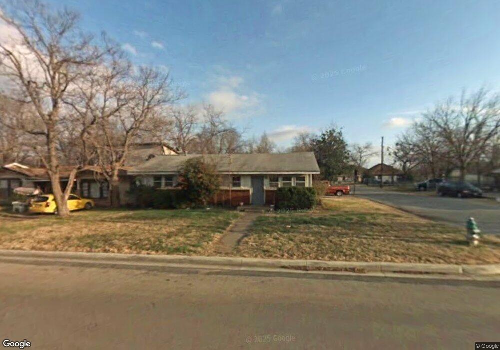
717 Phillips St Cleburne, TX 76033
Estimated Value: $205,983 - $214,000
3
Beds
2
Baths
1,260
Sq Ft
$166/Sq Ft
Est. Value
About This Home
This home is located at 717 Phillips St, Cleburne, TX 76033 and is currently estimated at $209,746, approximately $166 per square foot. 717 Phillips St is a home located in Johnson County with nearby schools including Cooke Elementary School, A.D. Wheat Middle School, and Cleburne High School.
Ownership History
Date
Name
Owned For
Owner Type
Purchase Details
Closed on
Jul 10, 1991
Sold by
Malcom Mark Alan and Malcom Kara Lynne
Bought by
Joslin Michael D and Joslin Sybil A
Current Estimated Value
Create a Home Valuation Report for This Property
The Home Valuation Report is an in-depth analysis detailing your home's value as well as a comparison with similar homes in the area
Home Values in the Area
Average Home Value in this Area
Purchase History
| Date | Buyer | Sale Price | Title Company |
|---|---|---|---|
| Joslin Michael D | -- | None Available |
Source: Public Records
Mortgage History
| Date | Status | Borrower | Loan Amount |
|---|---|---|---|
| Closed | Joslin Michael D | $0 |
Source: Public Records
Tax History
| Year | Tax Paid | Tax Assessment Tax Assessment Total Assessment is a certain percentage of the fair market value that is determined by local assessors to be the total taxable value of land and additions on the property. | Land | Improvement |
|---|---|---|---|---|
| 2025 | $3,727 | $167,169 | $40,000 | $127,169 |
| 2024 | $3,727 | $167,169 | $40,000 | $127,169 |
| 2023 | $3,720 | $167,169 | $40,000 | $127,169 |
| 2022 | $3,558 | $142,180 | $35,250 | $106,930 |
| 2021 | $2,953 | $113,163 | $30,500 | $82,663 |
| 2020 | $3,199 | $115,428 | $22,000 | $93,428 |
| 2019 | $3,411 | $115,428 | $22,000 | $93,428 |
| 2018 | $1,935 | $65,463 | $15,000 | $50,463 |
| 2017 | $1,856 | $63,060 | $15,000 | $48,060 |
| 2016 | $1,390 | $47,220 | $10,000 | $37,220 |
Source: Public Records
Map
Nearby Homes
- 805 Phillips St
- 809 Euclid St
- 603 Lilly St
- 718 Turner St
- 905 Euclid St
- 440 Rose Ave
- 433 Rose Ave
- 916 Poindexter Ave
- 504 Bales St
- 1102 Poindexter Ave
- 426 Rose Ave
- 422 Rose Ave
- 807 Poindexter Ave
- 405 Odell St
- 1123 Bales St
- 1116 Poindexter Ave
- 700 Poindexter Ave
- 1105 Poindexter Ave
- 414 Rose Ave
- 404 Rose Ave
- 715 Phillips St
- 801 Phillips St
- 713 Phillips St
- 802 Phillips St
- 711 Phillips St
- 716 Euclid St
- 803 Phillips St
- 714 Euclid St
- 800 Euclid St
- 709 Phillips St
- 712 Euclid St
- 1603 Virginia Place
- 708 Phillips St
- 807 Phillips St
- 707 Phillips St
- 708 Euclid St
- 806 Euclid St
- 706 Euclid St
- 705 Phillips St
- 1605 Virginia Place
Your Personal Tour Guide
Ask me questions while you tour the home.