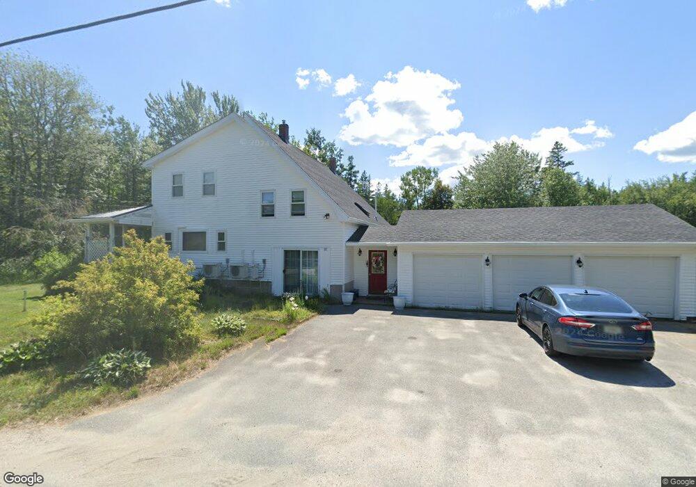
717 Point Rd Hancock, ME 04640
Estimated Value: $343,924 - $494,000
3
Beds
2
Baths
2,300
Sq Ft
$191/Sq Ft
Est. Value
About This Home
This home is located at 717 Point Rd, Hancock, ME 04640 and is currently estimated at $439,481, approximately $191 per square foot. 717 Point Rd is a home located in Hancock County with nearby schools including Sumner Memorial High School.
Create a Home Valuation Report for This Property
The Home Valuation Report is an in-depth analysis detailing your home's value as well as a comparison with similar homes in the area
Home Values in the Area
Average Home Value in this Area
Tax History
| Year | Tax Paid | Tax Assessment Tax Assessment Total Assessment is a certain percentage of the fair market value that is determined by local assessors to be the total taxable value of land and additions on the property. | Land | Improvement |
|---|---|---|---|---|
| 2024 | $3,077 | $261,900 | $78,500 | $183,400 |
| 2023 | $2,750 | $261,900 | $78,500 | $183,400 |
| 2022 | $2,750 | $261,900 | $78,500 | $183,400 |
| 2021 | $2,881 | $261,900 | $78,500 | $183,400 |
| 2019 | $2,802 | $261,900 | $78,500 | $183,400 |
| 2018 | $2,881 | $261,900 | $78,500 | $183,400 |
| 2017 | $2,881 | $261,900 | $78,500 | $183,400 |
| 2016 | $2,881 | $261,900 | $78,500 | $183,400 |
| 2015 | $2,711 | $261,900 | $78,500 | $183,400 |
| 2014 | $2,619 | $261,900 | $78,500 | $183,400 |
| 2013 | $2,606 | $261,900 | $78,500 | $183,400 |
Source: Public Records
Map
Nearby Homes
- 264 Cross Rd
- 11 Ocean Bridge Blvd
- 122 Cross Rd
- 84 Mosely Point Ln
- 103 Gull Rock Rd
- 6 Nob Hill Rd
- 140 Needles Eye Rd
- 0 Bay Rd
- 122 Waukeag Ave
- 782 Lamoine Beach Rd
- 791 Lamoine Beach Rd
- Lot 11 Kennel Brook Dr
- Lot 6 Kennel Brook Dr
- Lot 4 Kennel Brook Dr
- 66 Waukeag Ave
- 694 Lamoine Beach Rd
- 5 Main St
- Map7 Lot7 Maine 204
- 19 Needles Eye Rd
- 170 Partridge Cove Rd
Your Personal Tour Guide
Ask me questions while you tour the home.