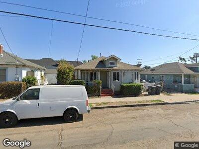
717 Sampson St San Diego, CA 92113
Logan Heights NeighborhoodEstimated Value: $525,000 - $629,000
2
Beds
1
Bath
819
Sq Ft
$725/Sq Ft
Est. Value
About This Home
This home is located at 717 Sampson St, San Diego, CA 92113 and is currently estimated at $593,843, approximately $725 per square foot. 717 Sampson St is a home located in San Diego County with nearby schools including Burbank Elementary School, Logan Memorial Educational Campus, and King-Chavez Academy Of Excellence.
Ownership History
Date
Name
Owned For
Owner Type
Purchase Details
Closed on
Apr 24, 1995
Sold by
Roberts Nita J and Covington Linda R
Bought by
Covington Linda R
Current Estimated Value
Home Financials for this Owner
Home Financials are based on the most recent Mortgage that was taken out on this home.
Original Mortgage
$71,250
Interest Rate
8.44%
Create a Home Valuation Report for This Property
The Home Valuation Report is an in-depth analysis detailing your home's value as well as a comparison with similar homes in the area
Home Values in the Area
Average Home Value in this Area
Purchase History
| Date | Buyer | Sale Price | Title Company |
|---|---|---|---|
| Covington Linda R | -- | Stewart Title Company |
Source: Public Records
Mortgage History
| Date | Status | Borrower | Loan Amount |
|---|---|---|---|
| Open | Covington Linda R | $280,000 | |
| Closed | Covington Linda R | $50,000 | |
| Closed | Covington Linda R | $71,250 |
Source: Public Records
Tax History Compared to Growth
Tax History
| Year | Tax Paid | Tax Assessment Tax Assessment Total Assessment is a certain percentage of the fair market value that is determined by local assessors to be the total taxable value of land and additions on the property. | Land | Improvement |
|---|---|---|---|---|
| 2024 | $733 | $63,820 | $17,544 | $46,276 |
| 2023 | $714 | $62,569 | $17,200 | $45,369 |
| 2022 | $694 | $61,343 | $16,863 | $44,480 |
| 2021 | $688 | $60,141 | $16,533 | $43,608 |
| 2020 | $679 | $59,525 | $16,364 | $43,161 |
| 2019 | $666 | $58,359 | $16,044 | $42,315 |
| 2018 | $622 | $57,216 | $15,730 | $41,486 |
| 2017 | $606 | $56,095 | $15,422 | $40,673 |
| 2016 | $593 | $54,996 | $15,120 | $39,876 |
| 2015 | $584 | $54,171 | $14,893 | $39,278 |
| 2014 | $574 | $53,111 | $14,602 | $38,509 |
Source: Public Records
Map
Nearby Homes
- 2185 Harrison Ave
- 2310 Irving Ave
- 611-19 Dewey St
- 1950 Kearney Ave Unit 538-290-28
- 1990 Harrison Ave
- 2194 Franklin Ave
- 212 S Evans St
- 2547 Commercial St
- 2699 D Commercial St
- 2699 Commercial St
- 2925 Franklin Ave
- 2674 - 2676 Main St
- 1845-47 Julian Ave
- 2948-50 Franklin Ave
- 2438 Commercial St
- 2680 L St
- 2946 Commercial St
- 3087 Ocean View Blvd
- 35 19th St
- 46 19th St
- 717 Sampson St
- 721 Sampson St
- 2205 Julian Ave
- 2211 Julian Ave
- 2219 Julian Ave
- 724 Sampson St
- 704 Sampson St
- 2227 Julian Ave Unit 31
- 2181 Julian Ave
- 2202 Kearney Ave
- 2204 Julian Ave
- 2220 Kearney Ave
- 2204-16 Julian Ave
- 2235 Julian Ave Unit 39
- 2220 Julian Ave
- 2220 Julian Ave Unit 24
- 2210 Kearney Ave Unit 16
- 2177 Julian Ave
- 2230 Kearney Ave
- 2190 Kearney Ave