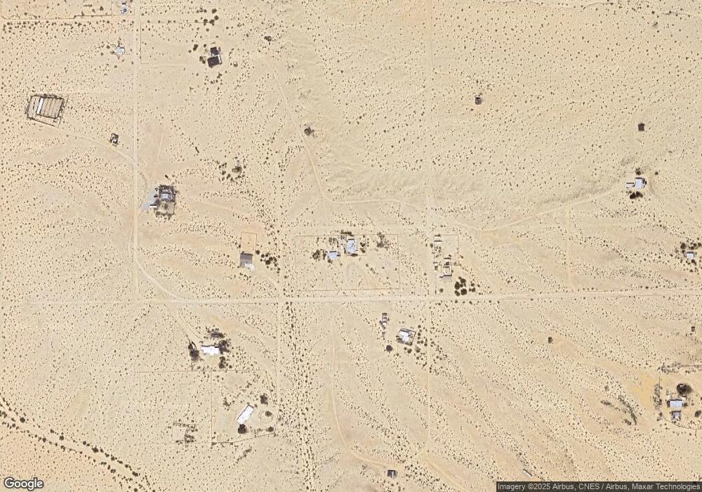
71750 Kelsey Rd Twentynine Palms, CA 92277
Estimated Value: $173,774 - $291,000
2
Beds
1
Bath
1,325
Sq Ft
$184/Sq Ft
Est. Value
About This Home
This home is located at 71750 Kelsey Rd, Twentynine Palms, CA 92277 and is currently estimated at $243,258, approximately $183 per square foot. 71750 Kelsey Rd is a home located in San Bernardino County with nearby schools including Twentynine Palms Elementary School, Twentynine Palms Junior High School, and Twentynine Palms High School.
Ownership History
Date
Name
Owned For
Owner Type
Purchase Details
Closed on
Jun 6, 2006
Sold by
Dawson Gwen L
Bought by
Dawson Cameron T and Dawson Gwen L
Current Estimated Value
Home Financials for this Owner
Home Financials are based on the most recent Mortgage that was taken out on this home.
Original Mortgage
$101,250
Interest Rate
6.57%
Mortgage Type
New Conventional
Create a Home Valuation Report for This Property
The Home Valuation Report is an in-depth analysis detailing your home's value as well as a comparison with similar homes in the area
Home Values in the Area
Average Home Value in this Area
Purchase History
| Date | Buyer | Sale Price | Title Company |
|---|---|---|---|
| Dawson Cameron T | -- | Commonwealth Land Title Co |
Source: Public Records
Mortgage History
| Date | Status | Borrower | Loan Amount |
|---|---|---|---|
| Closed | Dawson Cameron T | $101,250 |
Source: Public Records
Tax History Compared to Growth
Tax History
| Year | Tax Paid | Tax Assessment Tax Assessment Total Assessment is a certain percentage of the fair market value that is determined by local assessors to be the total taxable value of land and additions on the property. | Land | Improvement |
|---|---|---|---|---|
| 2025 | $731 | $36,276 | $2,441 | $33,835 |
| 2024 | $731 | $35,565 | $2,393 | $33,172 |
| 2023 | $719 | $34,868 | $2,346 | $32,522 |
| 2022 | $706 | $34,184 | $2,300 | $31,884 |
| 2021 | $698 | $33,514 | $2,255 | $31,259 |
| 2020 | $691 | $33,170 | $2,232 | $30,938 |
| 2019 | $685 | $32,519 | $2,188 | $30,331 |
| 2018 | $677 | $31,881 | $2,145 | $29,736 |
| 2017 | $669 | $31,256 | $2,103 | $29,153 |
| 2016 | $659 | $30,643 | $2,062 | $28,581 |
| 2015 | $583 | $30,183 | $2,031 | $28,152 |
| 2014 | $580 | $29,592 | $1,991 | $27,601 |
Source: Public Records
Map
Nearby Homes
- 7319 Lupine Ave
- 72082 Winters Rd
- 0 Mac Rae Rd
- 71522 Winters Rd
- 72160 Winters Rd
- 1421 Sunrise Ave
- 0 Westside Rd
- 1234 Westside Rd
- 6181311 Westside Rd
- 101 Westside Rd
- 0 Sunrise Ave
- 380 Mack Ln
- 0 Barbara Ln
- 0 Morongo Rd Unit HD25026402
- 0 Morongo Rd Unit SR25009621
- 290 Bluegrass Ave
- 0 Mesquite Springs Rd Unit OC24224010
- 0 Mesquite Springs Rd Unit 219118364DA
- 0 Mesquite Springs Rd Unit 25560035
- 70125 Rainbow Rd
- 71844 Kelsey Rd
- 71753 Kelsey Rd
- 71686 Kelsey Rd
- 71655 Kelsey Rd
- 71654 Kelsey Rd
- 1284 Mac Rae Rd
- 71663 Winters Rd
- 71954 Kelsey Rd
- 71588 Del Rey Rd
- 71688 Winters Rd
- 71979 Kelsey Rd
- 71567 Winters Rd
- 1238 Cahuilla Rd
- 5 Mac Rae Rd
- 72082 El Sereno Rd
- 0 Winters Rd Unit IV14220342
- 0 Winters Rd Unit PW16736701
- 0 Winters Rd Unit SW24022133
- 0 Winters Rd Unit JT21045265
- 0 Winters Rd Unit 521625
