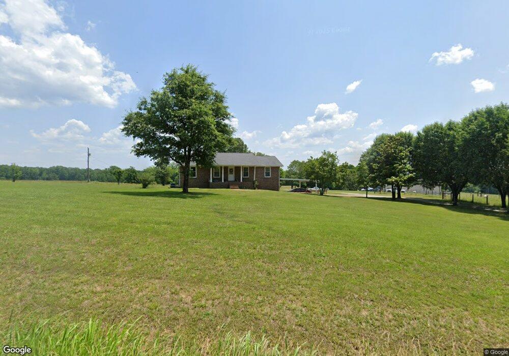
7176 Anderson Rd Fairview, TN 37062
Estimated Value: $379,464 - $629,000
--
Bed
2
Baths
1,377
Sq Ft
$383/Sq Ft
Est. Value
About This Home
This home is located at 7176 Anderson Rd, Fairview, TN 37062 and is currently estimated at $527,616, approximately $383 per square foot. 7176 Anderson Rd is a home located in Williamson County with nearby schools including Westwood Elementary School, Fairview Middle School, and Fairview High School.
Ownership History
Date
Name
Owned For
Owner Type
Purchase Details
Closed on
Apr 28, 1999
Sold by
Hornbeck Ronnie C and Hornbeck Virginia E
Bought by
Shelby Bobby D and Shelby Monica
Current Estimated Value
Home Financials for this Owner
Home Financials are based on the most recent Mortgage that was taken out on this home.
Original Mortgage
$193,800
Outstanding Balance
$49,155
Interest Rate
7.06%
Estimated Equity
$478,461
Purchase Details
Closed on
Sep 28, 1994
Sold by
Johnson Joyce D Day
Bought by
Hornbeck Ronnie C
Create a Home Valuation Report for This Property
The Home Valuation Report is an in-depth analysis detailing your home's value as well as a comparison with similar homes in the area
Home Values in the Area
Average Home Value in this Area
Purchase History
| Date | Buyer | Sale Price | Title Company |
|---|---|---|---|
| Shelby Bobby D | $204,000 | Mid State Title & Escrow Inc | |
| Hornbeck Ronnie C | $107,500 | -- |
Source: Public Records
Mortgage History
| Date | Status | Borrower | Loan Amount |
|---|---|---|---|
| Open | Shelby Bobby D | $193,800 |
Source: Public Records
Tax History Compared to Growth
Tax History
| Year | Tax Paid | Tax Assessment Tax Assessment Total Assessment is a certain percentage of the fair market value that is determined by local assessors to be the total taxable value of land and additions on the property. | Land | Improvement |
|---|---|---|---|---|
| 2025 | $1,305 | $102,575 | $42,725 | $59,850 |
| 2024 | $1,305 | $69,425 | $18,075 | $51,350 |
| 2023 | $1,305 | $69,425 | $18,075 | $51,350 |
| 2022 | $1,305 | $69,425 | $18,075 | $51,350 |
| 2021 | $1,305 | $69,425 | $18,075 | $51,350 |
| 2020 | $1,268 | $57,100 | $10,725 | $46,375 |
| 2019 | $1,268 | $57,100 | $10,725 | $46,375 |
| 2018 | $1,228 | $57,100 | $10,725 | $46,375 |
| 2017 | $1,228 | $57,100 | $10,725 | $46,375 |
| 2016 | $1,228 | $57,100 | $10,725 | $46,375 |
| 2015 | -- | $48,350 | $8,250 | $40,100 |
| 2014 | -- | $48,350 | $8,250 | $40,100 |
Source: Public Records
Map
Nearby Homes
- 0 Old Cox Pike Unit RTC2699167
- 7749 Crow Cut Rd
- 7285 Northwest Hwy
- 7503 Atwater Cir
- 7279 Northwest Hwy
- 7281 Belvoir Dr
- 7295 Belvoir Dr
- 0 Crow Cut Rd NW
- 7231 Old Cox Pike
- 7283 Belvoir Dr
- 7220 Hanworth St
- 7287 Orrinshire Dr
- 7218 Hanworth St
- PARKHILL Plan at Orrinshire
- ARYDALE Plan at Orrinshire
- MONROE Plan at Orrinshire
- COLTON Plan at Orrinshire
- MARSHALL Plan at Orrinshire
- SOMERVILLE Plan at Orrinshire
- 7297 Orrinshire Dr
- 0 Anderson Rd
- 7173 Anderson Rd
- 7224 Anderson Rd
- 7170 Anderson Rd
- 7207 Anderson Rd
- 7225 Anderson Rd
- 7199 Anderson Rd
- 7229 Anderson Rd
- 7155 Anderson Rd
- 7150 Anderson Rd
- 7196 Anderson Rd
- 2744 Anderson Rd (7199)
- 3146 Anderson Rd (7199)
- 7238 Anderson Rd
- 7246 Anderson Rd
- 7161 Elrod Rd
- 7139 Anderson Rd
- 7126 Anderson Rd
- 7251 Anderson Rd
- 7175 Elrod Rd