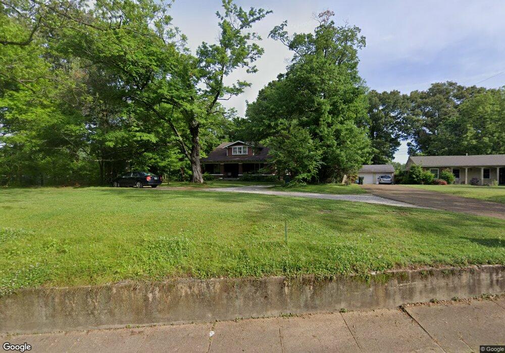
718 W Sherrod Ave Covington, TN 38019
Estimated Value: $244,000 - $297,000
--
Bed
3
Baths
2,556
Sq Ft
$103/Sq Ft
Est. Value
About This Home
This home is located at 718 W Sherrod Ave, Covington, TN 38019 and is currently estimated at $262,100, approximately $102 per square foot. 718 W Sherrod Ave is a home located in Tipton County with nearby schools including Crestview Elementary School, Crestview Middle School, and Covington High School.
Ownership History
Date
Name
Owned For
Owner Type
Purchase Details
Closed on
Nov 3, 2003
Sold by
Leo Wingate
Bought by
Watts James G
Current Estimated Value
Home Financials for this Owner
Home Financials are based on the most recent Mortgage that was taken out on this home.
Original Mortgage
$105,300
Outstanding Balance
$43,275
Interest Rate
4.38%
Estimated Equity
$218,825
Purchase Details
Closed on
Aug 15, 1980
Bought by
Wingate Leo
Purchase Details
Closed on
May 12, 1962
Create a Home Valuation Report for This Property
The Home Valuation Report is an in-depth analysis detailing your home's value as well as a comparison with similar homes in the area
Home Values in the Area
Average Home Value in this Area
Purchase History
| Date | Buyer | Sale Price | Title Company |
|---|---|---|---|
| Watts James G | $117,000 | -- | |
| Wingate Leo | -- | -- | |
| -- | -- | -- |
Source: Public Records
Mortgage History
| Date | Status | Borrower | Loan Amount |
|---|---|---|---|
| Open | Not Available | $105,300 |
Source: Public Records
Tax History Compared to Growth
Tax History
| Year | Tax Paid | Tax Assessment Tax Assessment Total Assessment is a certain percentage of the fair market value that is determined by local assessors to be the total taxable value of land and additions on the property. | Land | Improvement |
|---|---|---|---|---|
| 2024 | $1,182 | $46,650 | $10,325 | $36,325 |
| 2023 | $1,182 | $46,650 | $10,325 | $36,325 |
| 2022 | $1,079 | $32,900 | $7,600 | $25,300 |
| 2021 | $1,080 | $32,900 | $7,600 | $25,300 |
| 2020 | $1,079 | $32,900 | $7,600 | $25,300 |
| 2019 | $945 | $25,200 | $5,850 | $19,350 |
| 2018 | $945 | $25,200 | $5,850 | $19,350 |
| 2017 | $953 | $25,200 | $5,850 | $19,350 |
| 2016 | $953 | $25,400 | $5,850 | $19,550 |
| 2015 | $952 | $25,400 | $5,850 | $19,550 |
| 2014 | $951 | $25,389 | $0 | $0 |
Source: Public Records
Map
Nearby Homes
- 714 W Sherrod Ave
- 600 W Sherrod Ave
- 513 Garland Ave
- 417 Lennanwood Ave
- 1329 Herring Dr
- 518 James St
- 210 Kinney Ave
- 509 S College St
- 826 Douglas St
- 711 S Main St
- 722 S Main St
- 830 S Main St
- 715 S Maple St
- 624 Fyfe St
- 111 W Washington Ave
- 0 N Munford St Unit 10156264
- 0 N Munford St Unit 10156263
- 316 Sanford Ave
- 296 E Washington Ave Unit 3
- 212 S Tipton St
- 720 W Sherrod Ave
- 728 W Sherrod Ave Unit 1
- 728 W Sherrod Ave
- 519 Terrace Dr
- 523 Terrace Dr
- 821 S High St
- 515 Terrace Dr
- 0 Bert Johnston Ave
- 525 Terrace Dr
- 705 W Sherrod Ave
- 507 Terrace Dr
- 503 Terrace Dr
- 1006 Walters St
- 114 Star Shopping Ctr St
- 1009 Crestview St
- 634 W Sherrod Ave
- 114 Star Shopping Center St
- 1002 Crestview St
- 0 Roane St
- 520 Terrace Dr