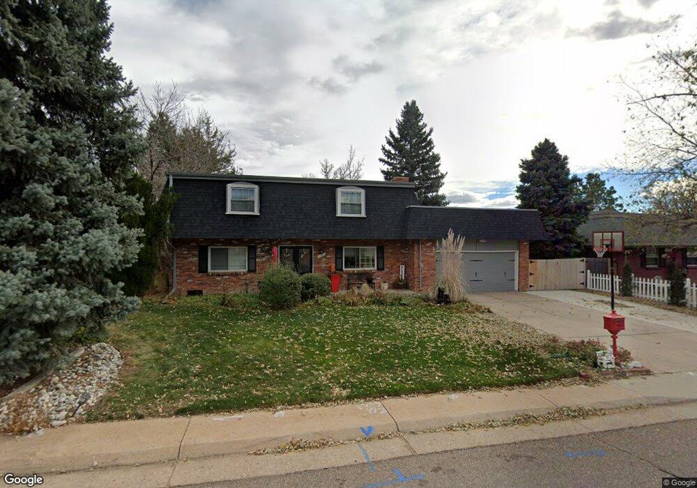
7180 S Sheridan Ct Littleton, CO 80128
Columbine Knolls NeighborhoodEstimated Value: $747,000 - $856,000
3
Beds
5
Baths
2,383
Sq Ft
$326/Sq Ft
Est. Value
About This Home
This home is located at 7180 S Sheridan Ct, Littleton, CO 80128 and is currently estimated at $777,852, approximately $326 per square foot. 7180 S Sheridan Ct is a home located in Jefferson County with nearby schools including Normandy Elementary School, Ken Caryl Middle School, and Columbine High School.
Ownership History
Date
Name
Owned For
Owner Type
Purchase Details
Closed on
Sep 21, 2017
Sold by
Self Edward S and Self Candis
Bought by
The Kee Trust
Current Estimated Value
Purchase Details
Closed on
May 15, 2001
Sold by
Self Edward S
Bought by
Self Edward S and Self Candis
Purchase Details
Closed on
Feb 9, 1998
Sold by
Self Edward S and Self Candis E
Bought by
Self Edward S
Create a Home Valuation Report for This Property
The Home Valuation Report is an in-depth analysis detailing your home's value as well as a comparison with similar homes in the area
Home Values in the Area
Average Home Value in this Area
Purchase History
| Date | Buyer | Sale Price | Title Company |
|---|---|---|---|
| The Kee Trust | -- | None Available | |
| Self Edward S | -- | -- | |
| Self Edward S | -- | Chicago Title |
Source: Public Records
Tax History Compared to Growth
Tax History
| Year | Tax Paid | Tax Assessment Tax Assessment Total Assessment is a certain percentage of the fair market value that is determined by local assessors to be the total taxable value of land and additions on the property. | Land | Improvement |
|---|---|---|---|---|
| 2024 | $3,551 | $38,480 | $14,851 | $23,629 |
| 2023 | $3,551 | $38,480 | $14,851 | $23,629 |
| 2022 | $2,857 | $34,860 | $12,746 | $22,114 |
| 2021 | $2,900 | $35,863 | $13,113 | $22,750 |
| 2020 | $2,601 | $32,985 | $11,404 | $21,581 |
| 2019 | $2,567 | $32,985 | $11,404 | $21,581 |
| 2018 | $2,216 | $28,879 | $8,584 | $20,295 |
| 2017 | $2,003 | $28,879 | $8,584 | $20,295 |
| 2016 | $1,839 | $26,524 | $8,733 | $17,791 |
| 2015 | $1,413 | $26,524 | $8,733 | $17,791 |
| 2014 | $1,413 | $21,580 | $5,970 | $15,610 |
Source: Public Records
Map
Nearby Homes
- 7120 S Sheridan Ct
- 5274 W Rowland Place
- 5040 W Geddes Cir
- 7175 S Polo Ridge Dr
- 5295 W Plymouth Dr
- 5041 W Portland Dr
- 5905 W Quarles Dr
- 7504 S Depew St
- 7329 S Jay St
- 6760 S Depew St
- 7636 S Eaton Way
- 4431 W Jamison Place
- 7604 S Platteview Dr
- 5474 W Canyon Trail Unit F
- 5344 W Canyon Trail Unit B
- 6617 S Chase Ct
- 6751 S Lamar St
- 7944 S Depew St Unit D
- 59 Spyglass Dr
- 6708 W Portland Ave
- 7170 S Sheridan Ct
- 7200 S Sheridan Ct
- 7171 S Sheridan Ct
- 7210 S Sheridan Ct
- 7160 S Sheridan Ct
- 7161 S Sheridan Ct
- 7201 S Sheridan Ct
- 5081 W Geddes Cir
- 7140 S Sheridan Ct
- 5327 W Fremont Place
- 7230 S Sheridan Ct
- 5172 W Fremont Dr
- 5324 W Fremont Place
- 5312 W Roxbury Place
- 5077 W Geddes Cir
- 5091 W Geddes Cir
- 5162 W Fremont Dr
- 7221 S Sheridan Ct
- 7130 S Sheridan Ct
- 5347 W Fremont Place