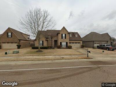
7183 Reliance Ln Olive Branch, MS 38654
Center Hill NeighborhoodEstimated Value: $315,000 - $410,000
3
Beds
3
Baths
2,261
Sq Ft
$153/Sq Ft
Est. Value
About This Home
This home is located at 7183 Reliance Ln, Olive Branch, MS 38654 and is currently estimated at $345,101, approximately $152 per square foot. 7183 Reliance Ln is a home located in DeSoto County with nearby schools including Overpark Elementary School, Center Hill High School, and Desoto Christian Academy.
Ownership History
Date
Name
Owned For
Owner Type
Purchase Details
Closed on
Mar 15, 2011
Sold by
Oakhurst Development Inc
Bought by
Barringer Kimberly D
Current Estimated Value
Home Financials for this Owner
Home Financials are based on the most recent Mortgage that was taken out on this home.
Original Mortgage
$191,031
Interest Rate
4.77%
Mortgage Type
FHA
Purchase Details
Closed on
Jun 11, 2009
Sold by
J Sweeney Homes Llc
Bought by
Bankplus
Create a Home Valuation Report for This Property
The Home Valuation Report is an in-depth analysis detailing your home's value as well as a comparison with similar homes in the area
Home Values in the Area
Average Home Value in this Area
Purchase History
| Date | Buyer | Sale Price | Title Company |
|---|---|---|---|
| Barringer Kimberly D | -- | None Available | |
| Bankplus | $187,072 | None Available |
Source: Public Records
Mortgage History
| Date | Status | Borrower | Loan Amount |
|---|---|---|---|
| Open | Barringer Kimberly D | $183,400 | |
| Closed | Barringer Kimberly D | $191,031 |
Source: Public Records
Tax History Compared to Growth
Tax History
| Year | Tax Paid | Tax Assessment Tax Assessment Total Assessment is a certain percentage of the fair market value that is determined by local assessors to be the total taxable value of land and additions on the property. | Land | Improvement |
|---|---|---|---|---|
| 2024 | $2,289 | $16,774 | $3,500 | $13,274 |
| 2023 | $2,289 | $16,774 | $0 | $0 |
| 2022 | $2,200 | $16,120 | $3,500 | $12,620 |
| 2021 | $2,200 | $16,120 | $3,500 | $12,620 |
| 2020 | $1,509 | $15,091 | $3,500 | $11,591 |
| 2019 | $1,509 | $15,091 | $3,500 | $11,591 |
| 2017 | $1,499 | $26,264 | $14,882 | $11,382 |
| 2016 | $1,499 | $14,882 | $3,500 | $11,382 |
| 2015 | $1,499 | $26,264 | $14,882 | $11,382 |
| 2014 | $1,600 | $15,893 | $0 | $0 |
| 2013 | $529 | $15,893 | $0 | $0 |
Source: Public Records
Map
Nearby Homes
- 7061 Reliance Ln
- 13066 Sandbourne N
- 6904 Braybourne Main
- 12855 Fox Ridge Ln
- 7413 Fox Creek Dr
- 13133 Braybourne Cove
- 13103 Braybourne Cove
- 13881 Goodman Rd
- 7251 Eastern Dr
- 6279 Braybourne Main
- 4380 Center Hill Rd
- 6177 Sandbourne W
- 6932 Stanley Dr
- 6264 Valley Oaks Dr W
- 14029 Knightsbridge Ln
- 6254 Houston Ln
- 6585 Cataloochee Ln
- 6472 Cataloochee Ln
- 14155 Miller Station Ln
- 14288 Santa fe Dr
- 7183 Reliance Ln
- 7195 Reliance Ln
- 7167 Reliance Ln
- 7157 Reliance Ln
- 7162 Windswept Ln
- 7180 Windswept Ln
- 7196 Windswept Ln
- 7150 Windswept Ln
- 7141 Reliance Ln
- 7197 Windswept Ln
- 7132 Windswept Ln
- 13233 Baskins Cove W
- 7127 Reliance Ln
- 13259 Baskins Cove W
- 13247 Baskins Cove W
- 7179 Windswept Ln
- 7161 Windswept Ln
- 13219 Baskins Cove W
- 13291 Baskins Cove
- 7149 Windswept Ln