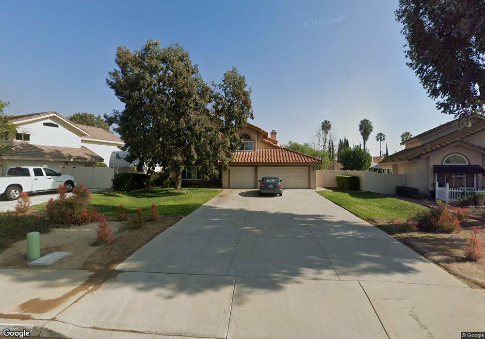
7190 Westport St Riverside, CA 92506
Mission Grove NeighborhoodEstimated Value: $734,802 - $825,000
4
Beds
3
Baths
2,224
Sq Ft
$351/Sq Ft
Est. Value
About This Home
This home is located at 7190 Westport St, Riverside, CA 92506 and is currently estimated at $781,451, approximately $351 per square foot. 7190 Westport St is a home located in Riverside County with nearby schools including William Howard Taft Elementary School, Amelia Earhart Middle School, and Martin Luther King Junior High School.
Ownership History
Date
Name
Owned For
Owner Type
Purchase Details
Closed on
Mar 21, 2014
Sold by
Scott James H and Scott Hweylee
Bought by
Scott Trust
Current Estimated Value
Purchase Details
Closed on
Nov 20, 2008
Sold by
Rodriguez Anthony W
Bought by
Scott James H and Scott Hwey Lee
Home Financials for this Owner
Home Financials are based on the most recent Mortgage that was taken out on this home.
Original Mortgage
$202,500
Outstanding Balance
$133,057
Interest Rate
6.1%
Mortgage Type
Purchase Money Mortgage
Estimated Equity
$648,394
Create a Home Valuation Report for This Property
The Home Valuation Report is an in-depth analysis detailing your home's value as well as a comparison with similar homes in the area
Home Values in the Area
Average Home Value in this Area
Purchase History
| Date | Buyer | Sale Price | Title Company |
|---|---|---|---|
| Scott Trust | -- | None Available | |
| Scott James H | $270,000 | Fnt Ie |
Source: Public Records
Mortgage History
| Date | Status | Borrower | Loan Amount |
|---|---|---|---|
| Open | Scott James H | $202,500 |
Source: Public Records
Tax History Compared to Growth
Tax History
| Year | Tax Paid | Tax Assessment Tax Assessment Total Assessment is a certain percentage of the fair market value that is determined by local assessors to be the total taxable value of land and additions on the property. | Land | Improvement |
|---|---|---|---|---|
| 2025 | $3,796 | $347,672 | $128,764 | $218,908 |
| 2023 | $3,796 | $334,173 | $123,765 | $210,408 |
| 2022 | $3,711 | $327,622 | $121,339 | $206,283 |
| 2021 | $3,667 | $321,199 | $118,960 | $202,239 |
| 2020 | $3,640 | $317,907 | $117,741 | $200,166 |
| 2019 | $3,571 | $311,675 | $115,433 | $196,242 |
| 2018 | $3,502 | $305,565 | $113,171 | $192,394 |
| 2017 | $3,440 | $299,574 | $110,952 | $188,622 |
| 2016 | $3,221 | $293,701 | $108,777 | $184,924 |
| 2015 | $3,175 | $289,292 | $107,144 | $182,148 |
| 2014 | $3,156 | $283,628 | $105,047 | $178,581 |
Source: Public Records
Map
Nearby Homes
- 7250 Goldboro Ln
- 106 Bracebridge Rd
- 7156 Stanhope Ln
- 945 Cannon Rd
- 1042 Coronet Dr
- 7429 Selena St
- 6752 Laurelbrook Dr
- 19121 Broken Bow Dr
- 7619 Hillhurst Dr
- 6879 Mission Grove Pkwy N
- 7639 Hillhurst Dr
- 19155 Vintage Woods Dr
- 18805 Moss Rd
- 1257 Fetlock Way
- 6978 Withers Rd
- 1249 Coronet Dr
- 6631 New Ridge Dr
- 5280 Melbourne Place
- 7047 Golden Vale Dr
- 7007 Golden Vale Dr
- 7198 Westport St
- 7182 Westport St
- 211 Cannon Rd
- 203 Cannon Rd
- 7174 Westport St
- 7218 Westport St
- 7203 Goldboro Ln
- 219 Cannon Rd
- 7195 Westport St
- 7179 Westport St
- 189 Cannon Rd
- 7166 Westport St
- 7230 Westport St
- 7227 Goldboro Ln
- 227 Cannon Rd
- 7202 Goldboro Ln
- 181 Cannon Rd
- 7165 Westport St
- 155 Bracebridge Rd
- 146 Bracebridge Rd