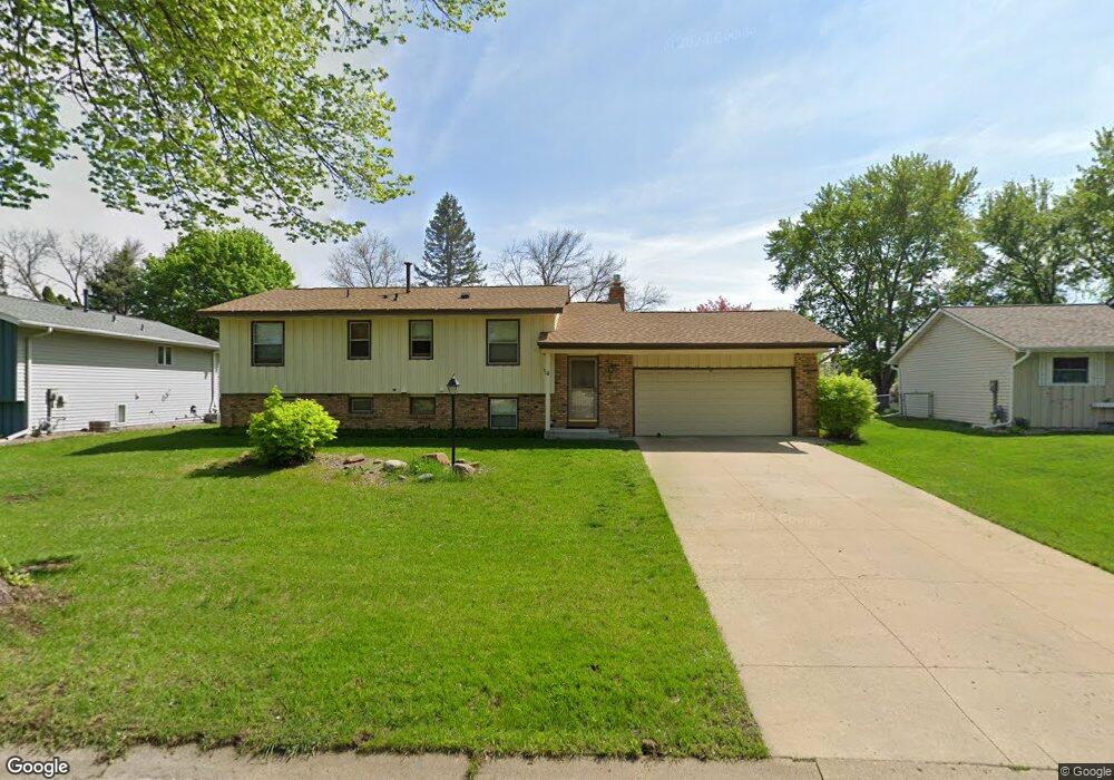
7196 145th St W Saint Paul, MN 55124
Scott Highlands NeighborhoodEstimated Value: $390,190 - $421,000
4
Beds
2
Baths
1,085
Sq Ft
$372/Sq Ft
Est. Value
About This Home
This home is located at 7196 145th St W, Saint Paul, MN 55124 and is currently estimated at $403,798, approximately $372 per square foot. 7196 145th St W is a home located in Dakota County with nearby schools including Greenleaf Elementary School, Falcon Ridge Middle School, and Apple Valley Senior High School.
Ownership History
Date
Name
Owned For
Owner Type
Purchase Details
Closed on
Jul 20, 2011
Sold by
Wheatcraft Donald L
Bought by
Edmond Jacob and Benites Laura
Current Estimated Value
Home Financials for this Owner
Home Financials are based on the most recent Mortgage that was taken out on this home.
Original Mortgage
$165,592
Outstanding Balance
$112,514
Interest Rate
4.25%
Mortgage Type
FHA
Estimated Equity
$291,284
Create a Home Valuation Report for This Property
The Home Valuation Report is an in-depth analysis detailing your home's value as well as a comparison with similar homes in the area
Home Values in the Area
Average Home Value in this Area
Purchase History
| Date | Buyer | Sale Price | Title Company |
|---|---|---|---|
| Edmond Jacob | $169,900 | Trademark Title Services Inc |
Source: Public Records
Mortgage History
| Date | Status | Borrower | Loan Amount |
|---|---|---|---|
| Open | Edmond Jacob | $165,592 |
Source: Public Records
Tax History Compared to Growth
Tax History
| Year | Tax Paid | Tax Assessment Tax Assessment Total Assessment is a certain percentage of the fair market value that is determined by local assessors to be the total taxable value of land and additions on the property. | Land | Improvement |
|---|---|---|---|---|
| 2024 | $4,154 | $358,800 | $87,100 | $271,700 |
| 2023 | $4,154 | $369,000 | $87,300 | $281,700 |
| 2022 | $3,278 | $352,700 | $87,000 | $265,700 |
| 2021 | $3,124 | $289,600 | $74,900 | $214,700 |
| 2020 | $3,128 | $271,500 | $71,300 | $200,200 |
| 2019 | $2,808 | $264,200 | $67,900 | $196,300 |
| 2018 | $2,622 | $249,800 | $64,700 | $185,100 |
| 2017 | $2,639 | $225,800 | $61,600 | $164,200 |
| 2016 | $2,652 | $216,600 | $58,700 | $157,900 |
| 2015 | $2,304 | $197,546 | $52,734 | $144,812 |
| 2014 | -- | $172,040 | $49,641 | $122,399 |
| 2013 | -- | $162,666 | $45,500 | $117,166 |
Source: Public Records
Map
Nearby Homes
- 14620 Garrett Ave Unit 310
- 14461 Freesia Way
- 14144 Garland Ave
- 14242 Glencove Trail
- 7662 142nd St W
- 7342 Upper 139th St W
- 14217 Footbridge Way
- 14440 Flax Way
- 7070 153rd St W Unit 211
- 14057 Flintwood Ct
- 13868 Glendale Ct
- 13720 Georgia Dr
- 13954 Flagstaff Ct
- 7291 Upper 136th St W
- 13947 Fleetwood Ave
- 14080 Guthrie Ave
- 14786 Hallmark Dr
- 7577 138th St W
- 834 Fireside Dr
- 15323 Foliage Ave
- 7172 145th St W
- 7204 145th St W
- 7173 146th St W
- 7154 145th St W
- 7203 146th St W
- 7154 7154 145th-Street-w
- 7195 145th St W
- 7151 146th St W
- 7175 145th St W
- 7205 145th St W
- 7137 146th St W
- 14555 Genesee Ave
- 14560 Genesee Ave
- 14559 Garrett Ave
- 14473 Garrett Ave
- 7135 145th St W
- 14573 Garrett Ave
- 7190 146th St W
- 7118 145th St W
- 7170 146th St W