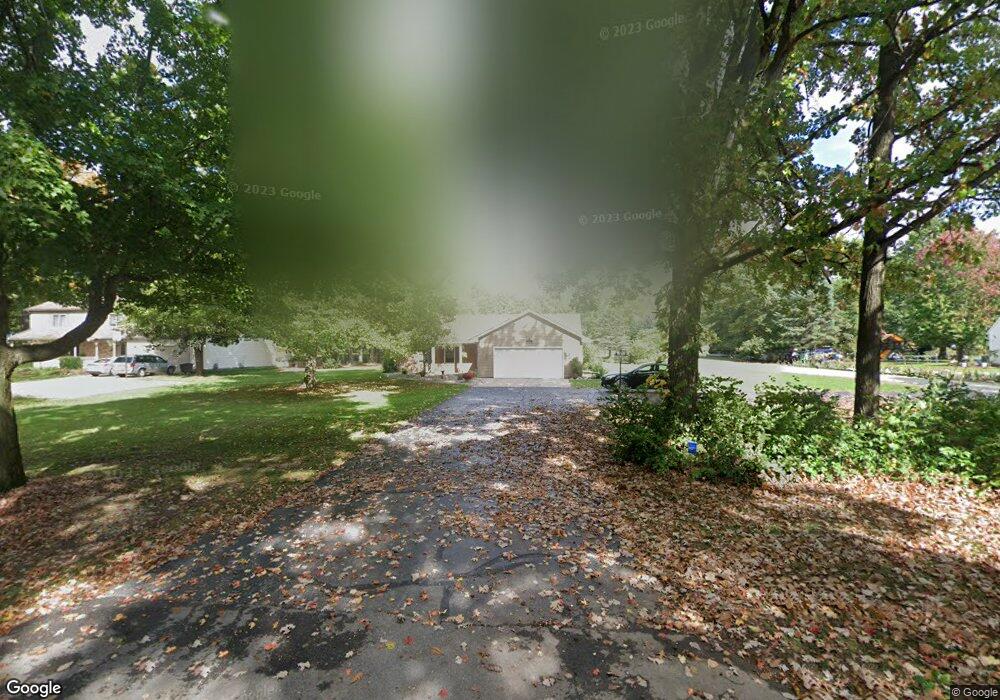
7196 King Rd Spring Arbor, MI 49283
Estimated Value: $283,000 - $363,000
3
Beds
2
Baths
2,300
Sq Ft
$140/Sq Ft
Est. Value
About This Home
This home is located at 7196 King Rd, Spring Arbor, MI 49283 and is currently estimated at $321,205, approximately $139 per square foot. 7196 King Rd is a home located in Jackson County with nearby schools including Western High School, Trinity Lutheran School, and Lumen Christi Catholic School.
Ownership History
Date
Name
Owned For
Owner Type
Purchase Details
Closed on
Aug 17, 2006
Sold by
Lazaroff Michael D and Lazaroff Mary C
Bought by
Berthiaume David L and Berthiaume Allyson M
Current Estimated Value
Home Financials for this Owner
Home Financials are based on the most recent Mortgage that was taken out on this home.
Original Mortgage
$195,000
Outstanding Balance
$133,119
Interest Rate
9.45%
Mortgage Type
Purchase Money Mortgage
Estimated Equity
$188,086
Create a Home Valuation Report for This Property
The Home Valuation Report is an in-depth analysis detailing your home's value as well as a comparison with similar homes in the area
Purchase History
| Date | Buyer | Sale Price | Title Company |
|---|---|---|---|
| Berthiaume David L | $210,000 | At |
Source: Public Records
Mortgage History
| Date | Status | Borrower | Loan Amount |
|---|---|---|---|
| Open | Berthiaume David L | $195,000 |
Source: Public Records
Tax History
| Year | Tax Paid | Tax Assessment Tax Assessment Total Assessment is a certain percentage of the fair market value that is determined by local assessors to be the total taxable value of land and additions on the property. | Land | Improvement |
|---|---|---|---|---|
| 2025 | $3,031 | $142,600 | $0 | $0 |
| 2024 | $18 | $136,800 | $0 | $0 |
| 2023 | $1,799 | $129,100 | $0 | $0 |
| 2022 | $2,750 | $126,700 | $0 | $0 |
| 2021 | $2,701 | $123,490 | $0 | $0 |
| 2020 | $2,668 | $101,090 | $0 | $0 |
| 2019 | $2,536 | $92,350 | $0 | $0 |
| 2018 | $2,527 | $91,310 | $9,030 | $82,280 |
| 2017 | $2,394 | $89,380 | $0 | $0 |
| 2016 | $1,528 | $88,170 | $0 | $88,170 |
| 2015 | $62,788 | $74,920 | $74,920 | $0 |
| 2014 | $62,788 | $66,690 | $66,690 | $0 |
| 2013 | -- | $66,690 | $66,690 | $0 |
Source: Public Records
Map
Nearby Homes
- 7315 King Rd
- V/L S Dearing Rd Unit 40 Acres Vacant Land
- 2635 S Dearing Rd
- 2625 S Dearing Rd
- 2503 Milford Rd
- 7969 Brandon Dr
- 6728 King Rd
- 68 Dickens St
- 1400 Chapel Rd
- 1400 Chapel Rd Unit B
- 1400 Chapel Rd Unit A
- 1570 Chapel Rd
- 1126 Chapel Rd
- 2659 Fairway Dr
- 5454 Vrooman Rd
- 4849 Indian Creek Dr Unit 6
- 28 Engelhardt Strasse
- 4557 Westbrook Dr Unit 31
- 5427 Vrooman Rd
- 1035 Engelhardt Strasse
- 7200 King Rd
- 7140 King Rd
- 7136 King Rd
- 7310 King Rd
- 7135 King Rd
- 7195 King Rd
- 7259 King Rd Unit 5
- 182 Remington Dr
- 7313 King Rd Unit 4
- 7313 King Rd
- 7131 King Rd
- 170 Remington Dr
- 7132 King Rd
- 172 Remington - Lot 10 Dr
- 7316 King Rd
- 7258 Sydney Ct
- 181 Remington Dr Unit 13 Dr
- 181 Remington Dr
- 188 Remington #12
- 7315 King Rd Unit 3
Your Personal Tour Guide
Ask me questions while you tour the home.