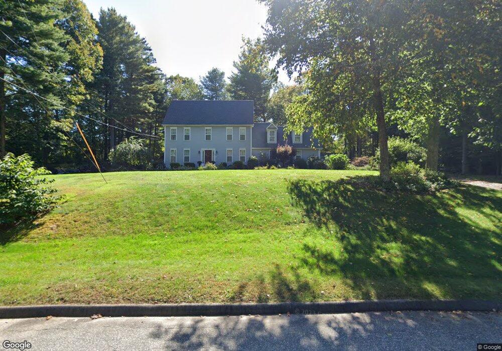
72 Derek Dr Tolland, CT 06084
Estimated Value: $543,000 - $583,133
4
Beds
3
Baths
2,206
Sq Ft
$256/Sq Ft
Est. Value
About This Home
This home is located at 72 Derek Dr, Tolland, CT 06084 and is currently estimated at $565,033, approximately $256 per square foot. 72 Derek Dr is a home located in Tolland County with nearby schools including Birch Grove Primary School, Tolland Intermediate School, and Tolland Middle School.
Ownership History
Date
Name
Owned For
Owner Type
Purchase Details
Closed on
May 18, 2004
Sold by
Cook Lawrence and Cook Ellen
Bought by
Pater Christopher and Pater Julie
Current Estimated Value
Home Financials for this Owner
Home Financials are based on the most recent Mortgage that was taken out on this home.
Original Mortgage
$253,000
Interest Rate
5.47%
Purchase Details
Closed on
Nov 17, 1998
Sold by
Sugar Hill Designs
Bought by
Cook Lawrence and Cook Ellen
Home Financials for this Owner
Home Financials are based on the most recent Mortgage that was taken out on this home.
Original Mortgage
$165,900
Interest Rate
6.25%
Create a Home Valuation Report for This Property
The Home Valuation Report is an in-depth analysis detailing your home's value as well as a comparison with similar homes in the area
Home Values in the Area
Average Home Value in this Area
Purchase History
| Date | Buyer | Sale Price | Title Company |
|---|---|---|---|
| Pater Christopher | $343,000 | -- | |
| Pater Christopher | $343,000 | -- | |
| Cook Lawrence | $215,900 | -- |
Source: Public Records
Mortgage History
| Date | Status | Borrower | Loan Amount |
|---|---|---|---|
| Open | Cook Lawrence | $210,000 | |
| Closed | Cook Lawrence | $253,000 | |
| Previous Owner | Cook Lawrence | $165,900 |
Source: Public Records
Tax History Compared to Growth
Tax History
| Year | Tax Paid | Tax Assessment Tax Assessment Total Assessment is a certain percentage of the fair market value that is determined by local assessors to be the total taxable value of land and additions on the property. | Land | Improvement |
|---|---|---|---|---|
| 2025 | $9,424 | $346,600 | $78,300 | $268,300 |
| 2024 | $8,744 | $231,500 | $74,600 | $156,900 |
| 2023 | $8,642 | $231,500 | $74,600 | $156,900 |
| 2022 | $8,468 | $231,500 | $74,600 | $156,900 |
| 2021 | $8,591 | $231,500 | $74,600 | $156,900 |
| 2020 | $8,346 | $231,500 | $74,600 | $156,900 |
| 2019 | $8,598 | $238,500 | $76,900 | $161,600 |
| 2018 | $8,348 | $238,500 | $76,900 | $161,600 |
| 2017 | $8,154 | $238,500 | $76,900 | $161,600 |
| 2016 | $8,154 | $238,500 | $76,900 | $161,600 |
| 2015 | $7,956 | $238,500 | $76,900 | $161,600 |
| 2014 | $7,756 | $249,800 | $85,400 | $164,400 |
Source: Public Records
Map
Nearby Homes
- 95 Derek Dr
- 120 Derek Dr
- 322 Buff Cap Rd
- 128 Slater Rd
- 152 Buff Cap Rd
- 368 Buff Cap Rd
- 28 Angela Dr
- 0 Tolland Stage Rd Unit 24101836
- 476 Old Stafford Rd
- 395 Old Stafford Rd
- 461 Old Stafford Rd
- 257 Torry Rd
- 66 Deerwood Rd
- 0 Tolland Turnpike Unit 24107059
- 71 Neff Hill Rd
- 43 Deerwood Rd
- 8 Neff Hill Rd
- 25 Josephine Way
- 745 Old Stafford Rd
- 100 Neff Hill Rd