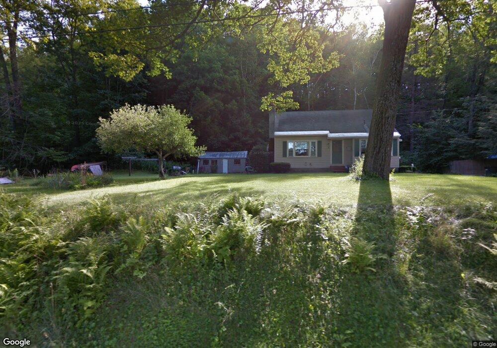
72 E Wilder Rd West Lebanon, NH 03784
Estimated Value: $371,937 - $480,000
3
Beds
1
Bath
1,164
Sq Ft
$358/Sq Ft
Est. Value
About This Home
This home is located at 72 E Wilder Rd, West Lebanon, NH 03784 and is currently estimated at $417,234, approximately $358 per square foot. 72 E Wilder Rd is a home located in Grafton County with nearby schools including Mt. Lebanon School, Lebanon Middle School, and Lebanon High School.
Ownership History
Date
Name
Owned For
Owner Type
Purchase Details
Closed on
May 23, 2019
Sold by
Roger C Borggaard Ret and Borggaard
Bought by
Borggaard Roger
Current Estimated Value
Home Financials for this Owner
Home Financials are based on the most recent Mortgage that was taken out on this home.
Original Mortgage
$132,400
Outstanding Balance
$116,166
Interest Rate
4.2%
Mortgage Type
New Conventional
Estimated Equity
$301,068
Purchase Details
Closed on
Oct 12, 2017
Sold by
Borggaard Roger
Bought by
Roger C Borggaard Ret and Borggaard
Purchase Details
Closed on
Jul 7, 2014
Sold by
Wood Caleb J and Wood Peter J
Bought by
Borggaard Roger
Create a Home Valuation Report for This Property
The Home Valuation Report is an in-depth analysis detailing your home's value as well as a comparison with similar homes in the area
Home Values in the Area
Average Home Value in this Area
Purchase History
| Date | Buyer | Sale Price | Title Company |
|---|---|---|---|
| Borggaard Roger | -- | -- | |
| Borggaard Roger | -- | -- | |
| Roger C Borggaard Ret | -- | -- | |
| Roger C Borggaard Ret | -- | -- | |
| Borggaard Roger | $175,000 | -- | |
| Borggaard Roger | $175,000 | -- |
Source: Public Records
Mortgage History
| Date | Status | Borrower | Loan Amount |
|---|---|---|---|
| Open | Borggaard Roger | $132,400 | |
| Closed | Borggaard Roger | $132,400 | |
| Closed | Borggaard Roger | $0 |
Source: Public Records
Tax History Compared to Growth
Tax History
| Year | Tax Paid | Tax Assessment Tax Assessment Total Assessment is a certain percentage of the fair market value that is determined by local assessors to be the total taxable value of land and additions on the property. | Land | Improvement |
|---|---|---|---|---|
| 2024 | $6,525 | $248,300 | $104,200 | $144,100 |
| 2023 | $6,029 | $248,300 | $104,200 | $144,100 |
| 2022 | $5,721 | $248,300 | $104,200 | $144,100 |
| 2021 | $4,967 | $184,100 | $73,400 | $110,700 |
| 2019 | $5,163 | $170,000 | $76,000 | $94,000 |
| 2018 | $5,052 | $170,000 | $76,000 | $94,000 |
| 2017 | $5 | $170,000 | $76,000 | $94,000 |
| 2016 | $611 | $170,000 | $76,000 | $94,000 |
| 2015 | $4,694 | $170,000 | $76,000 | $94,000 |
| 2014 | $4,337 | $165,100 | $76,000 | $89,100 |
| 2013 | $4,786 | $187,600 | $77,100 | $110,500 |
Source: Public Records
Map
Nearby Homes
- 5 E Wilder Rd
- 9 Walnut St
- 13 Hawthorn St
- 1668 Hartford Ave
- 68 Passumpsic Ave
- 78 Division St
- 99 Depot St
- 61 Depot St
- 1 Depot St
- 55 Horseshoe Ave
- 2577 Hartford Ave
- 478 Chandler Rd
- 00 Christian St
- 86 Woodhaven Dr
- 169 Woodhaven Dr Unit 2J
- 36 Juniper Dr Unit 6B
- 46A Barrister Dr Unit 205
- 0 Barrister Dr Unit 3
- 85 Lebanon St
- 2 Brockway Rd
- 68 E Wilder Rd
- 78 E Wilder Rd
- 66 E Wilder Rd
- 62 E Wilder Rd
- Unit E-1 365 North Main St Unit E-1
- 0 E Wilder Rd
- 21 Linden Dr Unit H-3
- 10 Linden Dr Unit E4
- 24 Linden Dr
- 27 Linden Dr Unit G2
- 10 Linden Dr
- 20 Linden Dr Unit F3
- 23 Linden Dr Unit H4
- 22 Linden Dr Unit F2
- 79 E Wilder Rd
- 15 Linden Dr
- 15 Linden Dr Unit 15
- 60 E Wilder Rd
- 38 Lily Ln Unit L-4
- 38 Lily Ln