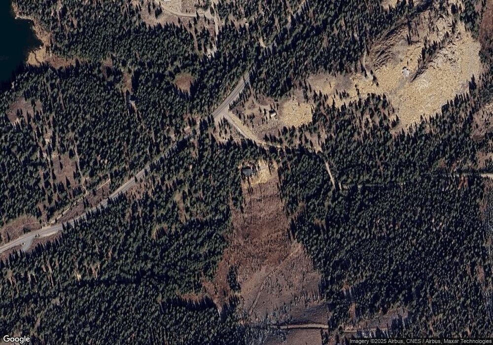
72 Rand Rd Bridgeport, CA 93517
Estimated Value: $737,000 - $1,003,933
4
Beds
3
Baths
2,744
Sq Ft
$325/Sq Ft
Est. Value
About This Home
This home is located at 72 Rand Rd, Bridgeport, CA 93517 and is currently estimated at $891,311, approximately $324 per square foot. 72 Rand Rd is a home located in Mono County.
Ownership History
Date
Name
Owned For
Owner Type
Purchase Details
Closed on
Sep 15, 2011
Sold by
Carruth Dennis C and Carruth Lina S
Bought by
Carruth Dennis and Carruth Lina
Current Estimated Value
Home Financials for this Owner
Home Financials are based on the most recent Mortgage that was taken out on this home.
Original Mortgage
$417,000
Outstanding Balance
$160,952
Interest Rate
4.37%
Mortgage Type
New Conventional
Estimated Equity
$730,359
Purchase Details
Closed on
Aug 30, 2011
Sold by
Carruth Dennis and Carruth Linda
Bought by
Carruth Dennis C and Carruth Lina S
Home Financials for this Owner
Home Financials are based on the most recent Mortgage that was taken out on this home.
Original Mortgage
$417,000
Outstanding Balance
$160,952
Interest Rate
4.37%
Mortgage Type
New Conventional
Estimated Equity
$730,359
Purchase Details
Closed on
Dec 2, 2003
Sold by
Meyers Mary and Myers Philip
Bought by
Carruth Dennis and Carruth Lina
Create a Home Valuation Report for This Property
The Home Valuation Report is an in-depth analysis detailing your home's value as well as a comparison with similar homes in the area
Purchase History
| Date | Buyer | Sale Price | Title Company |
|---|---|---|---|
| Carruth Dennis | -- | Accommodation | |
| Carruth Dennis C | -- | Inyo Mono Title Company | |
| Carruth Dennis | $225,000 | Inyo Mono Title Company |
Source: Public Records
Mortgage History
| Date | Status | Borrower | Loan Amount |
|---|---|---|---|
| Open | Carruth Dennis C | $417,000 |
Source: Public Records
Tax History
| Year | Tax Paid | Tax Assessment Tax Assessment Total Assessment is a certain percentage of the fair market value that is determined by local assessors to be the total taxable value of land and additions on the property. | Land | Improvement |
|---|---|---|---|---|
| 2025 | $6,492 | $700,000 | $135,000 | $565,000 |
| 2024 | $6,492 | $606,775 | $135,000 | $471,775 |
| 2023 | $6,492 | $700,000 | $135,000 | $565,000 |
| 2022 | $6,420 | $600,000 | $135,000 | $465,000 |
| 2021 | $5,890 | $550,000 | $135,000 | $415,000 |
| 2020 | $5,633 | $525,000 | $135,000 | $390,000 |
| 2019 | $5,625 | $525,000 | $135,000 | $390,000 |
| 2018 | $5,498 | $513,000 | $135,000 | $378,000 |
| 2017 | $5,498 | $513,000 | $135,000 | $378,000 |
| 2016 | $5,498 | $513,000 | $135,000 | $378,000 |
| 2015 | $5,528 | $513,000 | $135,000 | $378,000 |
| 2014 | $5,498 | $513,000 | $135,000 | $378,000 |
Source: Public Records
Map
Nearby Homes
- 265 Westwood Dr
- 235 Westwood Dr
- 40 Paoha Dr
- 70405 Hwy 395
- No Addresss Hwy 395
- Lot 11 Rickey Peak Rd
- 7 Rickey Peak Rd
- 87846 Hwy 395
- 0 Rickey Peak Rd Unit 2312950
- 350 Aspen Ln
- 186 Milk Ranch Rd
- 300 Kingsley St
- 235 Lakeside Dr
- Lot 25 California 182
- Lot 6 Stock Dr
- 80 S Tamarack Dr
- Lot 3 Highway 395
- APN: 006-120-040-000 Hwy 395
- APN:011-030-007 Hwy 395
- 0 Mono Lake Unit 250362
- 72 Rand Rd Unit 72
- 5473 Virginia Lakes Rd
- 50 Summit Dr Unit 50
- Sub 4 - Lot #11 Tip Top Ln
- Sub 4 - Lot #11 Tip Top Ln Unit 11
- 5672 Virginia Lakes Rd
- 5672 Virginia Lakes Rd Unit 21
- 5364 Virginia Lakes
- 5364 Virginia Lakes Rd
- 5364 Virginia Lakes Unit 6
- 5364 Virginia Lakes Rd Unit 6
- 58 Hawthorne Rd
- 12 Pinecrest Unit Lot 12, Subdivision
- 6 Tip Top Ln
- 12 Tip Top Ln
- 9 Tip Top Ln
- 39 Tip Top Ln
- 11 Tip Top Ln
- 90 Pinecrest
- 90 Pinecrest Unit 8
Your Personal Tour Guide
Ask me questions while you tour the home.
