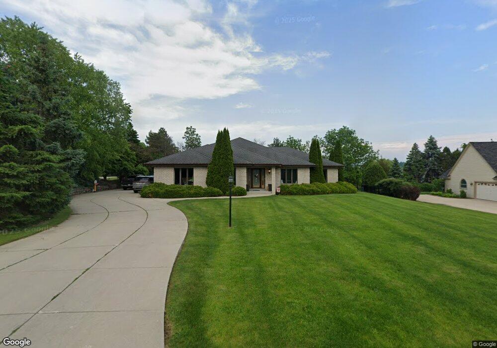
720 Auburn Dr Brookfield, WI 53045
Estimated Value: $768,000 - $869,065
3
Beds
3
Baths
2,695
Sq Ft
$306/Sq Ft
Est. Value
About This Home
This home is located at 720 Auburn Dr, Brookfield, WI 53045 and is currently estimated at $824,766, approximately $306 per square foot. 720 Auburn Dr is a home located in Waukesha County with nearby schools including Swanson Elementary School, Wisconsin Hills Middle School, and Brookfield Central High School.
Ownership History
Date
Name
Owned For
Owner Type
Purchase Details
Closed on
Mar 20, 2020
Sold by
Fessenbecker Anna M and Fessenbecker Todd B
Bought by
Graber Kerry and Graber Valerierose
Current Estimated Value
Home Financials for this Owner
Home Financials are based on the most recent Mortgage that was taken out on this home.
Original Mortgage
$368,000
Outstanding Balance
$325,295
Interest Rate
3.4%
Mortgage Type
New Conventional
Estimated Equity
$499,471
Purchase Details
Closed on
Feb 7, 2005
Sold by
Fessenbecker Anna M and Ulrich Anna M
Bought by
Fessenbecker Todd B and Fessenbecker Anna M
Home Financials for this Owner
Home Financials are based on the most recent Mortgage that was taken out on this home.
Original Mortgage
$100,400
Interest Rate
5.78%
Mortgage Type
Stand Alone Refi Refinance Of Original Loan
Purchase Details
Closed on
Apr 20, 1999
Sold by
Ulrich Michael and Ulrich Maria
Bought by
Michael & Maria Ulrich Revocable Trust
Create a Home Valuation Report for This Property
The Home Valuation Report is an in-depth analysis detailing your home's value as well as a comparison with similar homes in the area
Home Values in the Area
Average Home Value in this Area
Purchase History
| Date | Buyer | Sale Price | Title Company |
|---|---|---|---|
| Graber Kerry | $460,000 | None Available | |
| Fessenbecker Todd B | -- | -- | |
| Michael & Maria Ulrich Revocable Trust | -- | -- |
Source: Public Records
Mortgage History
| Date | Status | Borrower | Loan Amount |
|---|---|---|---|
| Open | Graber Kerry | $368,000 | |
| Previous Owner | Fessenbecker Todd B | $100,400 |
Source: Public Records
Tax History Compared to Growth
Tax History
| Year | Tax Paid | Tax Assessment Tax Assessment Total Assessment is a certain percentage of the fair market value that is determined by local assessors to be the total taxable value of land and additions on the property. | Land | Improvement |
|---|---|---|---|---|
| 2024 | $8,102 | $715,400 | $230,000 | $485,400 |
| 2023 | $8,918 | $715,400 | $230,000 | $485,400 |
| 2022 | $8,882 | $561,700 | $230,000 | $331,700 |
| 2021 | $9,349 | $561,700 | $230,000 | $331,700 |
| 2020 | $9,257 | $561,700 | $230,000 | $331,700 |
| 2019 | $8,627 | $561,700 | $230,000 | $331,700 |
| 2018 | $9,097 | $575,500 | $230,000 | $345,500 |
| 2017 | $10,297 | $575,500 | $230,000 | $345,500 |
| 2016 | $9,204 | $575,500 | $230,000 | $345,500 |
| 2015 | $9,142 | $575,500 | $230,000 | $345,500 |
| 2014 | $9,484 | $575,500 | $230,000 | $345,500 |
| 2013 | $9,484 | $575,500 | $230,000 | $345,500 |
Source: Public Records
Map
Nearby Homes
- 935 Auburn Ct
- Lt1 Davidson Rd
- 655 Mac Henry Cir Unit B
- 19125 Hi View Dr Unit 125
- 1405 S Westwoods Rd
- 18625 Emerald Cir Unit G
- 18740 Emerald Cir Unit E
- 18525 Emerald Cir
- 165 Aerie Cir Unit 104
- 165 Aerie Cir Unit 105
- 165 Aerie Cir Unit 102
- 18705 Follett Dr
- 18290 Prairie Falcon Ln
- 745 Hi Ridge Ave
- 18600 Brookfield Lake Dr Unit 53
- 18575 Brookfield Lake Dr Unit 61
- 1701 S Lilly Ln
- Lt2 Downie Rd
- 19000 Toldt Woods Dr Unit 39
- 18415 W Wisconsin Ave Unit 18415
- 750 Auburn Dr
- 745 Fleetwood Ct
- 690 S Stonehedge Dr Unit A
- 690 S Stonehedge Dr Unit B
- 735 Auburn Dr
- 755 Fleetwood Ct
- 775 Auburn Dr
- 730 Fleetwood Ct
- 780 Auburn Dr
- 660 S Stonehedge Dr Unit A
- 660 S Stonehedge Dr Unit B
- 695 S Stonehedge Dr Unit B
- 695 S Stonehedge Dr Unit A
- 655 S Stonehedge Dr Unit B
- 655 S Stonehedge Dr Unit A
- 760 Fleetwood Ct
- 785 Fleetwood Ct
- 815 Auburn Dr
- 19480 Whitehall Dr
- 800 Auburn Dr