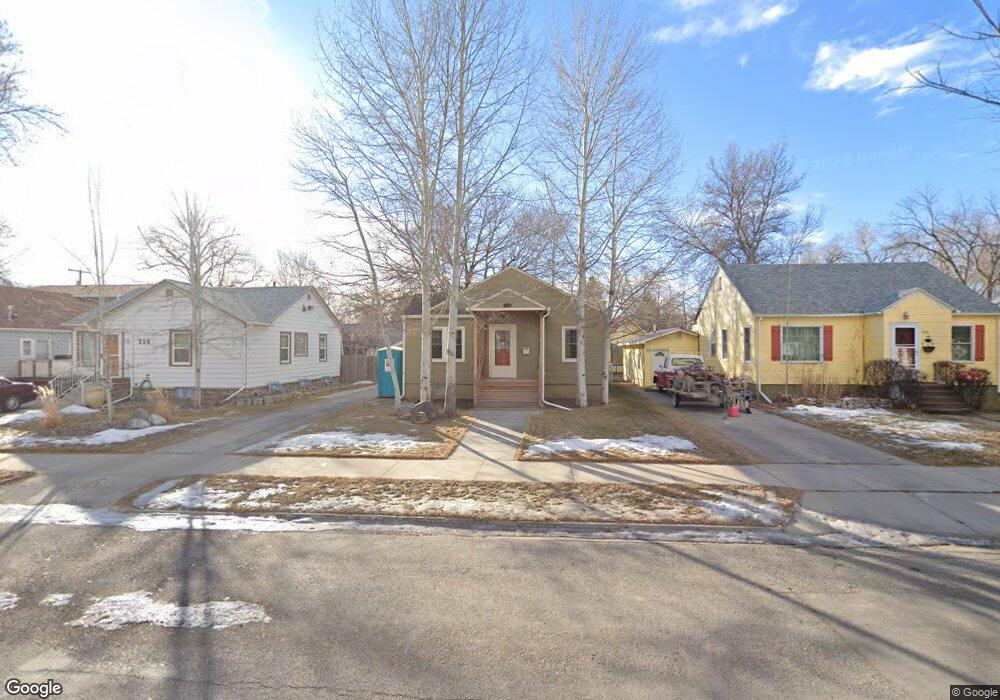
720 Miles Ave Billings, MT 59101
East Central Billings NeighborhoodEstimated Value: $267,000 - $288,000
3
Beds
1
Bath
952
Sq Ft
$287/Sq Ft
Est. Value
About This Home
This home is located at 720 Miles Ave, Billings, MT 59101 and is currently estimated at $273,588, approximately $287 per square foot. 720 Miles Ave is a home located in Yellowstone County with nearby schools including Washington School, Lewis & Clark Junior High School, and Billings Senior High School.
Ownership History
Date
Name
Owned For
Owner Type
Purchase Details
Closed on
Mar 20, 2009
Sold by
Hommes Glenn and Hommes Katharine R
Bought by
Abbott Kenneth R
Current Estimated Value
Home Financials for this Owner
Home Financials are based on the most recent Mortgage that was taken out on this home.
Original Mortgage
$146,205
Outstanding Balance
$93,262
Interest Rate
5.19%
Mortgage Type
Purchase Money Mortgage
Estimated Equity
$180,326
Purchase Details
Closed on
Dec 12, 2007
Sold by
Hommes Glenn and Hommes Katharine R
Bought by
Hommes Glenn and Hommes Katharine R
Purchase Details
Closed on
Jun 8, 2007
Sold by
Mccarten Thomas P and Mccarten Cheryl L
Bought by
Hommes Glen and Hommes Katharine P
Home Financials for this Owner
Home Financials are based on the most recent Mortgage that was taken out on this home.
Original Mortgage
$100,000
Interest Rate
6.14%
Mortgage Type
Purchase Money Mortgage
Create a Home Valuation Report for This Property
The Home Valuation Report is an in-depth analysis detailing your home's value as well as a comparison with similar homes in the area
Home Values in the Area
Average Home Value in this Area
Purchase History
| Date | Buyer | Sale Price | Title Company |
|---|---|---|---|
| Abbott Kenneth R | -- | St | |
| Hommes Glenn | -- | None Available | |
| Hommes Glen | -- | None Available |
Source: Public Records
Mortgage History
| Date | Status | Borrower | Loan Amount |
|---|---|---|---|
| Open | Abbott Kenneth R | $146,205 | |
| Previous Owner | Hommes Glen | $100,000 |
Source: Public Records
Tax History
| Year | Tax Paid | Tax Assessment Tax Assessment Total Assessment is a certain percentage of the fair market value that is determined by local assessors to be the total taxable value of land and additions on the property. | Land | Improvement |
|---|---|---|---|---|
| 2025 | $2,387 | $261,800 | $36,975 | $224,825 |
| 2024 | $2,387 | $237,100 | $36,951 | $200,149 |
| 2023 | $2,385 | $237,100 | $36,951 | $200,149 |
| 2022 | $2,194 | $191,300 | $0 | $0 |
| 2021 | $2,093 | $191,300 | $0 | $0 |
| 2020 | $2,171 | $186,300 | $0 | $0 |
| 2019 | $2,068 | $186,300 | $0 | $0 |
| 2018 | $1,957 | $172,200 | $0 | $0 |
| 2017 | $1,900 | $172,200 | $0 | $0 |
| 2016 | $1,736 | $156,900 | $0 | $0 |
| 2015 | $1,691 | $156,900 | $0 | $0 |
| 2014 | $1,526 | $74,571 | $0 | $0 |
Source: Public Records
Map
Nearby Homes
- 708 Terry Ave
- 632 Saint Johns Ave Unit 8
- 608 Broadwater Ave
- 925 Miles Ave
- 626 Wyoming Ave
- 947 Howard Ave
- 428 Custer Ave
- 418 Cook Ave
- 43 Prickett Ln
- 1003 Wyoming Ave
- 1009 Wyoming Ave
- 734 Burlington Ave
- 502 Lewis Ave
- 1116 8th St W
- 238 Terry Ave
- 334 & 334 1/2 Yellowstone Ave
- 1029 Yellowstone Ave Unit 2
- 1132 Saint Johns Ave
- 122 Orchard Ln
- 223 Custer Ave
Your Personal Tour Guide
Ask me questions while you tour the home.